Month: August 2016

Leave a reply

Week 8: (Part 4) The Bungle Bungles

Today, Friday the 19th, we left Kununura and headed west before turning south down the Great Nothern Highway towards the Bungle Bungles. We had lunch along the way and set up camp in the free camp almost opposite the turn off for the Bungle Bungles. There were several other campers staying there but we were glad for that as we planned on leaving the caravan parked there over the following two days.

The Bungle Bungles had been closed for around a week prior to this due to an out-of-control fire and was due to open 9am the following day.

The next day we left at around 8am in hope of making it into the Bungle Bungles by 9am. The road was corrugated and windy so it took us longer than 1 hour to get there. We made it there a bit after 9 and sorted out our passes (on top of your Holiday Pass you need to obtain a day pass at no charge).

DSC09082 DSC09084

We headed to the northern end of the park, our first stop at Echidna Chasm. When we arrived there was no one there so we got ourselves organised and walked into the chasm. It was very amazing! The chasm walls are up to 200m high and the chasm is around 600m long. The shining sun makes the rock walls glow an orange-red colour which is spectacular.

IMG_02347 IMG_02355

We walked right to the end before coming back and meeting other people walking. We sat and stayed in the chasm for over an hour and waited for the golden 11:30am. At this time the sun passes over the chasm and the suns rays shine down through the chasm. It was quite nice!

IMG_02369 IMG_02374 IMG_02406

After lots of photos we left and went up to the small lookout not far from the chasms entrance.

IMG_02442 IMG_02446

We returned to the Jeep and had lunch and then headed down to Mini Palm Gorge. This was another short walk which took us up a creek bed and then into the gorge. The gorge was spectacular and much different to what we’d already seen. We rested at the end and took in the view for quite some time before heading back.

IMG_02485 IMG_02450 IMG_02452 IMG_02459

We then chilled out for over an hour before heading to the sunset lookout near to the rangers station. We arrived and walked up to the top with around 40 minutes until sunset. We relaxed with some food and drink. Sunset was very nice and we headed out of the national park and back to the caravan in the dark.

BungleBunglesSunset

The next day we headed back into the Bungle Bungles but this time headed south. We arrived at the trail head at around 8:30am and began our walk for the day. We walked to the Picaninny Creek Lookout first. The Bungle Bungles were amazing and we gazed at the towering beehive like rocks as we walked.

IMG_02601 IMG_02541

Our next stop wasn’t too far and is not far from the main track and is the Window. It is a hole in one of the rocks. It wasn’t quite as amazing as what we were expecting but was worth a look.

IMG_02561

We continued along the track and made our way up to the end of Whip Snake Gorge. It was a fair walk and was mostly in the creek bed of sand or rock. The gorge was large and had a very dry plunge pool and no water flowing down the waterfall so it was a little underwhelming.

IMG_02593 IMG_02594

After spending some time there we made our way back to Cathedral Gorge. It is a beautiful walk up the creek and is only 500m from the main track. Cathedral Gorge is a massive natural amphitheatre with sand on the floor and a pool of water in the middle. It was absolutely amazing – we were blown away!

BungleBunglesPicininnyCreek BungleBunglesCathedral_2

We then walked back to the Jeep via the Dome walk and had lunch. When we got back in the Jeep it wwas flashing that one of the tyres was flat. I had a look at them and they seemed ok so we made the trek out of the national park and back to the caravan where we chilled out for the afternoon.


Leave a reply

Week 8: (Part 3) Gregory and Keep River National Parks

We left Katherine today and headed west towards Gregory National Park. We made a stop in at the Victoria River Roadhouse for lunch and made it to the Big Horse Creek campground in the Gregory National Park by the afternoon. This campground is just off the Victoria Highway and is next to the Victoria River, making it a great stop for caravaners.

DSC09033

That night we listened to the local Park Rangers talk about the National Park and made plans for the next day.

The next day we got going nice and early and made our way back to the entrance to Gregory NP and headed to the Calcite Flows which is nearby to the Limestone Gorge. On the way out to the Calcite Flows we stopped in at the Tufa Dams which are in the creek adjacent to the road. These are really interesting and almost look like some sort of man made dams. It is hardly a walk and just a quick stop so it is worth having a look.

IMG_02151

Not far up the road is the Calcite Flows. The walk takes you a short distance up the hill to a lookout. On the way up you will see some signage and information about the eroded limestone rocks. Once you are at the lookout it is unfortunately still a fair distance from the calcite flows so it left us feeling a little disappointed.

IMG_02153 IMG_02155

We then headed down south further to the homestead. This is a really interesting place. There’s plenty of information and some first hand stories. Nearby to the homestead is the old cattle yards which is also worth looking at.

IMG_02157 IMG_02171

After looking at the homestead we exited the national park and drove back towards our campground on the Victoria Highway. Before reaching the campground we went up to some lookouts which overlook the Victoria River and Timber Creek (the town).

IMG_02173 IMG_02175

We then drove past our campground and went out to Gregory’s Tree. Gregory’s Tree is a massive boab tree inscribed with the date “July 2nd 1856”. Gregory’s camp was at the site of the tree in 1855 and 1856. The area is of significance to the Aboriginal people as well.

IMG_02191 IMG_02190

We went back to the campground, hitched up the caravan and headed on to Keep River National Park. Keep River is right on the NT/WA border and just north of the Victoria Highway. We stayed in the closest campground to the highway, called “Goorrandalng” which is around 16km of unsealed road.

IMG_02194

The next morning we did the walk from the campground which takes you up to the base of the escarpment. It was only 2km long but has some amazing views. It was a beautiful walk and we thoroughly enjoyed it. The track is well sign posted and has a lot of good information along the way.

IMG_02227 IMG_02231 KeepRiver_HDR4

We then headed up to the Jarnem campground and did the Jarnem Loop walk which takes you up to the lookout and back down via Nigli Gap. It was very hot and much of the walk is exposed to the sun. It was a very nice walk and has beautiful rock formations and views along the way. At the end of the Nigli Gap in the cave there are some aboriginal rock drawings. It was around 7km return and definitely worth the effort.

IMG_02278 IMG_02282 IMG_02291 IMG_02295 IMG_02302

On our way out of the national park we did the very short 200m Ginger’s Hill walk which takes you up to a traditional hawk-hunting hide. It is a pretty interesting way to catch food and worth a look.

IMG_02314

We left Keep River National Park and headed west. We crossed the NT/WA border, including going through the fruit fly inspection station. This is a 24hour manned fruit fly inspection station. There are many types of fruit and vegetables that are prohibited so it is worth your while to do some research. The gentleman at the station was very helpful and allowed us to turn around and stop in at the rest area adjacent to the inspection station to prepare some of our vegetables to be allowed through.

After passing through we made our way into Kununura and restocked some of the fruit and vegetables we lost. We also purchased a 4 week Holiday Pass for the WA National Parks and booked in to a local caravan park.

That afternoon we jetted into Mirima National Park for sunset. We were slightly late but luckily still caught the last of sunset. It has some great lookouts to catch sunset and we would recommend watching from there.

IMG_02326 IMG_02316


Leave a reply

Week 8: (Part 2) Katherine

We stayed in Katherine for 1 night. While we were there we re-stocked our food and visited NT Rare Rocks. It is a rock shop run from an old gentleman’s shed. He has collected the rocks himself over the last 30 years and has some great specimens. He also sells them for a lot cheaper than the gift shops visitor centres and markets. It is well worth a look if your in town.

In the afternoon we went down to Katherine Hot Springs and relaxed in the water for a couple of hours. It’s a lovely spot and the water is only 25-30 degrees so it’s great for a cool off.

DSC09010 DSC09026

The next day we left Katherine and traveled west.


Leave a reply

Week 8: (Part 1) Douglas Hot Springs and Butterfly Gorge

We start week 8 in Douglas Hot Springs. Yesterday we drove from Litchfield NP, heading back to the Stuart Highway and then south to the turn off to Douglas Hot Springs. The road is sealed until the last turn off to Douglas Hot Springs. We had a dip in the hot spring when we arrived, there were many people in the water but it was not bad. There were at least 30 other camps set up in the campground and we stayed the night.

DSC08979 DSC08981

We went for a quick dip in the morning in the hot spring and it was much more pleasant with only a hand full of people down there. The hot water seems to only bubble up in one area and mixes in to the cooler creek water. The water is shallow and the sand is very rough.

DSC08984 DSC08986

From the campground we made our way out on the 4WD track down to Butterfly Gorge. The track isn’t too difficult with only a few minor washouts and small sections of bull dust. It is fairly corrugated in some sections and takes a bit of time to get out as it is 16km long. There was 2 small creek crossings at the time of our travels but they were not deep.

Once out at the carpark it was only a short walk to the river. From there it was a fairly difficult rock scramble up and over two sections and then we made it to the gorge. The start of the gorge is beautiful and had a sizeable swimming area with a sandy beach area. The water was warm so we went for a dip.

ButterflyGorge_HDR1

We swam across to the entrance to the gorge which was quite narrow and scrambled up some rocks. Inside the gorge it was very spectacular. There was a large swimming hole around the corner which was very deep. The water was a greenish colour and a very comfortable temperature. We had a great time swimming around, jumping in and sitting on the rocks.

DSC08992 DSC08998 DSC08999

If you have a 4WD, the time and are able to scramble over some rocks we’d highly recommend going up to Butterfly Gorge. It was a very lovely place and not very busy.

We left the Douglas Hot Springs Campground that afternoon and made our way back to the Stuart Highway and turned south heading for Katherine. We camped in a road stop 30km out of Katherine.


Leave a reply

Week 7: (Part 2) Litchfield National Park

From Darwin we drove south and visited Berry Springs. Berry Springs are located only around 50kms from Darwin and offers a great swimming spot. The spring is warm and there are 3 distinct swimming spots in the spring; 2 are large pools while the third is small but is much more shallow and has a small waterfall.

DSC08855 DSC08864

After our swim at Berry Springs we drove all the way down to Litchfield National Park and camped at Wangi Falls Campground for 3 nights.

Day 1 of Litchfield
We visited the southern ends of the park today but before we headed south we went up to the Cascades and did the short walk up to the lower end of the Cascades. It was a nice walk and led us to some small but nice cascades.

LitchfieldCascades_HDR3

We then went back for a swim at Wangi Falls to cool off. We left Wangi Falls and headed south and turned off at the Southern Access Track. There are a number of river crossings on this road and as a result it is 4wd access only. The first crossing was only 40cm deep. After the crossing we continued south and then turned off to visit Blyth Homestead. This track is a little more rough and has a slightly deeper water crossing but still only came up to the side steps of the Jeep. Upon arriving at the homestead we were greeted by a number of large flies. The homestead was interesting and contained a really great book that had stories from previous occupants.

LitchfieldWangiFalls_HDR3 IMG_01980 IMG_01978

After having a good read and look around we left the homestead, drove back to the main track and continued south. Unfortunately Sandy Creek was closed, rumour has it due to a salt water crocodile being present, so we continued down towards Surprise Creek. We reached the Reynalds River Crossing. It is a fairly long crossing with soft sand and can be quite deep. We entered the crossing slowly and quickly realised that the sand was very soft! There is a half-way bail out which takes you onto dry land before finishing the crossing, so we headed up that, gained a little momentum and finished the crossing.

DSC08924

We arrived at Surprise Creek and had lunch. We didn’t really know what to expect, other than not many people and a place to swim. We did the short walk and were met by a group of older people who told us that there was 3 levels of plunge pools and to go up to the higher ones to swim. We had a look around and climbed to the top pool. This was an absolute gem of a swimming spot, probably the best in Litchfield! The lowest plunge pool is at ground level and is the bottom of the waterfalls. Up from that is a very deep plunge pool with amazing water and finally up again is a third plunge pool which also is very deep and has amazing water. We enjoyed a swim, some jumps and diving for a few hours only sharing the place with several people at a time.

DSC08888 DSC08893 DSC08901 DSC08902

We made our way back to Wangu Falls for the night.

Day 2 in Litchfield
We drove out to the Lost City in the morning. The track is marked as a 4wd only track but it was in great condition and was very easy. Out at the Lost City the carpark looked very busy, there were about 7 or 8 vehicles parked across the beginning and end of the walking loop. We park a little further away and realised that it was a large group of backpackers who appeared to have camped there. They had loud music pumping, their belongings were scattered in front of their cars and a large tarpaulin was layed on the ground in the picnic area. We ate our morning tea at the Jeep and then navigated our way through the backpackers to a walking track. We walked the short loop walk through the Lost City and marveled at the rock formations and rock stacks. It is almost unbelievable that some of the stacks of rocks haven’t toppled over. We had a great time walking through the area.

LitchfieldLostCity_HDR1 LitchfieldLostCity_HDR2

From the Lost City we drove out to Buley Rockhole. The carpark was absolutely full so we continued on to Florence Falls. It too was very busy but we found a car park. We walked out to the lookout and then down to the plunge pool. Florence Falls is a very beautiful water fall that is actually two water falls. There were a lot of people swimming and sitting around the edge on the rocks. We jumped in for a swim too and cooled off as it was getting very hot. We stayed there into the early afternoon before heading off back to Buley Rockhole.

LitchfieldFlorenceFalls_HDR1

Buley Rockhole appeared to be less busy, so we found ourselves a car parked and walked down. Buley Rockhole was amazing; it blew us away at the way the creek had been formed and the number of amazing cascades and swimming holes. A very noisy group of backpackers then arrived and we realised they were the same ones down at the Lost City. They were pumping music from a portable device and proceeded to jump and bomb/canon ball in a pool that a group of older people occupied. They then lit up their smokes and popped open beers. Meanwhile the older gentleman was trying to make a conversation. Soon after the older group left the pool to the backpackers. We jumped into the lowest rock holes and slowly made our way up as people vacated the pools. We really enjoyed the beauty of this location and decided we’d come back early in the morning.

LitchfieldBuleyRockhole_HDR1 IMG_02074

Day 3 in Litchfield
We left the campground fairly early and got up to Buley Rockhole at around 8:30/9:00am in the morning. There was only one other couple there already. We promptly found ourselves another rock hole and jumped in. It was much more peaceful and relaxing to come at this time and be able to enjoy the place without so many people. We stayed there for a couple of hours, by which time it was very busy, and left going back to the caravan.

LitchfieldBuleyRockhole_HDR4 IMG_02111

We packed up the caravan and headed for the Magnetic Termite Mounds. These really amazed us. Scientists conducted experiments which concluded that the termites, who are actually blind, build their mounds in an almost perfect north/south direction using their own inbuilt compass! How cool is that?!

IMG_02124 DSC08920 IMG_02131

After marveling at the magnetic termite mounds we also had a look at the Cathedral Termite mound and then left Litchfield heading for Douglas Hot Spring.


Leave a reply

Week 7: (Part 1) Darwin

This week we were in Darwin for the first half and then headed down to Litchfield National Park for the rest of the week.

We arrived in Darwin on Sunday the 7th of August and planted ourselves at the Howard Springs Big4 Holiday Park. That night we went to the Mindil Beach Markets as previously mentioned in the last blog post. The next day we had a rest day in the caravan park. We did 4 load of washing and relaxed in the caravan, by the pool and in the water park. We really enjoyed not driving or going anywhere and having a slow relaxed day. It is something we needed after so much travel.

DSC08762 DSC08764

The next day we headed up towards Darwin. We wanted to see some of the WW2 sites and have a look around Darwin city. Our first stop was the Quarantine Anti-Aircraft Battery. It was quite interesting and had a number of ruins including an underground situation room.

IMG_01905 IMG_01906 IMG_01907

From there we headed up to Charles Darwin National Park where we had a look at a number of “Bomb Dumps” – ammunition storage facilities. They have a great display in one of the bunkers with a lot of information and accounts during WW2. This spot is well worth a look. At the end of the road there is a lookout which overlooks Darwin city as well.

DSC08798 IMG_01923 IMG_01926

After that we headed into the city where we had lunch and a look at some of the shops. From the shops we walked to the WW2 underground Oil Storage Tanks. There are 2 tanks open to the public which are accessed via the same tunnel. The tanks are unbelievably big with one being 77m long and the other 176m long and both around 4.5m high and 5m wide. The long tunnel has a really well set up display inside and we found it highly informative. It is $8 entry for an adult and is great value.

DSC08816 DSC08827 14045225_10154440045954136_471599614_o

We were feeling very hot after our walking so we decided to go to the Palmerston Water Park which has free entry. The park itself doesn’t have any swimming pools but has some water spraying features, an open water slide and some kids pools. We had a great time!

14037954_10154440024479136_673604137_o DSC08848

It was now late afternoon/early evening and we made a last stop at 16 Mile Camp. 16 Mile Camp is a WW2 site where Australian soldiers were posted and dug themselves in. The idea was that this would be a post for Australia to defend itself from a Japanese land invasion. Scary stuff!

14012418_10154440024234136_2002683925_o 14045188_10154440024364136_1552632266_o

The next day we did our big grocery shop and gave the Jeep and Caravan a wash, it looked like new, and then headed out of Darwin.

14045183_10154440045879136_1107649531_o 14001785_10154440045794136_198828437_o


Leave a reply

Week 6: (Part 2) Kakadu National Park

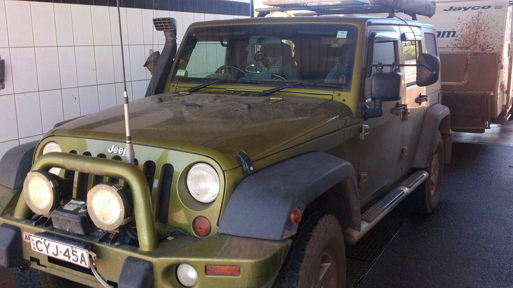
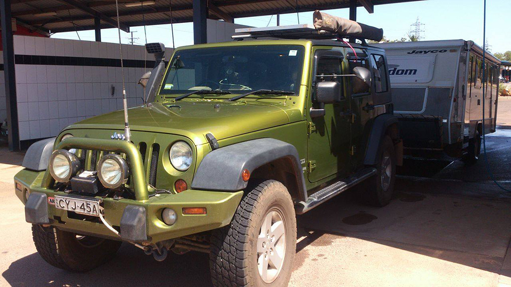
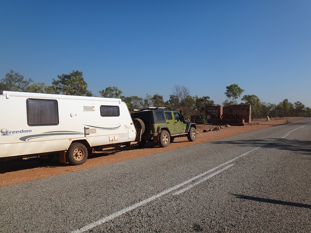
For the rest of this week we were in Kakadu National Park. We spent 5 nights in Kakadu and left on Sunday when we headed for Darwin.

Day 1 in Kakadu
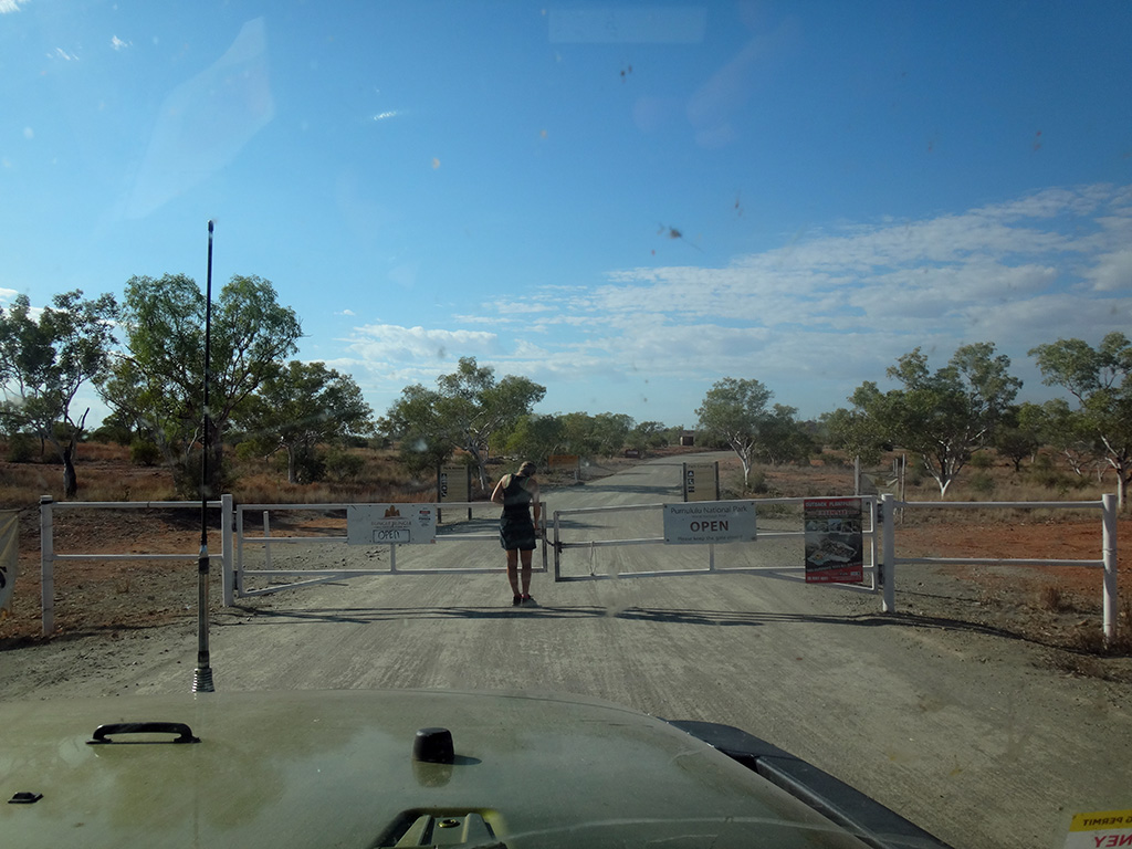
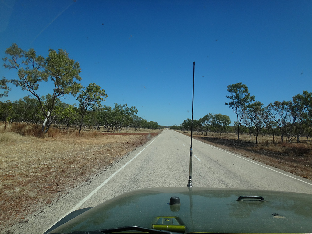
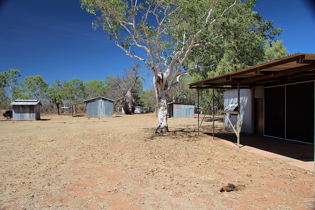
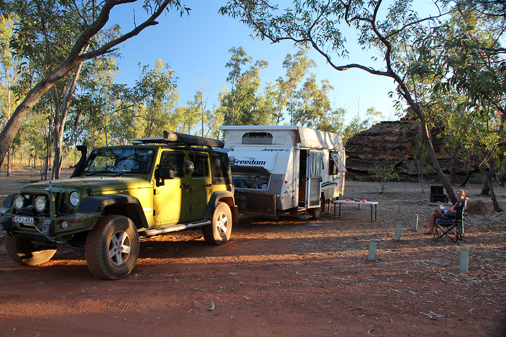
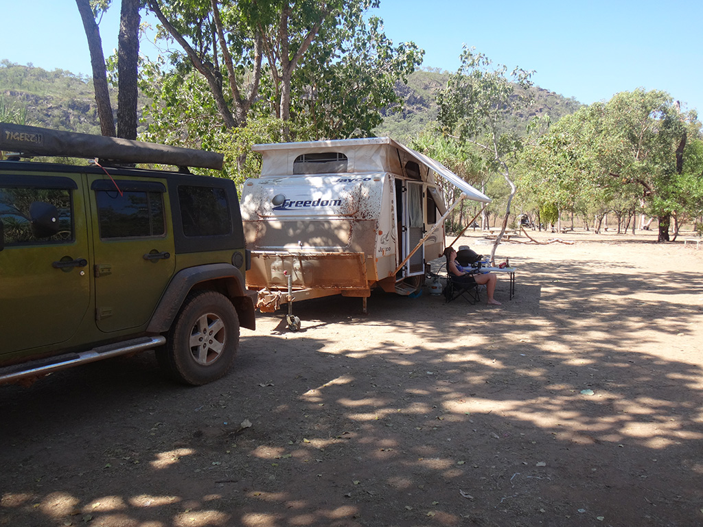
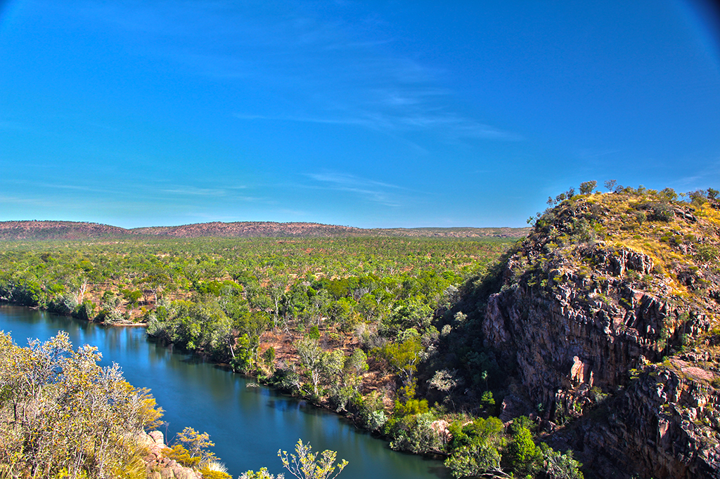
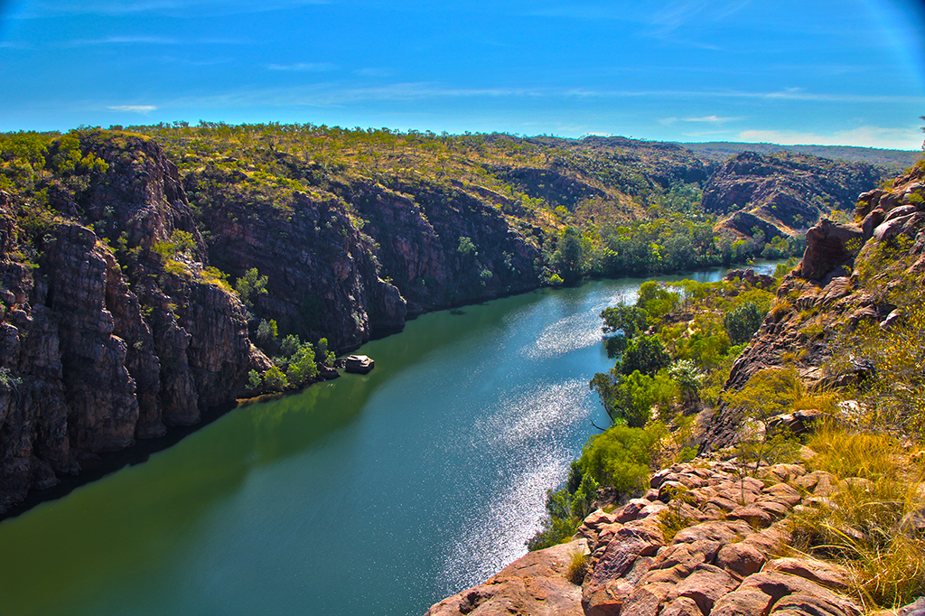
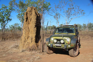
We dropped in to the Mary River Roadhouse in hope of getting some local information on the road conditions and to collect our parks passes. Unfortunately they were out of passes but the gentleman did give us some information on the road to Gunlom. He told us the road was a little corrugated but nothing to worry about. We proceeded into Kakadu and headed for Gunlom as we were hoping to camp 2 nights there.

DSC08485

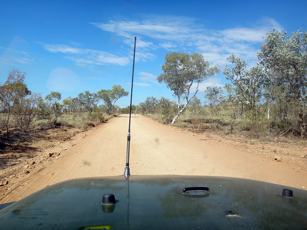
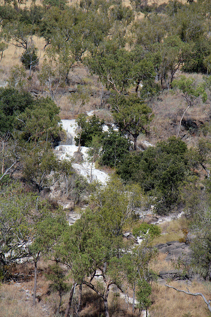
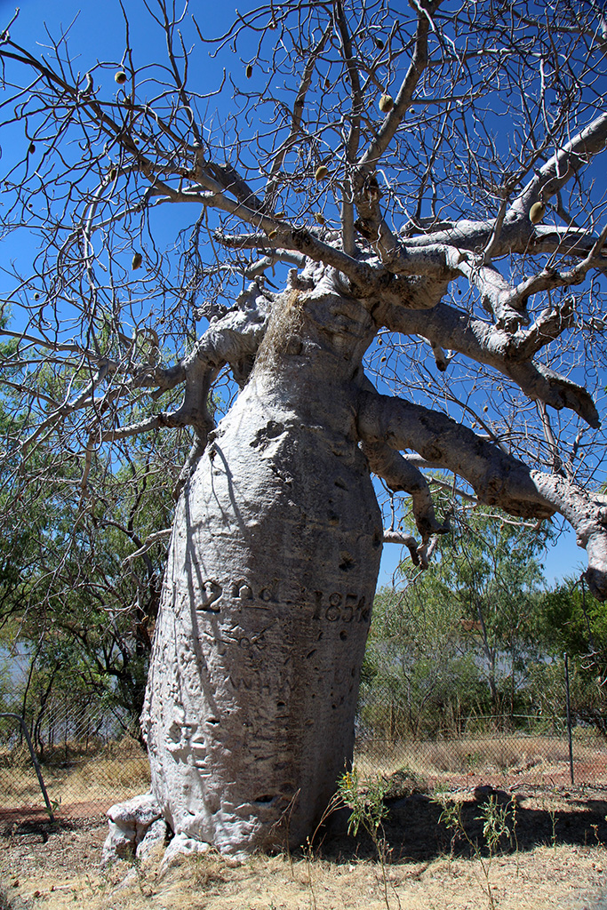
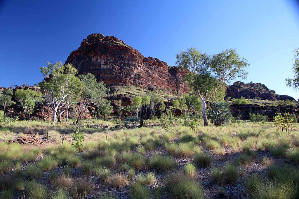
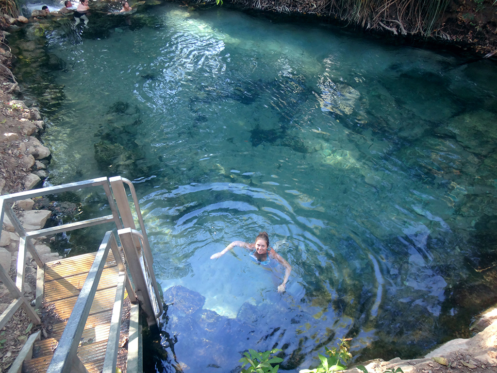
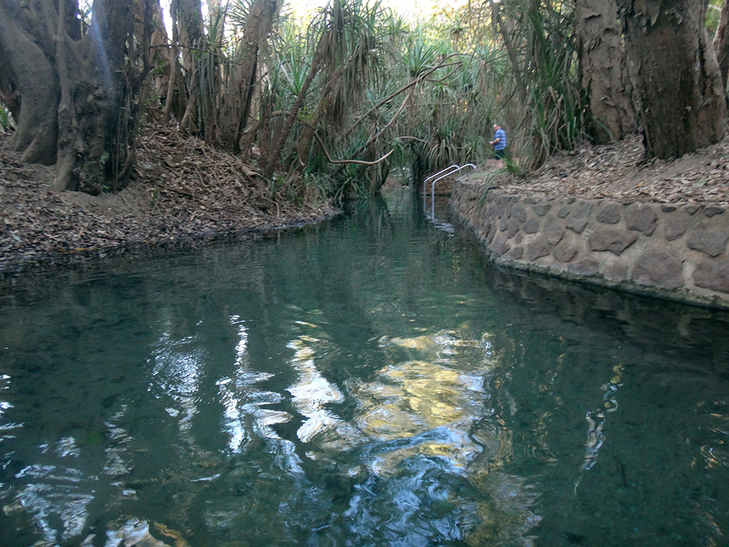
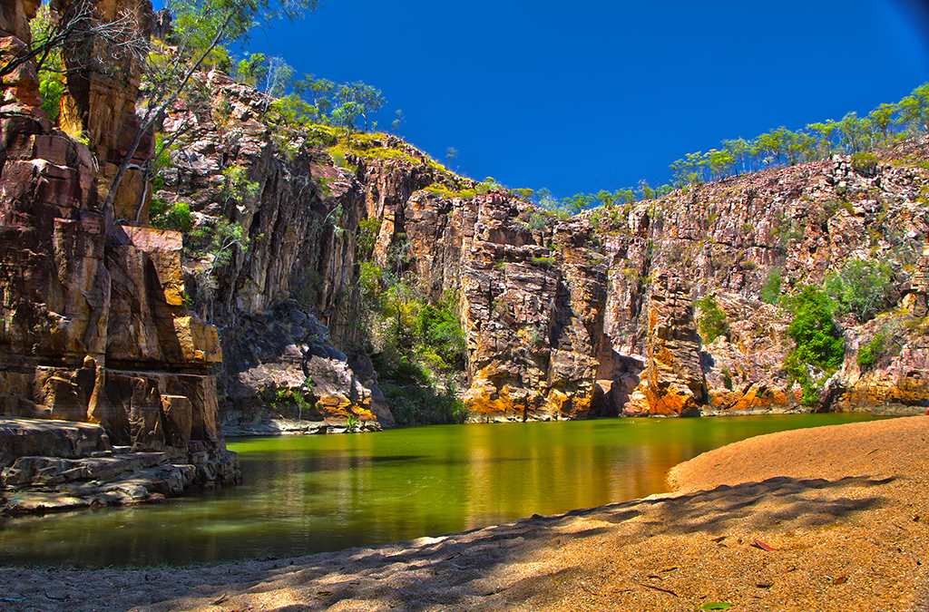
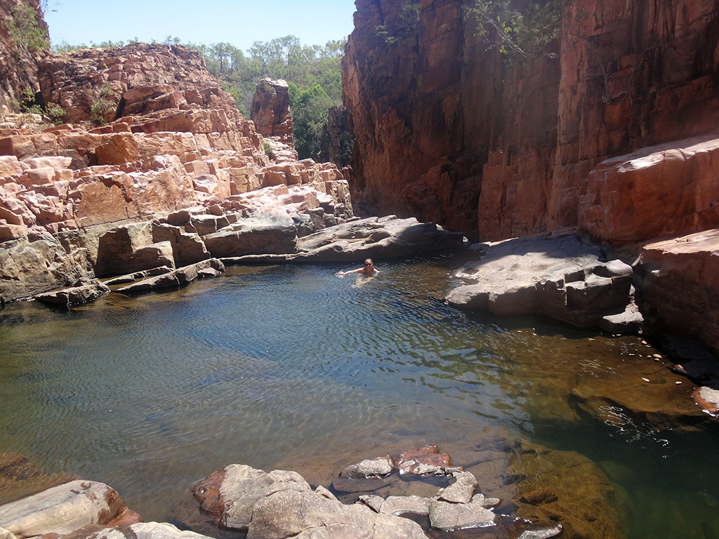
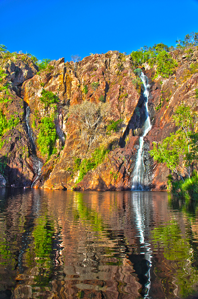
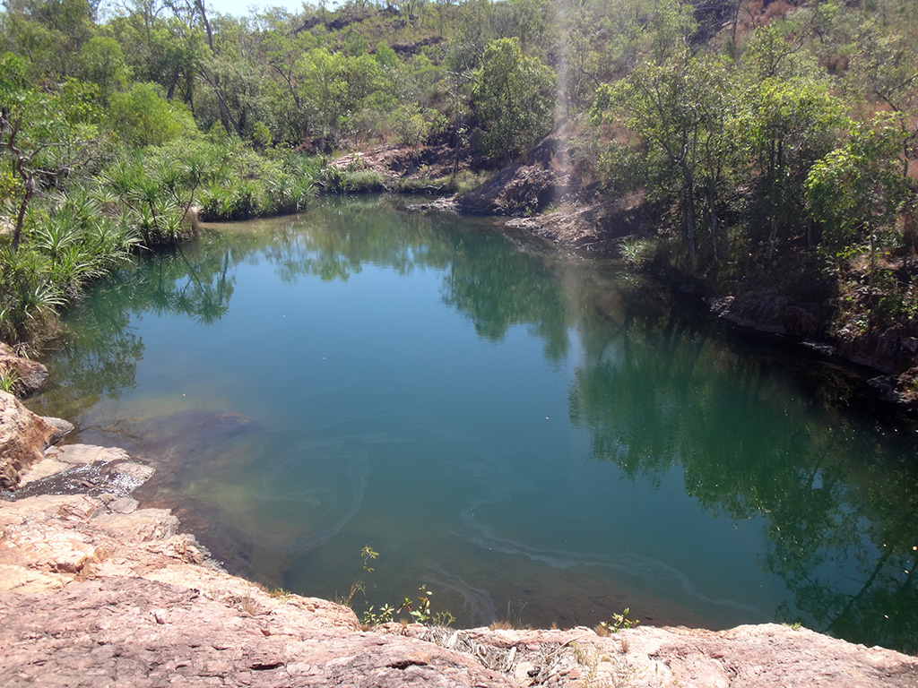
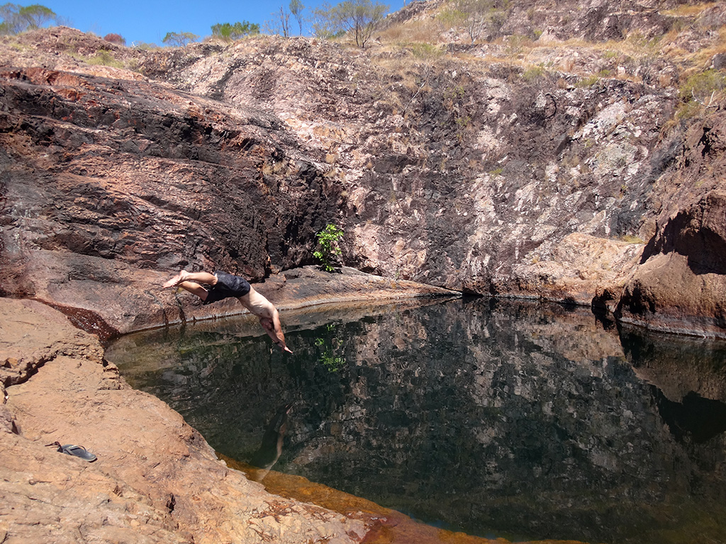
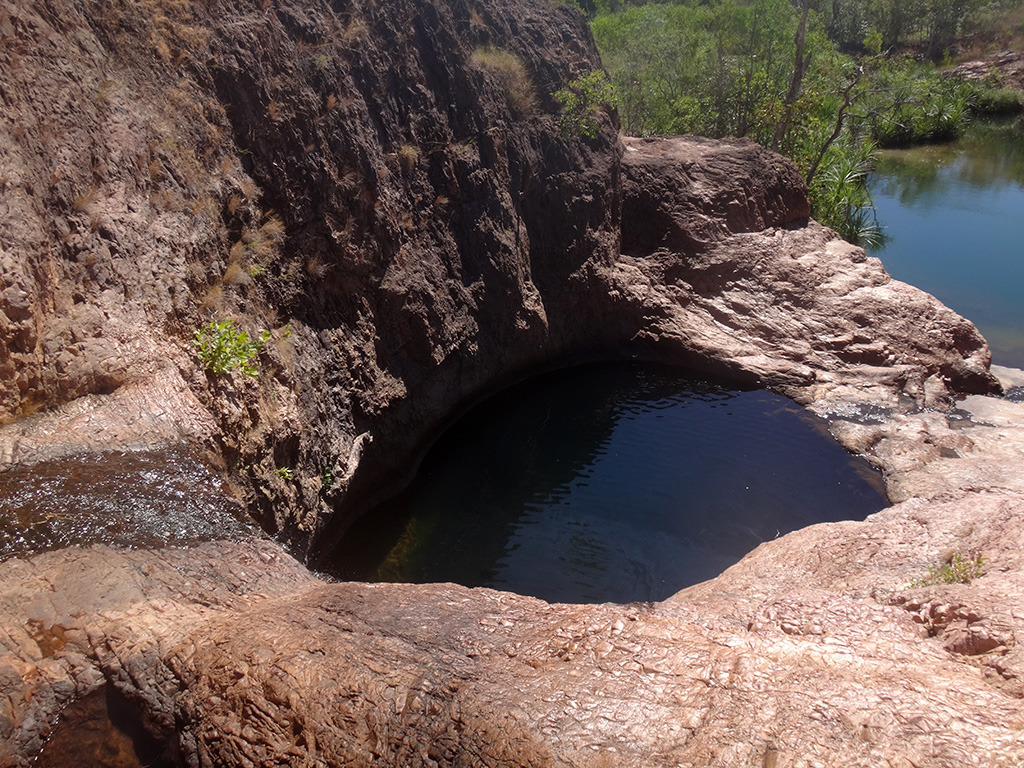
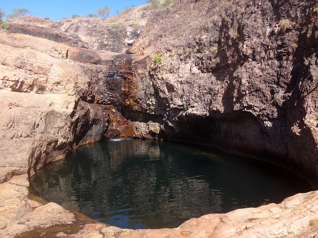
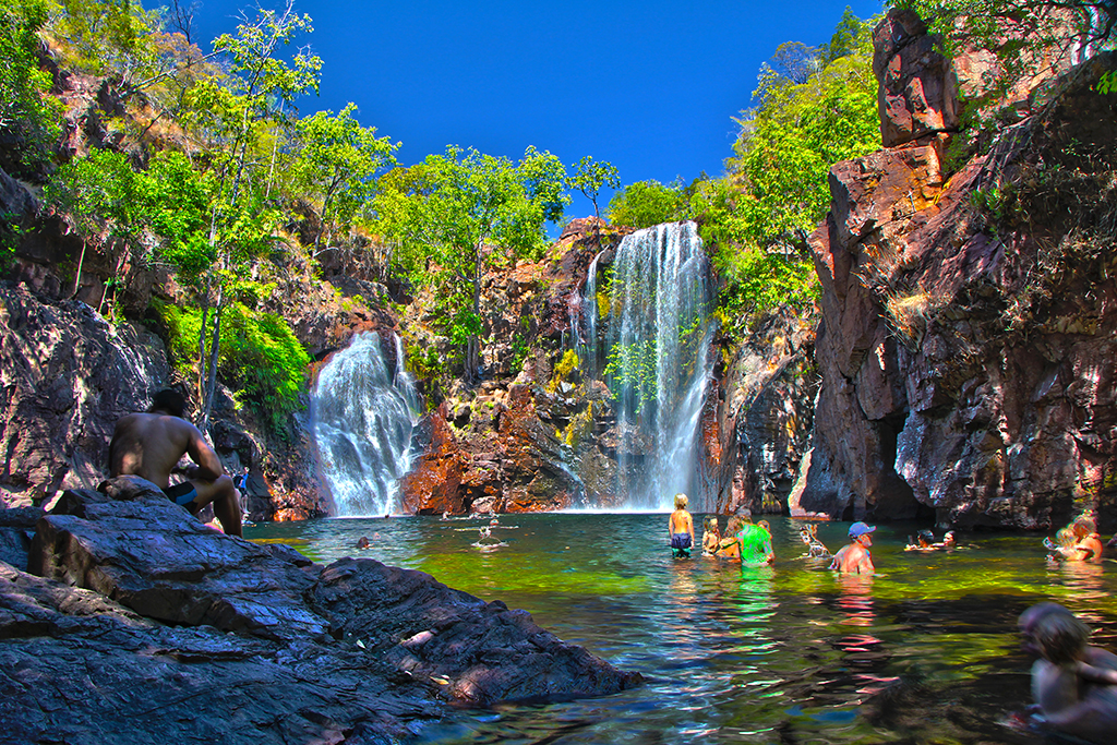
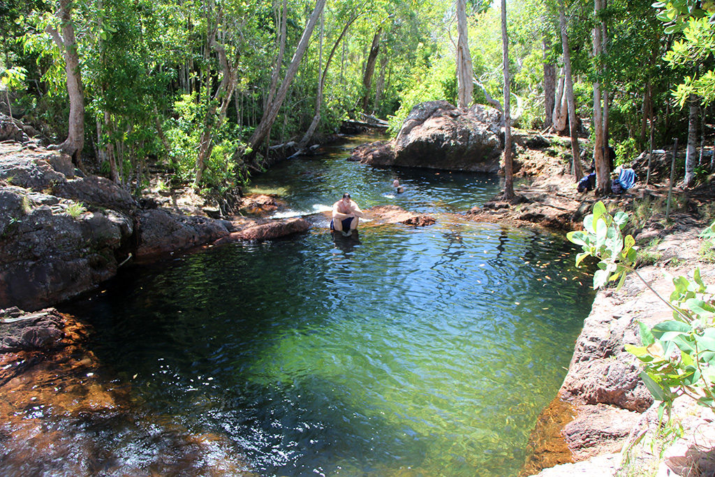
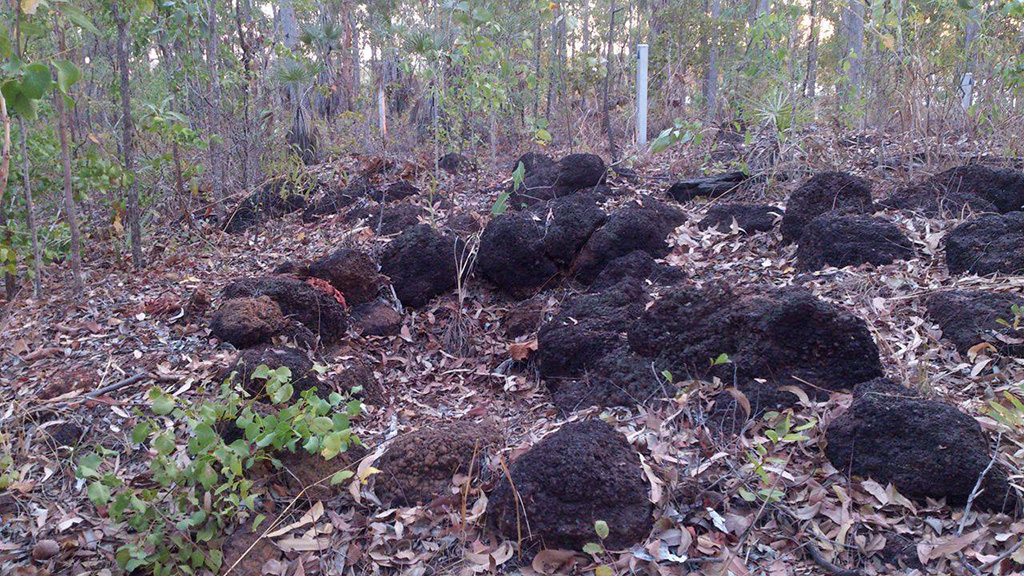
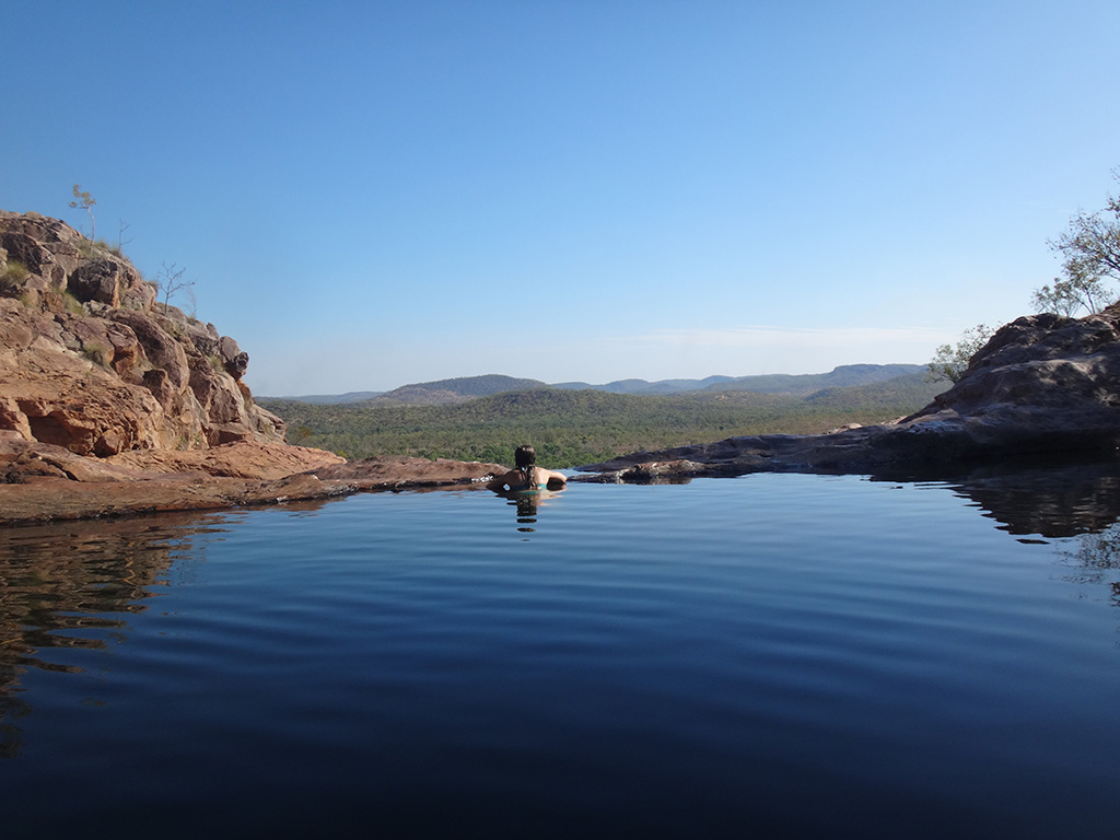
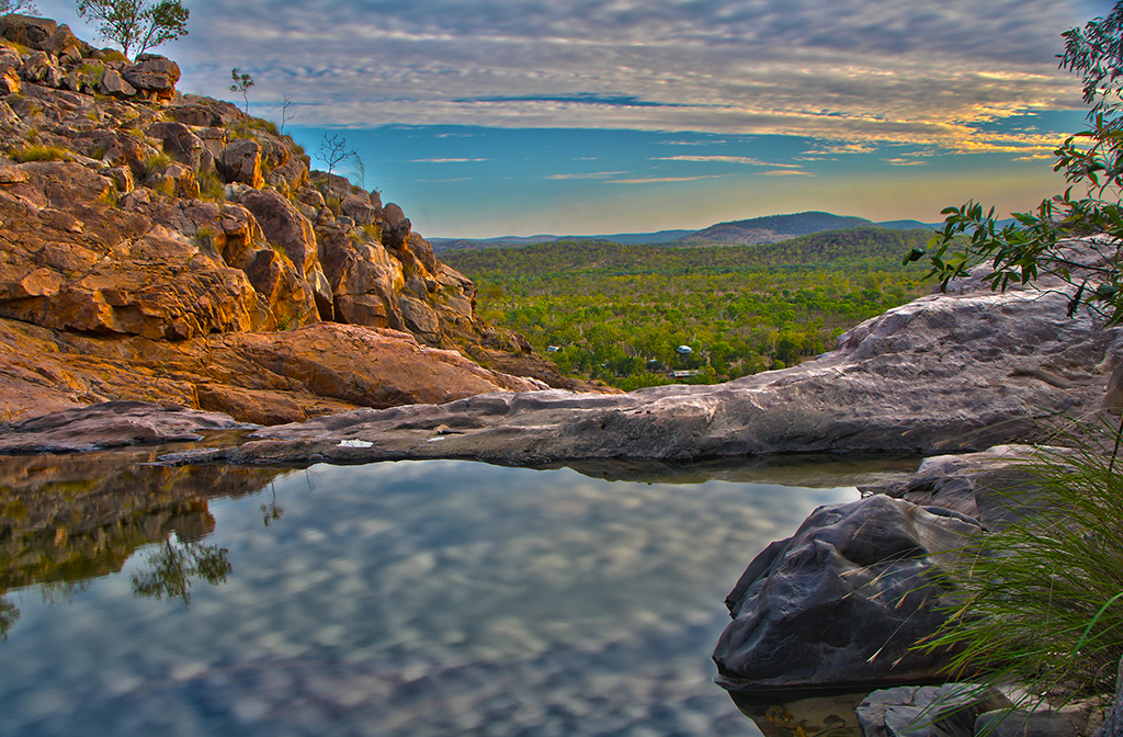
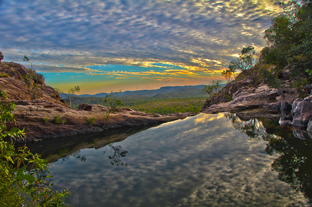
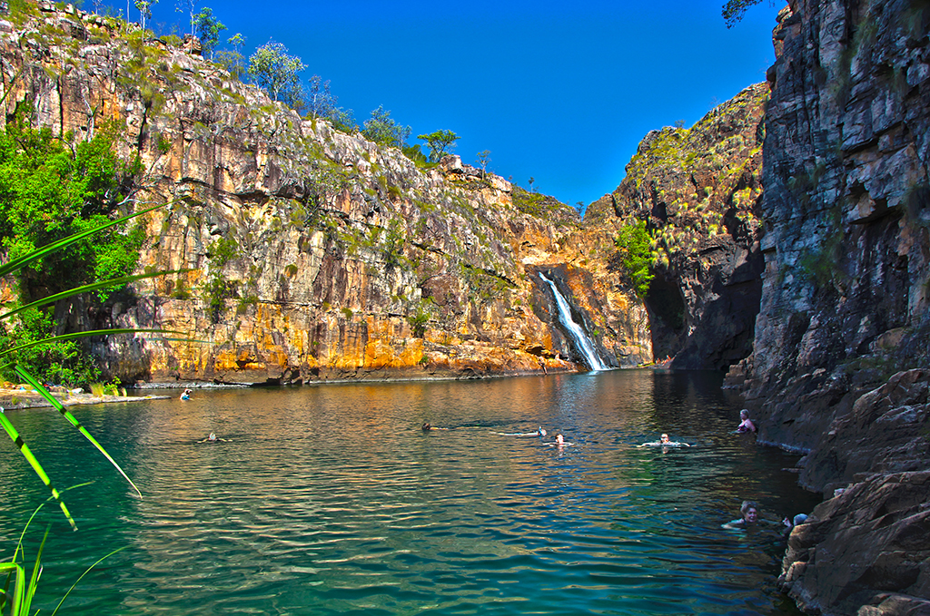
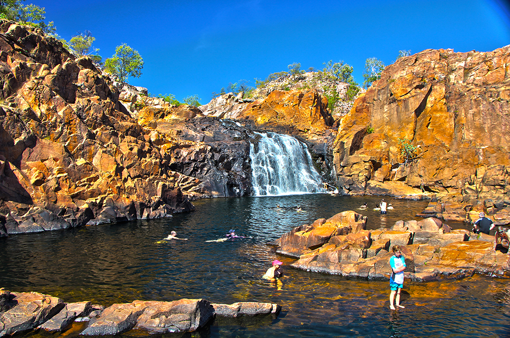
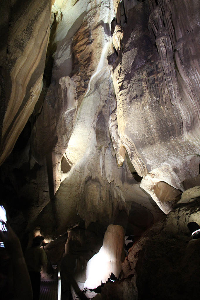
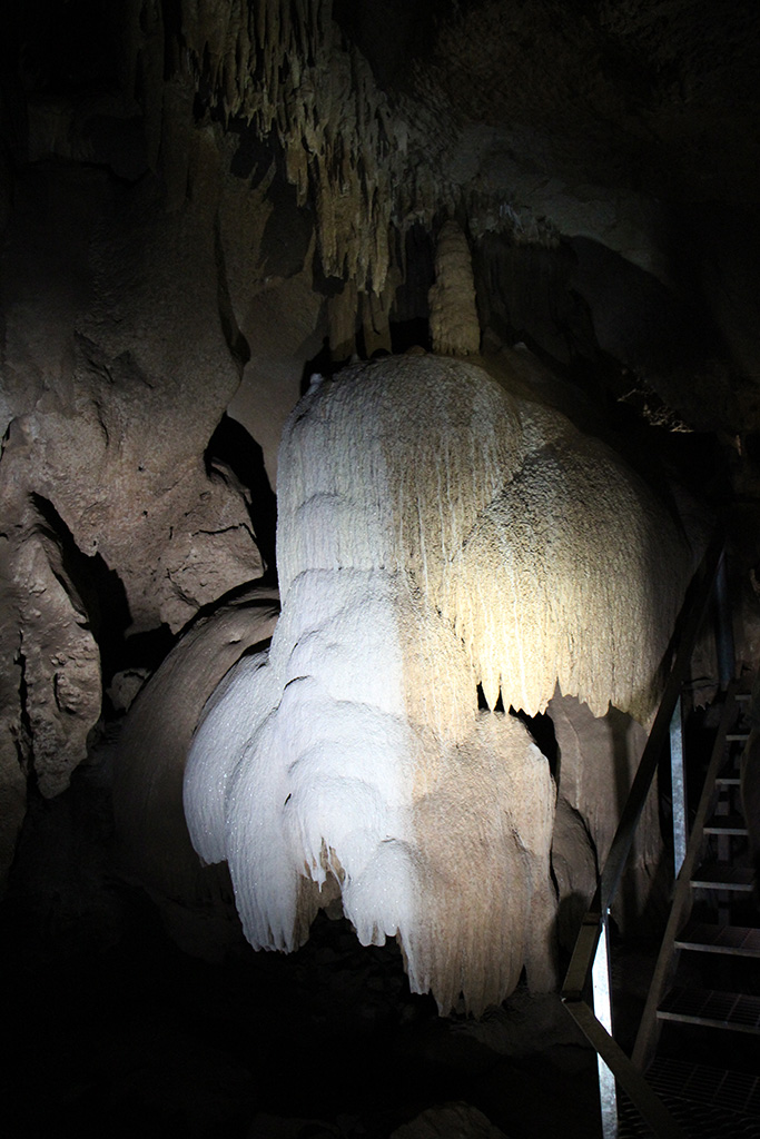
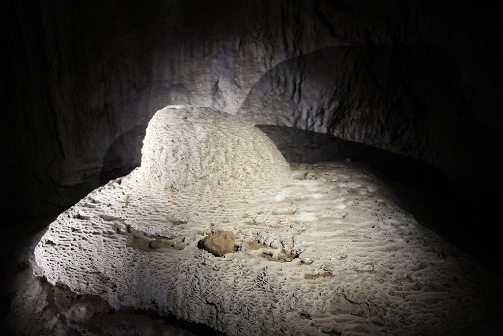
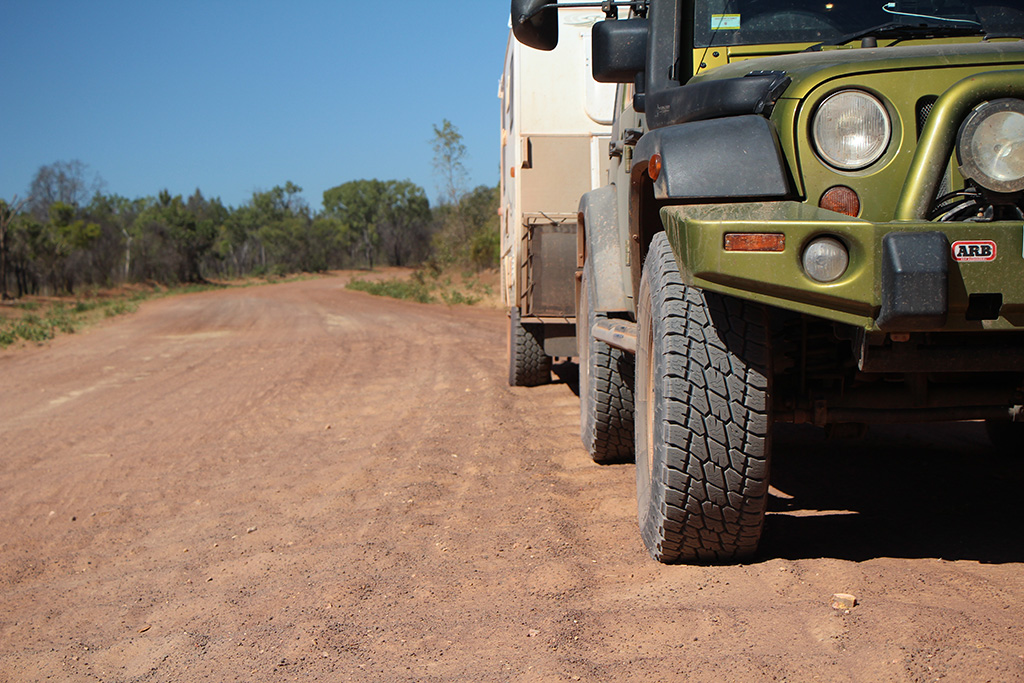
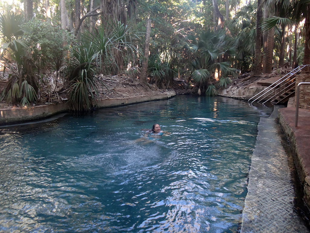
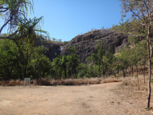
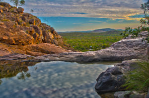
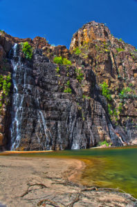
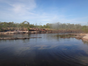
The road to Gunlom was some of the worst road we’d driven. It was 40km of dirt and it was very corrugated pretty much the whole way. We took our time to get there and tried our best not to rattle ourselves to pieces. We eventually arrived at the Gunlom camp area, had lunch and hung around for a while. At around 3pm we decided to head up to the top of Gunlom Falls for a swim and a nice spot for the “golden hour”. The walk to the top of Gunlom Falls is only 500m but it is steep. We arrived to the top and immediately jumped into the plunge pool. There are a number of plunge pools at the top and you get an amazing view from them. They are often referred to as a natural infinity pool. We enjoyed the swim and having a look around each of the pools. The view was fantastic and we had some beautiful clouds in the sky giving us a great view!

DSC08488 DSC08492 DSC08520 KakaduGunlomFallsInfinity_HDR4 KakaduGunlomFallsInfinity_HDR5 KakaduGunlomFallsUpper_HDR3

Day 2 in Kakadu
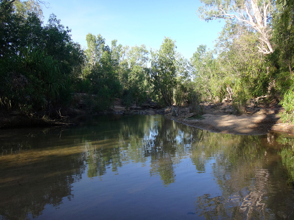
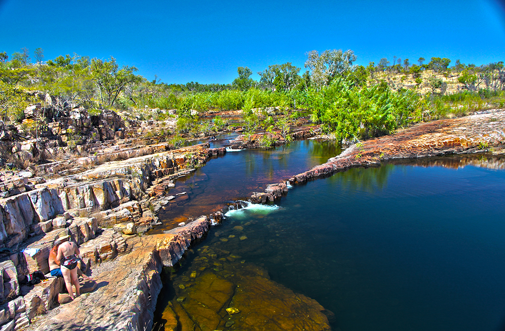
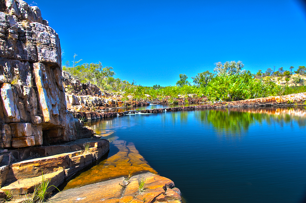
The next day we jetted up to Cooinda to get our parks passes and book ourselves onto a Yellow Water sunset cruise for the following evening. From there we headed back down south to Maguk. The road out to Maguk is classified as a 4wd track but we found it to be better than the road out to Gunlom and it was only 10km.

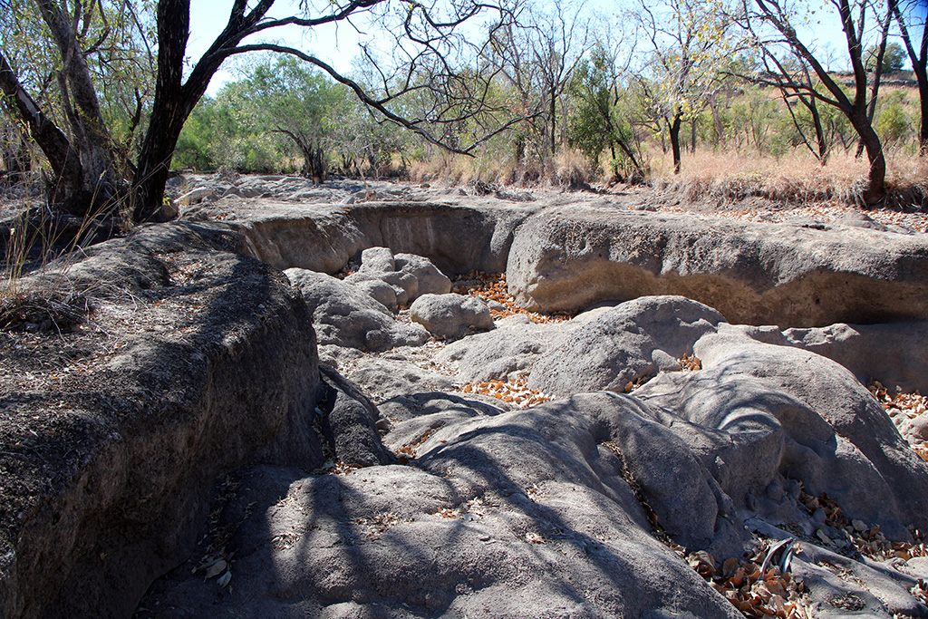
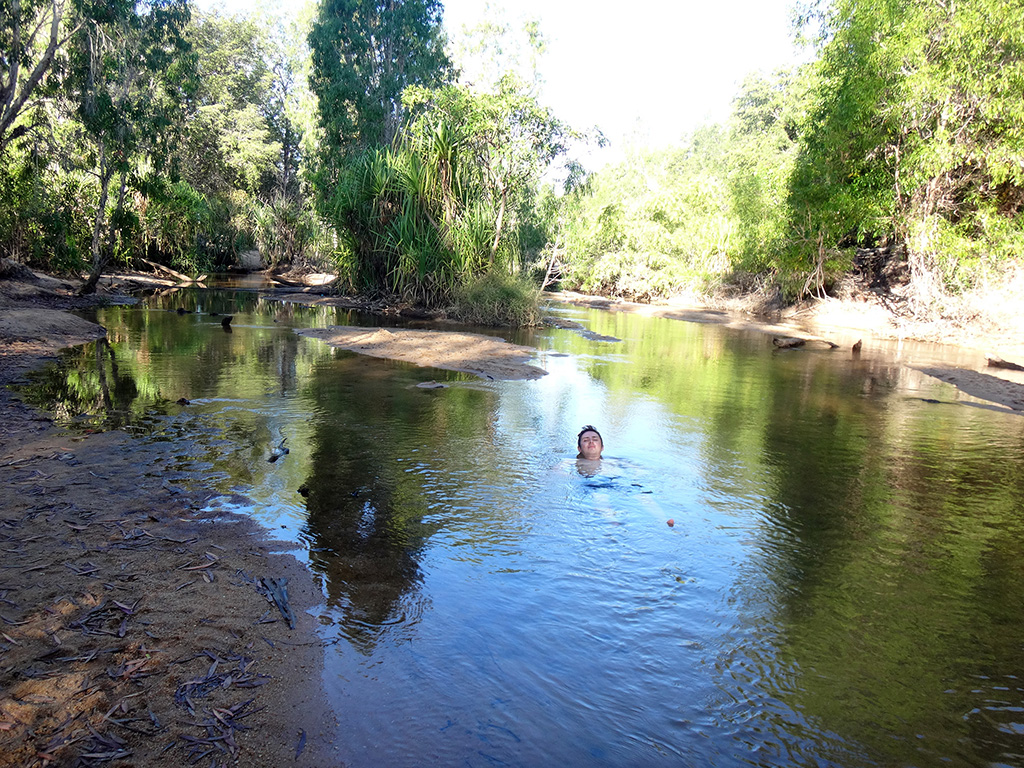
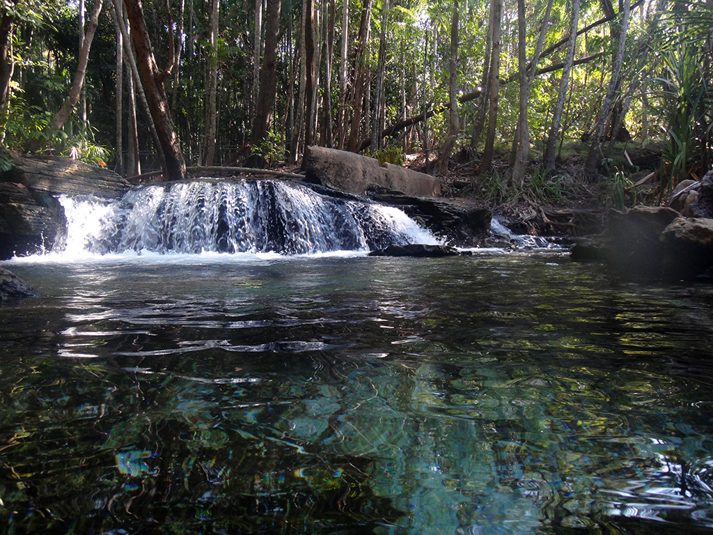
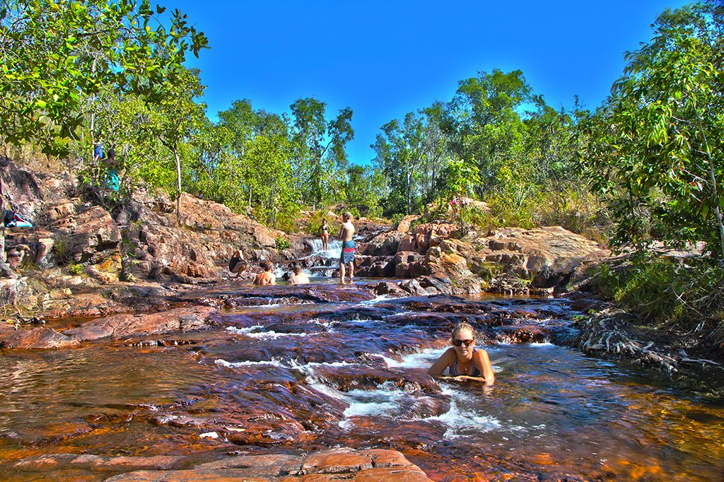
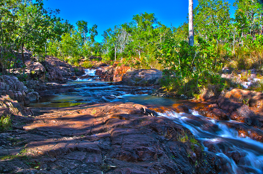
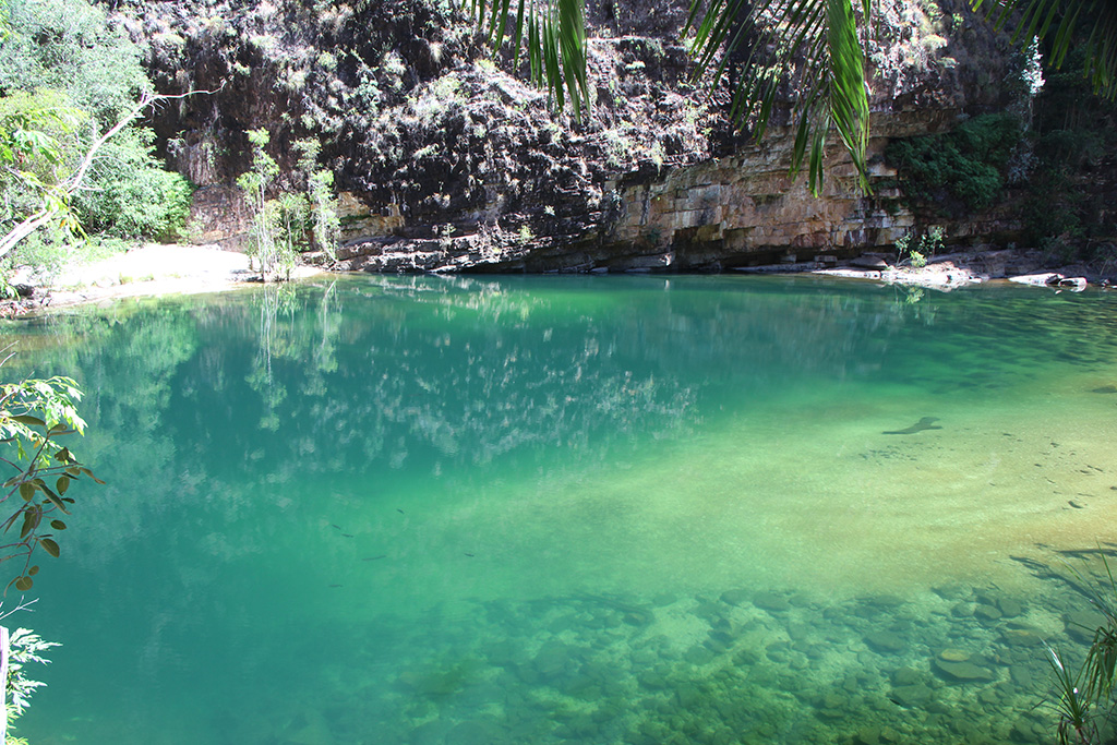
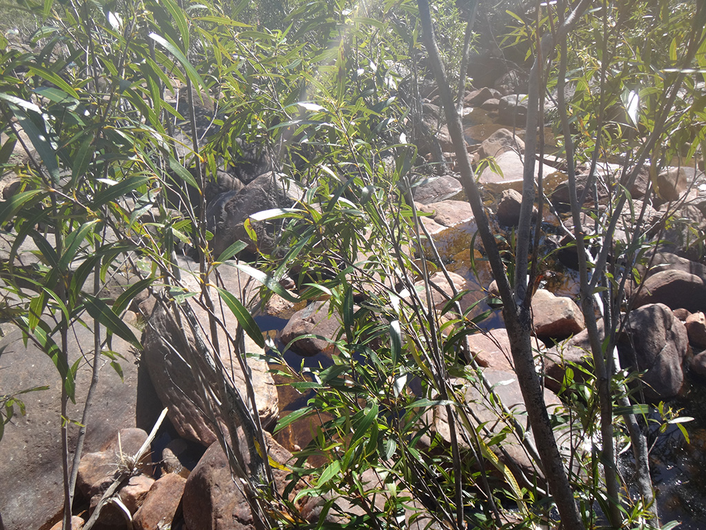
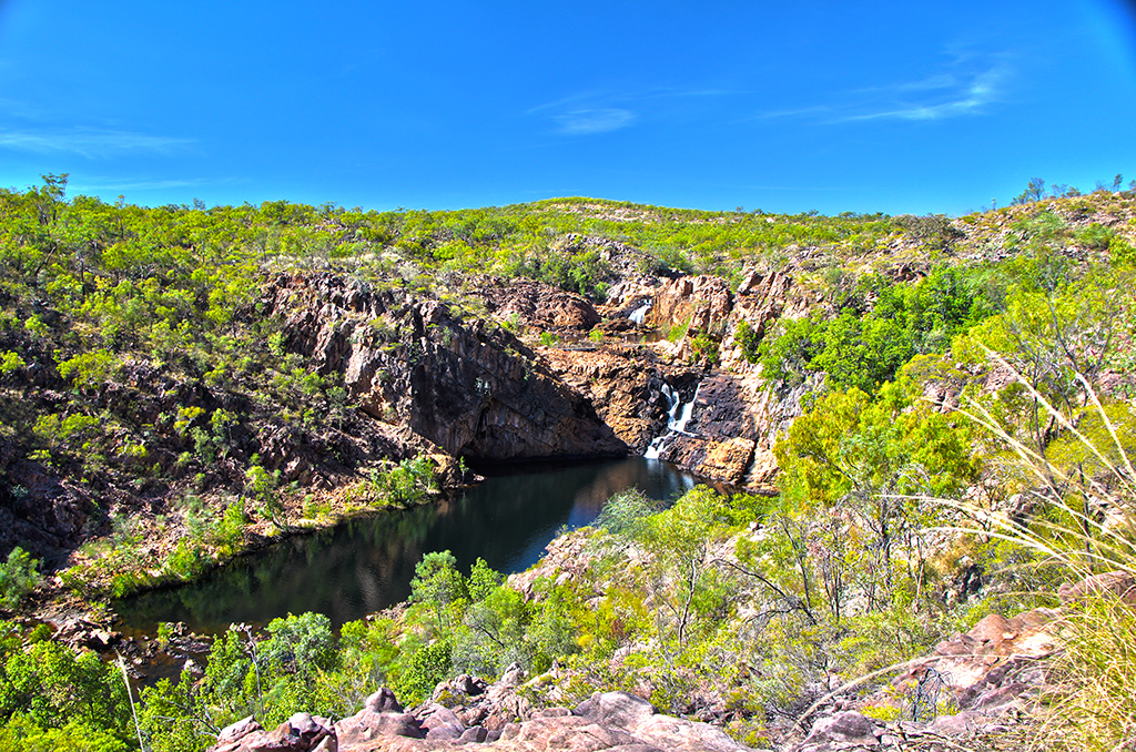
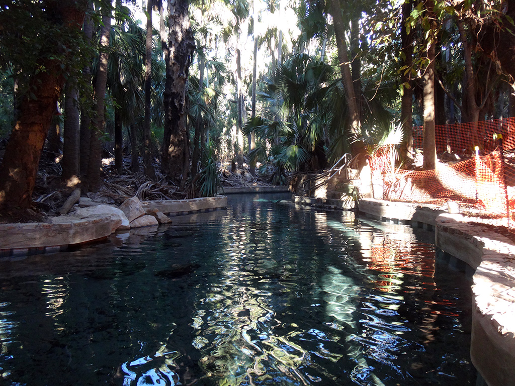
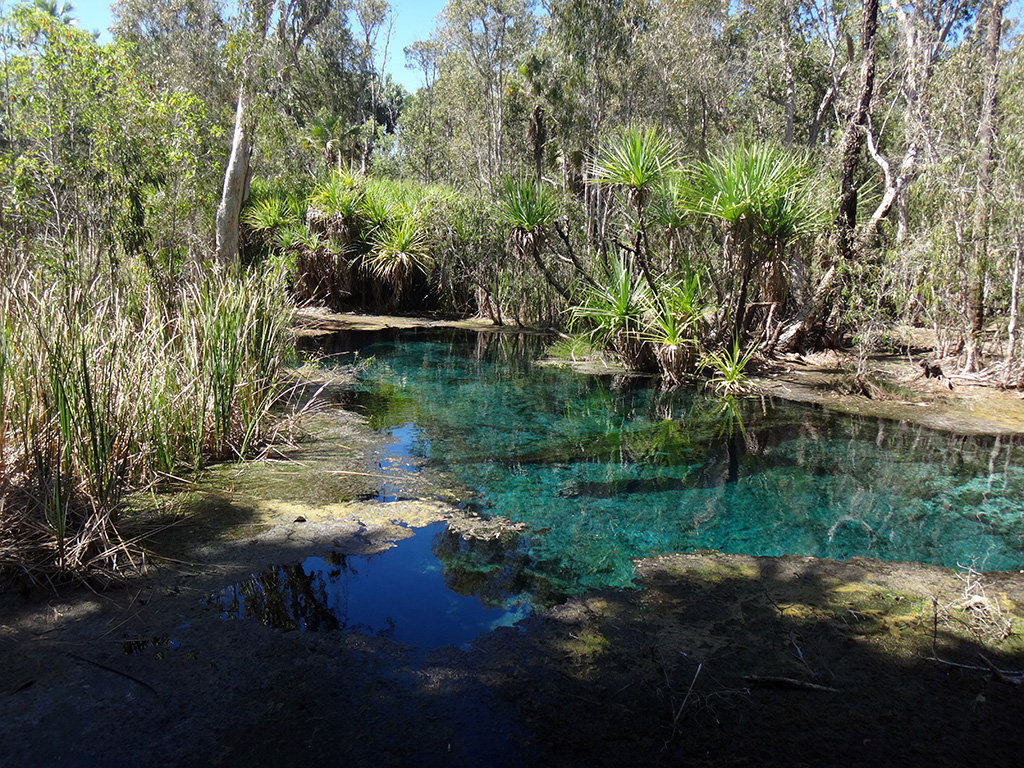
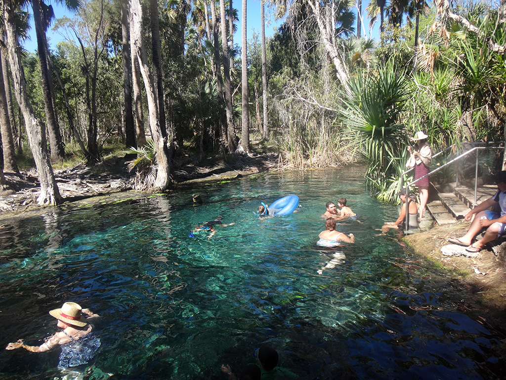
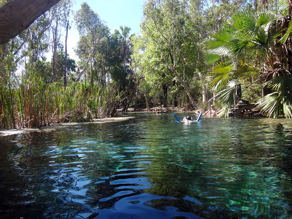
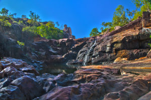
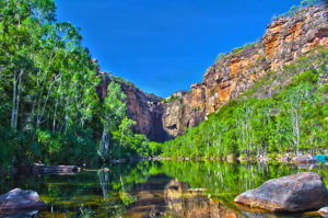
Maguk is a great swimming spot and has an easy 1km walk to it. Towards the end of the walk you are required to scramble over some rocks but it isn’t very difficult. The water was an amazing blue colour, it was very deep but it still was quite warm. At the far end there is a waterfall which is putting “cold” water into the plunge pool. We enjoyed a relaxing swim for a while before heading back to camp.

KakaduMaguk_HDR1 IMG_01453

Day 3 in Kakadu
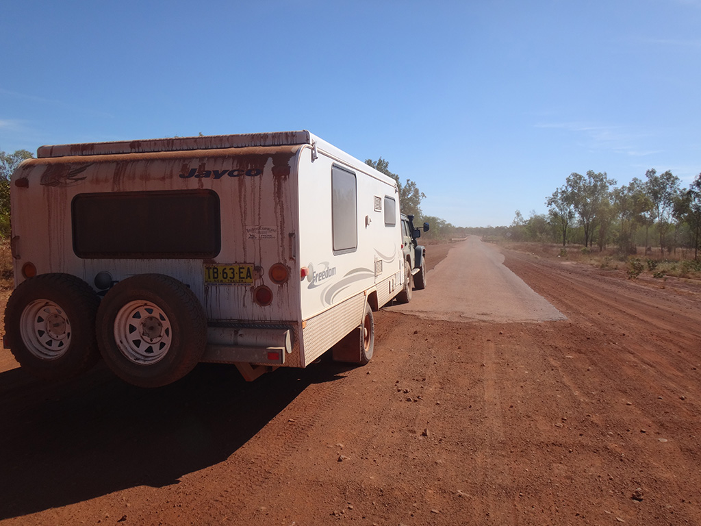
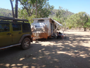
We packed up camp and left Gunlom. We took it very slow and it ended up taking us 1hr 40mins to drive the 40km’s out. We were not even the slowest vehicle traveling out, there was a hired campervan that we overtook. Once we hit the sealed road we headed north up to Mardugal where we set up camp and chilled out until the afternoon.

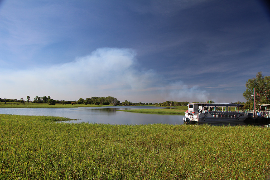
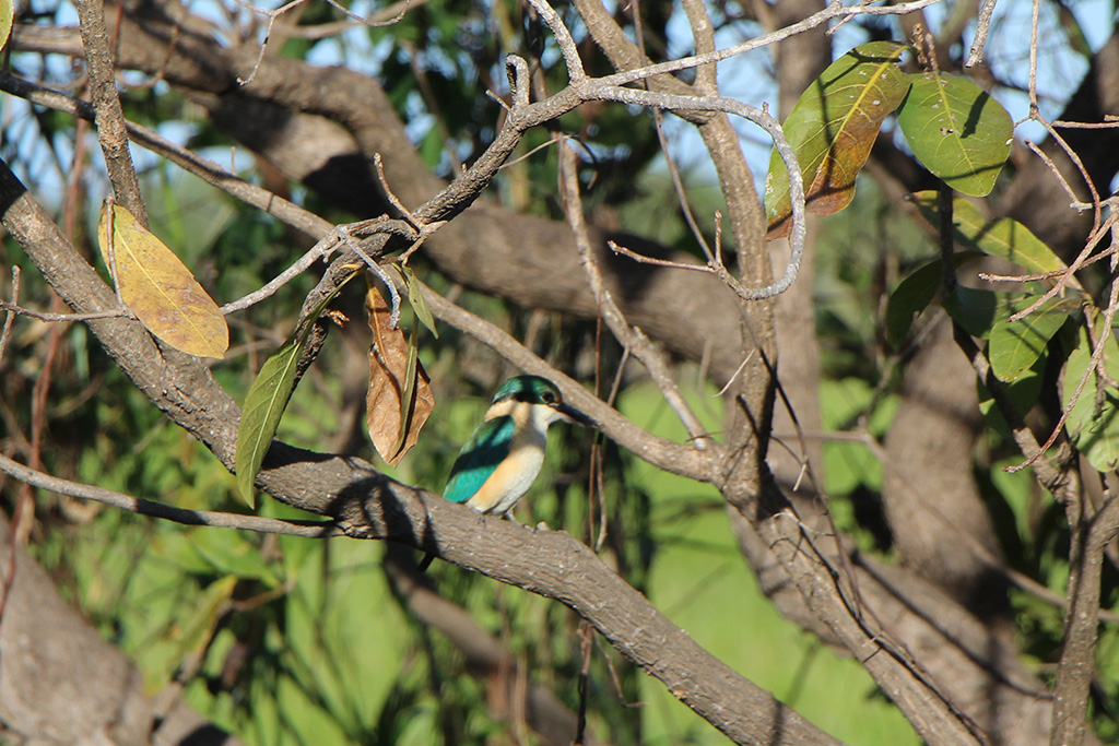
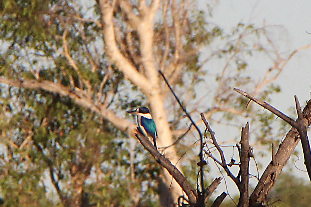
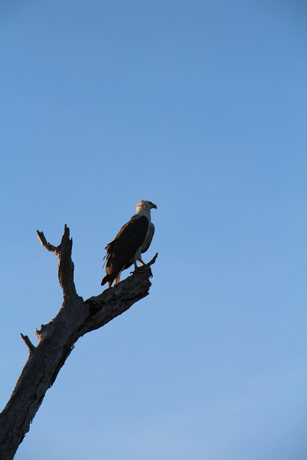
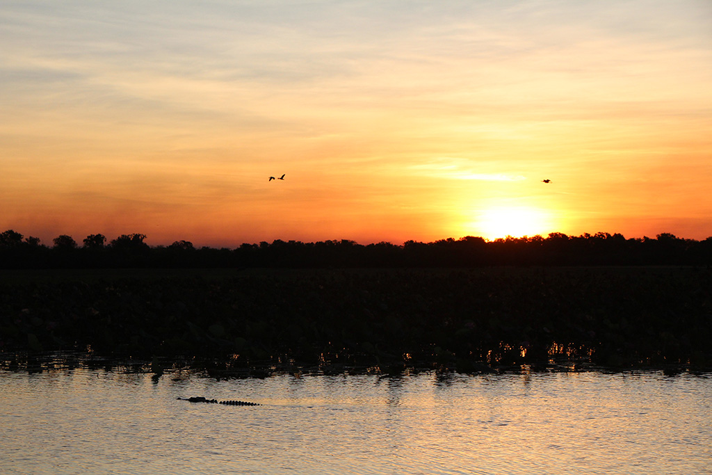
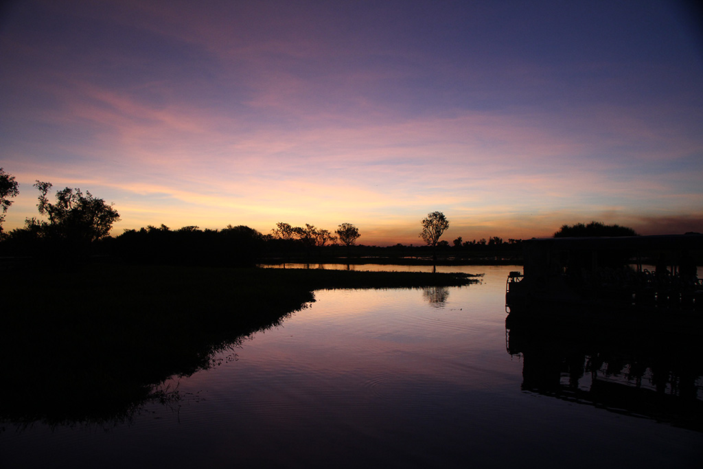
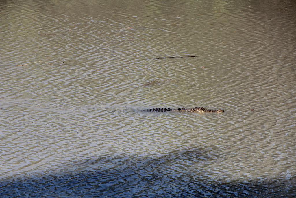
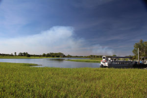
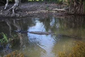
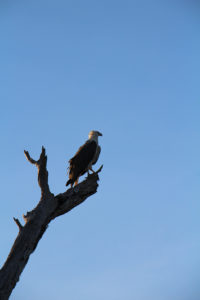
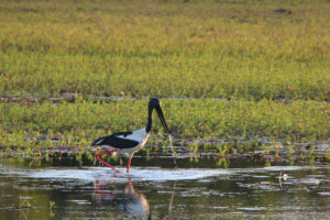
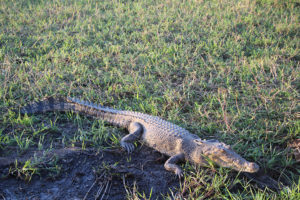
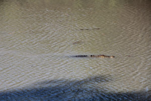
We drove to the Warradjan Cultural Centre and had a look around before heading to our cruise. The Cultural Centre was very well set up, very fancy and told a great story of the Traditional Owners. We then went to Yellow Water and boarded our boat for the cruise. We thoroughly enjoyed the cruise and highly recommend doing one. The tour guide was knowledgeable and had a great eye for spotting wildlife. It was a privilidge to see many different types of birds including Forest Kingfisher, Azure Kingfisher, Sacred Kingfisher, Rainbow Bee Eater, Whistle Duck, Sea Eagle, Jabiru, Egret, Magpie Goose and Comb Crested Jacana, and see Salt Water Crocodiles in their natural habitat. At the end of the cruise we watched sunset and were lucky enough to have a crocodile right in front of us.

IMG_01462 IMG_01490 IMG_01516 IMG_01535 IMG_01554 IMG_01566 IMG_01581 IMG_01604 IMG_01617

Day 4 in Kakadu
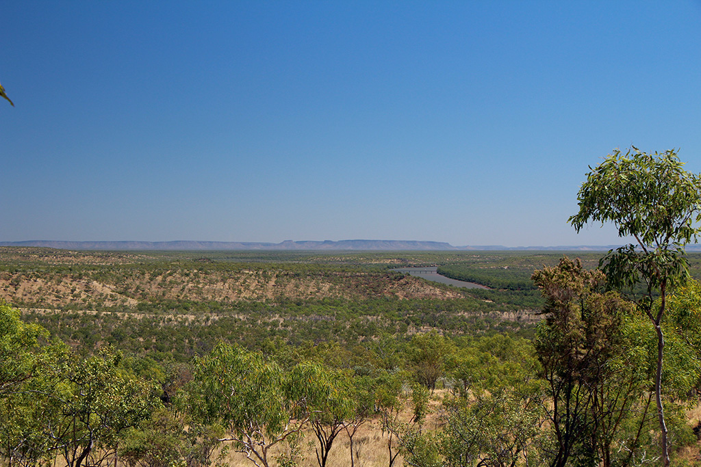
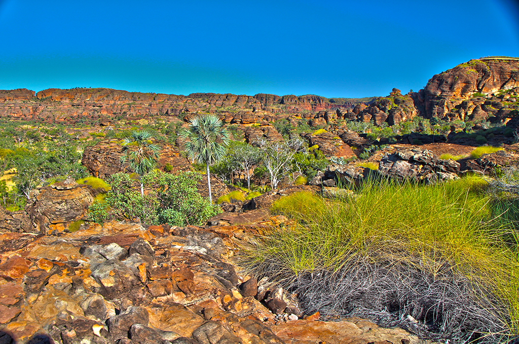
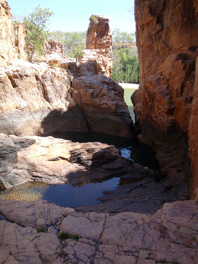
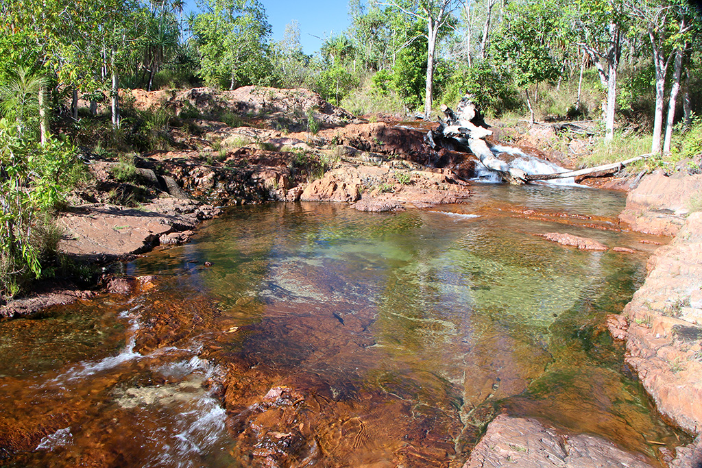
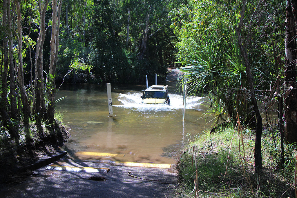
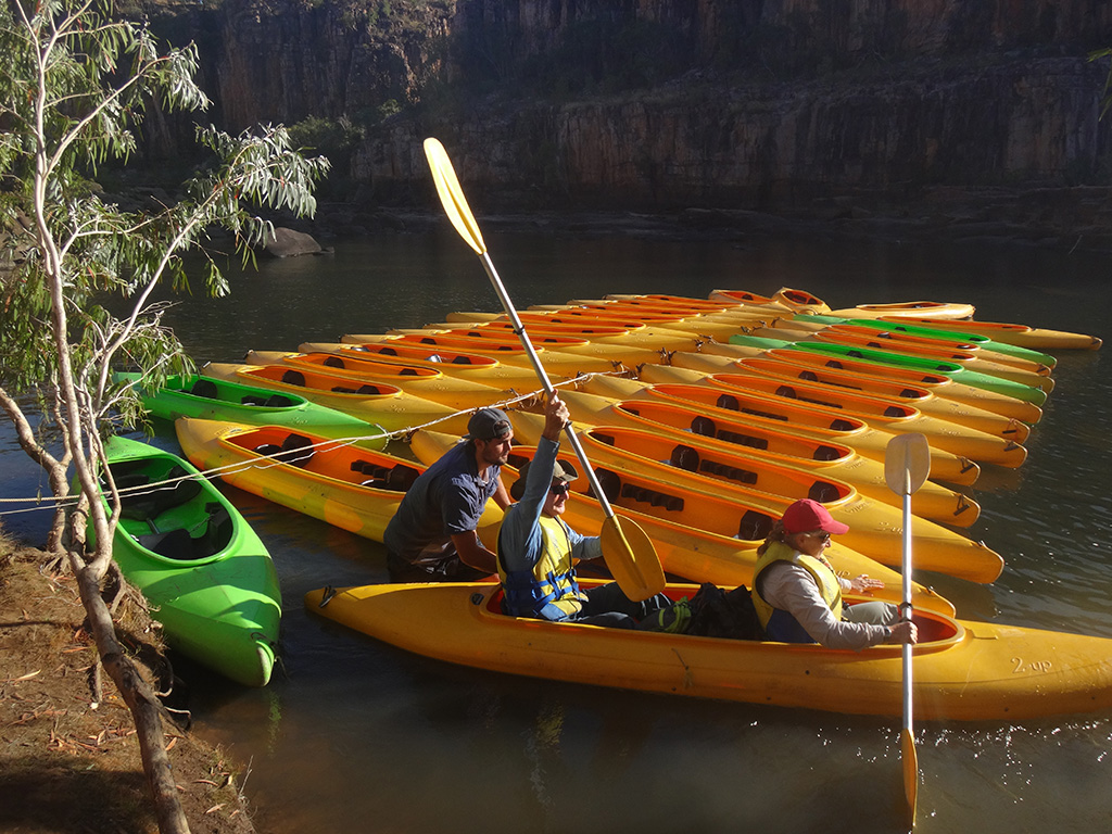
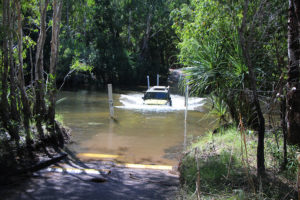
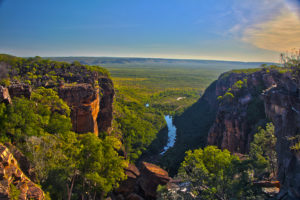
Today we went to Twin Falls and Jim Jim Falls. We had been told by a ranger that the road down to the falls had been recently fixed and was in good condition. After our rough ride out to Gunlom we were really hoping this was the case. Unfortunately it couldn’t be more wrong. The road was so rough and corrugated that it was a very uncomfortable ride out. We made the turn for Twin Falls and proceeded through the deep water crossing. It was around 75-80cm deep and came right up to the lip of the Jeeps bonnet. It had a concrete base so it makes the crossing quite easy other than the depth of water.

IMG_01632

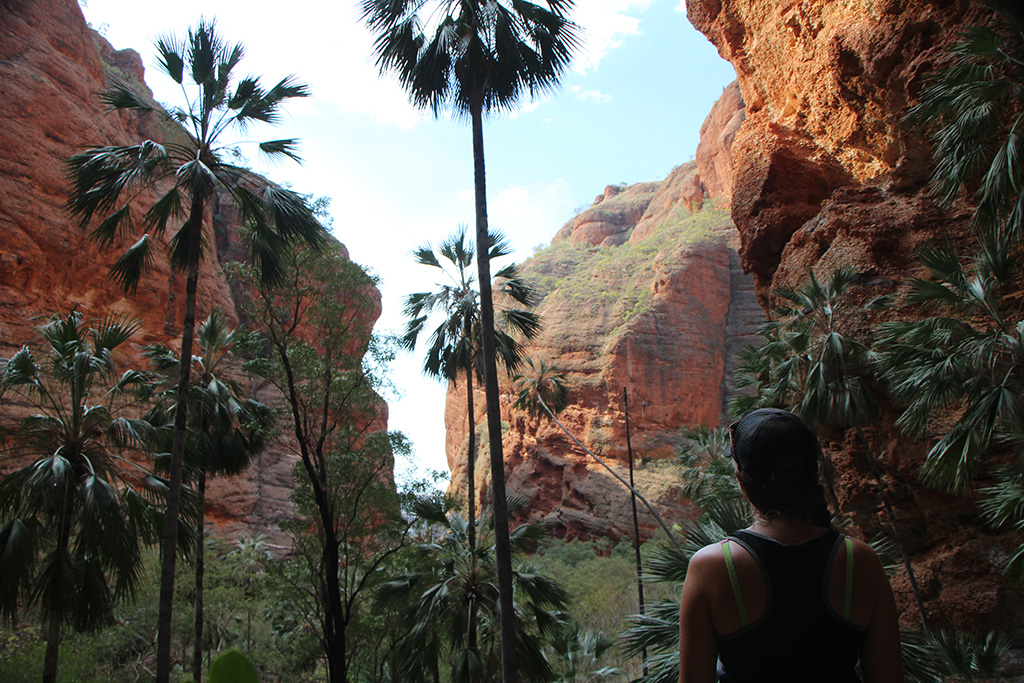
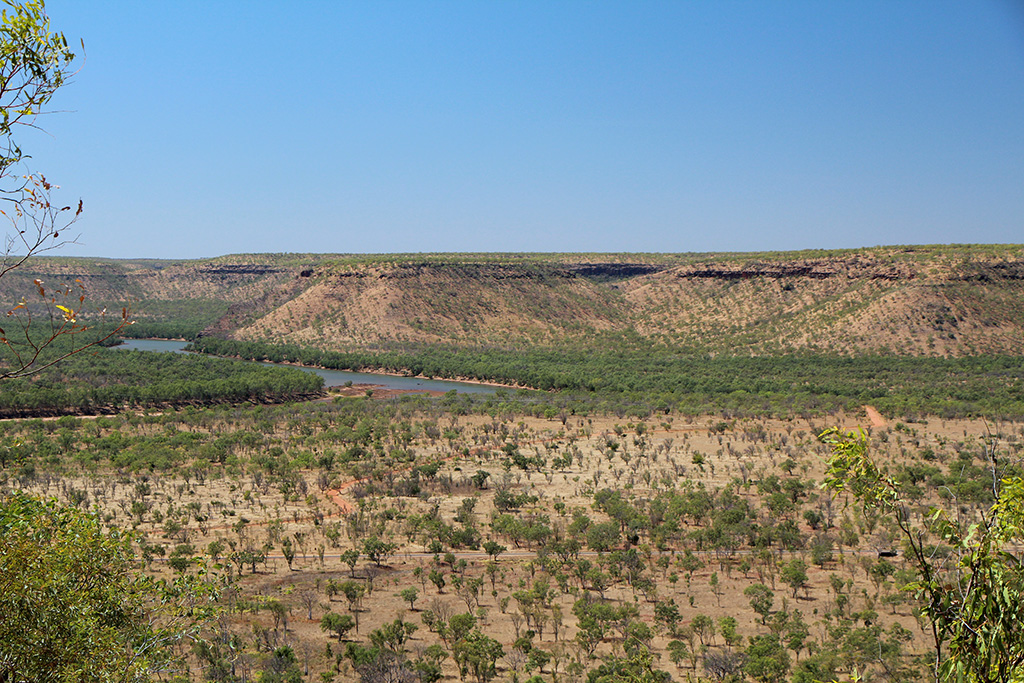
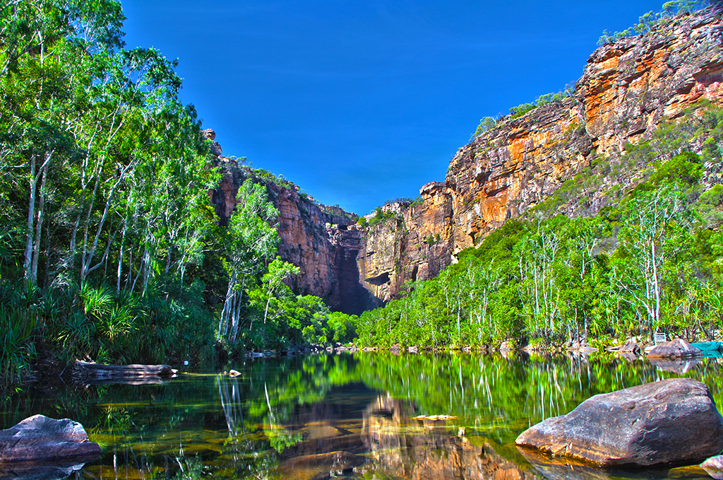
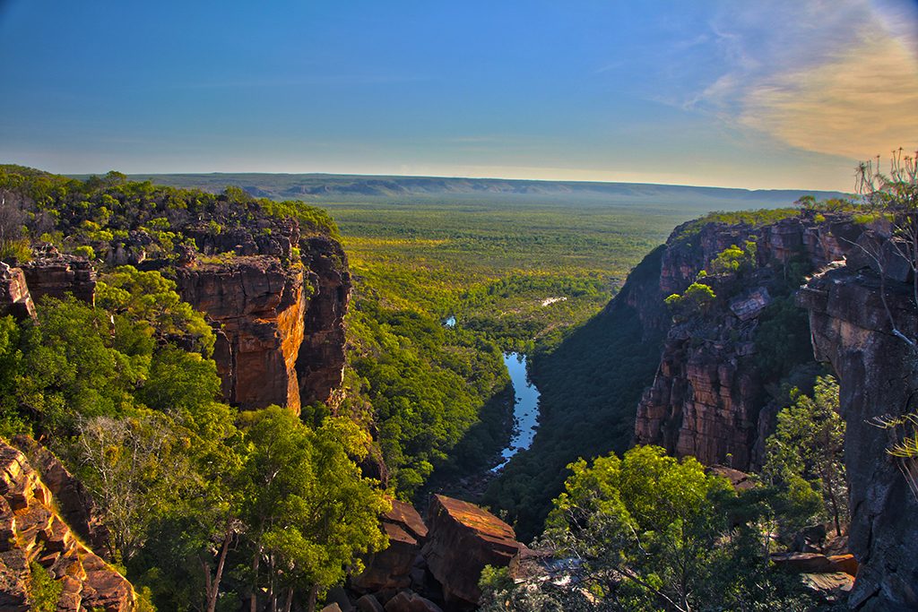
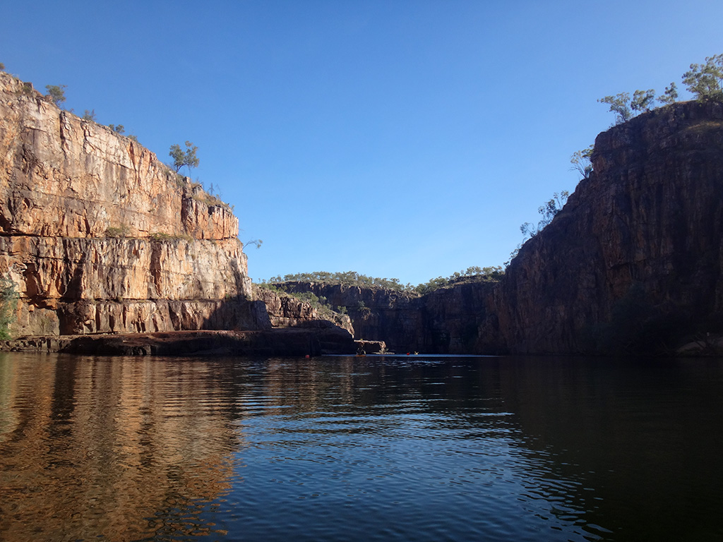
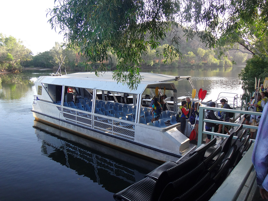
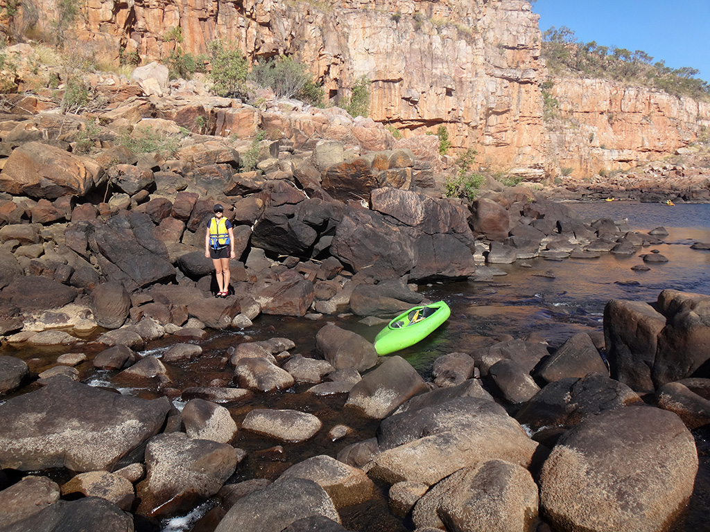
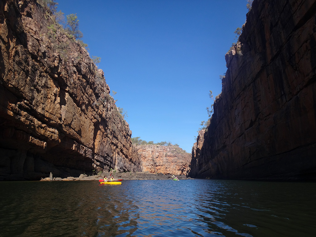
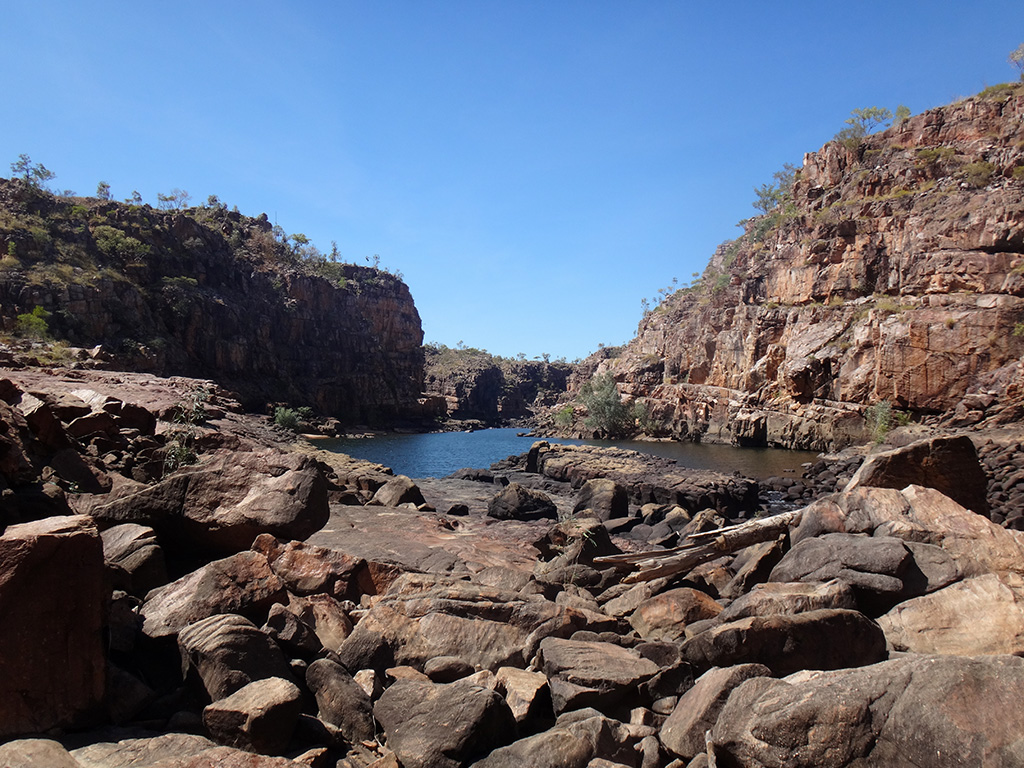
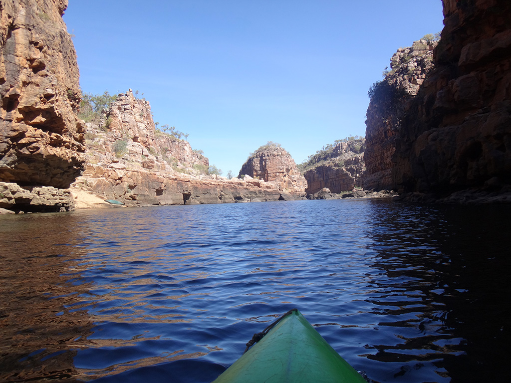
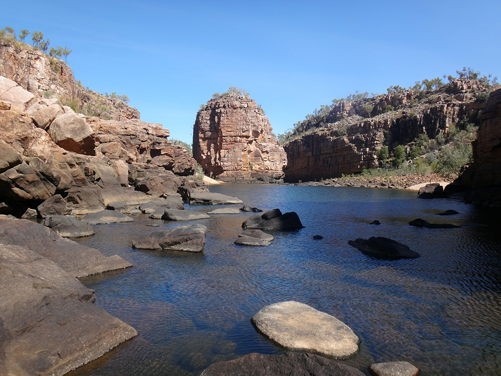
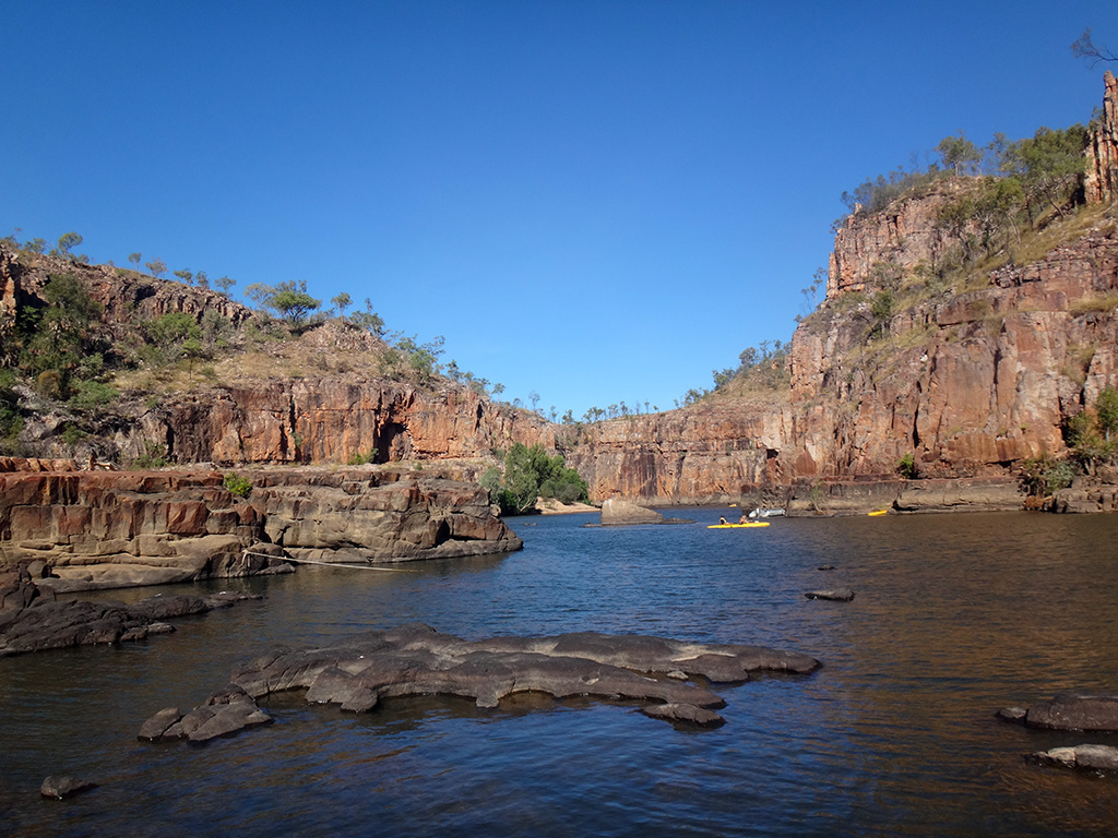
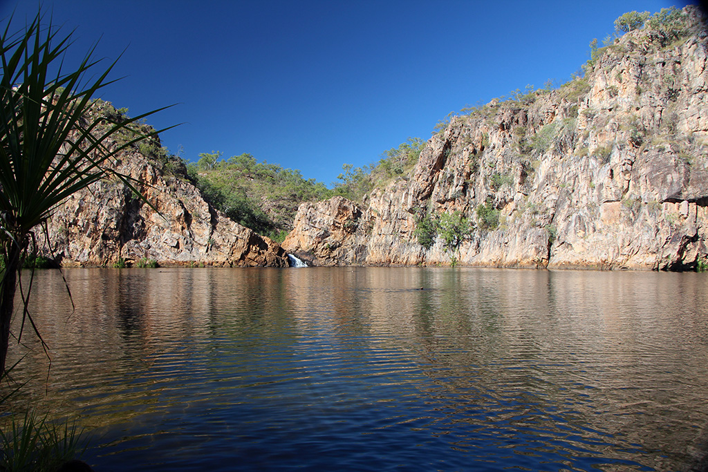
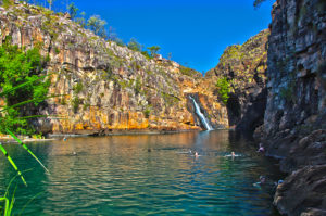
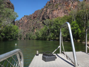
We arrived at the carpark and made the short 400m walk to the boat that takes you down the gorge. We jumped right onto the boat and the Ranger took us down in the gorge. It is a beautiful gorge with amazingly clear water and high steep walls. We disembarked from the boat and walked up to the falls. There is quite a rock scramble to get up there but it is a very nice walk. The water was inviting but you are not allowed to swim for cultural reasons and due to the danger of Salt Water Crocodiles. Twin Falls itself is quite a high waterfall and has a lovely beach area below.

DSC08638 DSC08652 IMG_01666 KakaduTwinFalls_HDR1

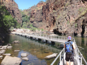
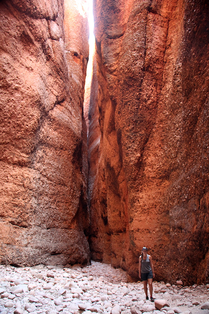
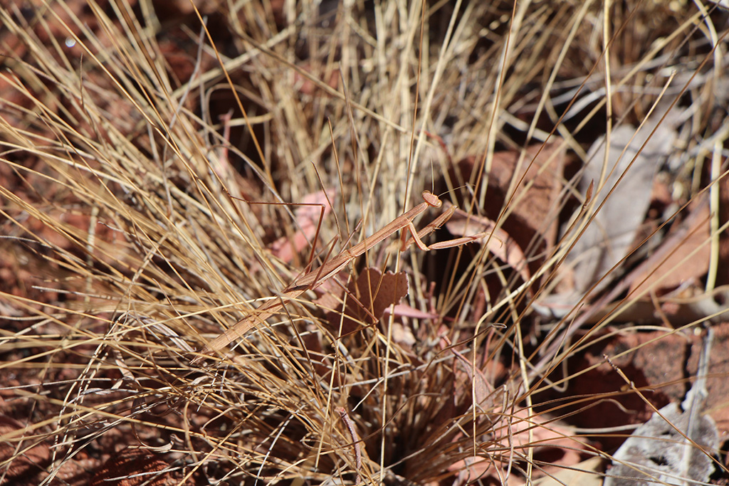
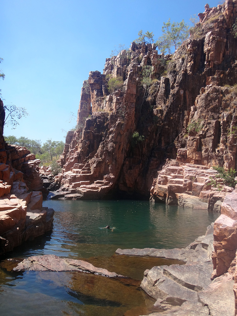
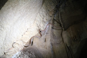
We headed back down the gorge, boarded the boat and walked back to the Jeep. We drove through the deep water crossing once again and then stopped for some lunch. After lunch we headed down to Jim Jim Falls. We decided that we were walking to the top of Jim Jim Falls. It was only 3km but looked like a tough climb and the sign warned that the walked was very difficult, very steep and would take around 4-6 hours. It advised to only start the walk before 10:30am. It was now 3pm but we decided to do it anyway. As warned the climb was very difficult and steep. As we crossed the second river we were lucky enough to spot a Green Tree Snake.

KakaduJimJimFalls_HDR1 DSC08675

We eventually made it up to the top of the climb and were surprised that it took a further 30+ minutes to walk to the top of Jim Jim Falls. We were exhausted when we got to the top and had a look around before resting in one of the plunge pools.

DSC08687 KakaduJimJimFalls_HDR2

We left the top and made our way down. The sunset was amazing and we got a great view of it on our way down. As we arrived back to the Jeep it was beginning to get dark. We were in for a late dinner back at the caravan!

Day 5 in Kakadu
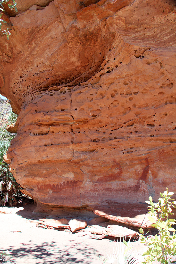
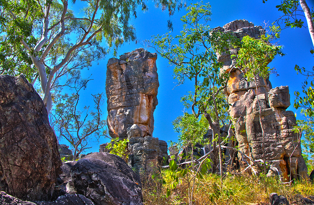
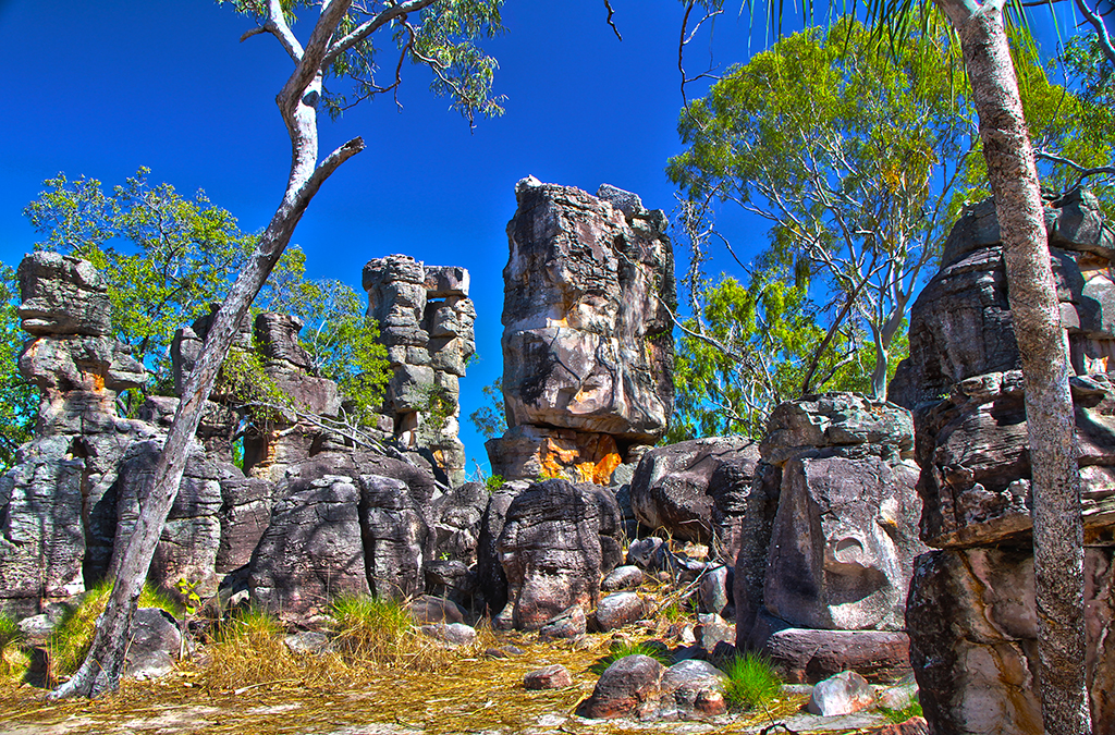
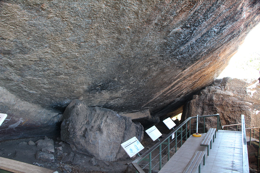
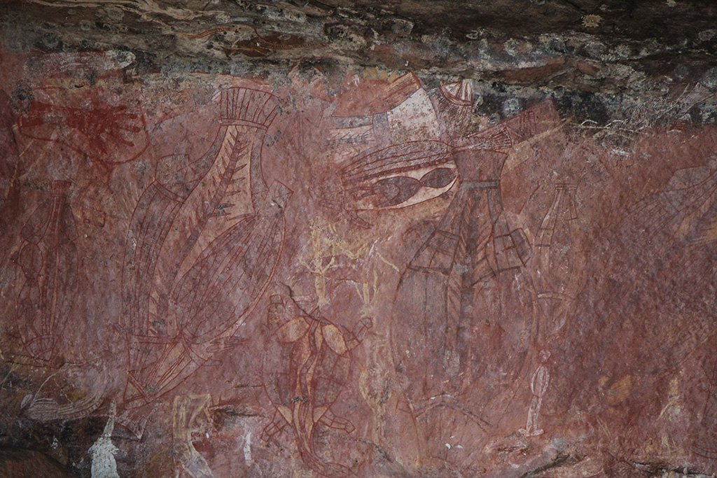
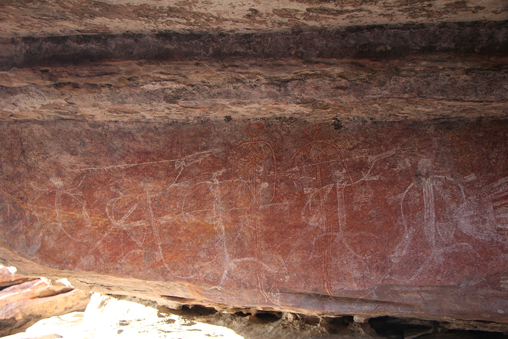
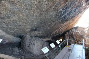
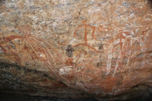
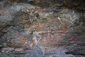
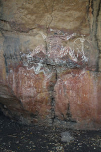
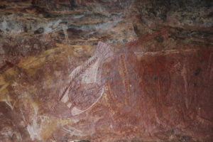
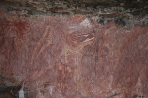
We packed up camp and headed north to Nourlangie. It has a fairly short and easy walk which takes you in and around the aboriginal rock art. It was quite interesting and has some nice art works. It was a very popular spot so we couldn’t marvel at the art for too long before being swamped by other tourists.

IMG_01693 IMG_01697 IMG_01705 IMG_01710

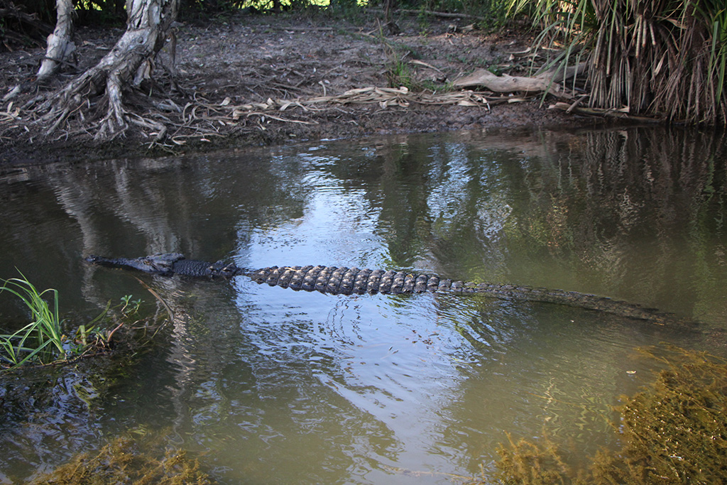
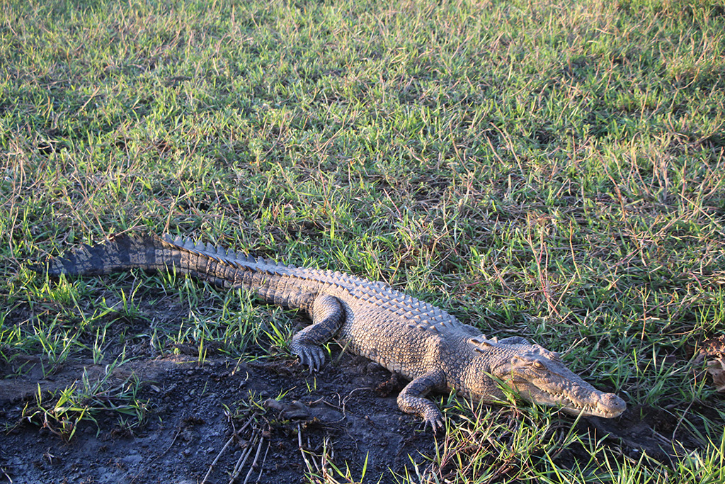
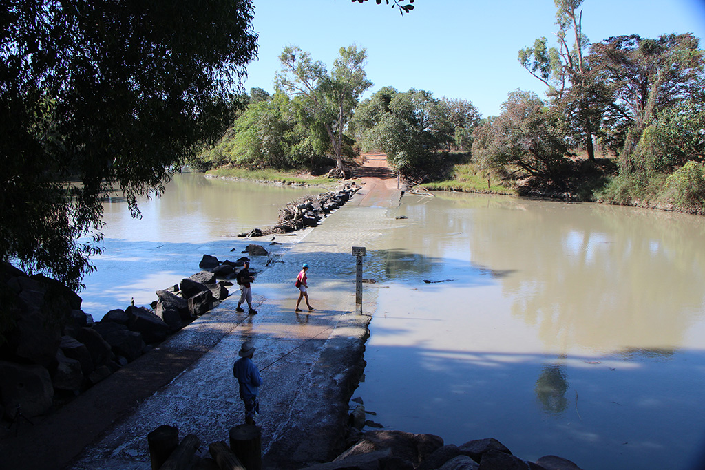
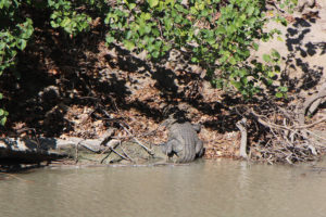
From here we headed to Jabiru where we visited the cultural centre and then had lunch by the lake. We then went up to Merl and set up camp. We then took the short 500m walk down to Cahill’s Crossing to have a look for crocodiles. We saw over half a dozen in the water and a couple on the banks of the river.

IMG_01713 IMG_01718 IMG_01722

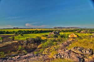
After returning to the caravan we then drove up to Ubirr. It is a very short drive from Merl and there was plenty of parking at this time of the afternoon. We wandered around the aboriginal rock art sites. Ubirr is a very nice spot with plenty of shade and lots of rock overhangs and small caves.

IMG_01749 IMG_01750 IMG_01769

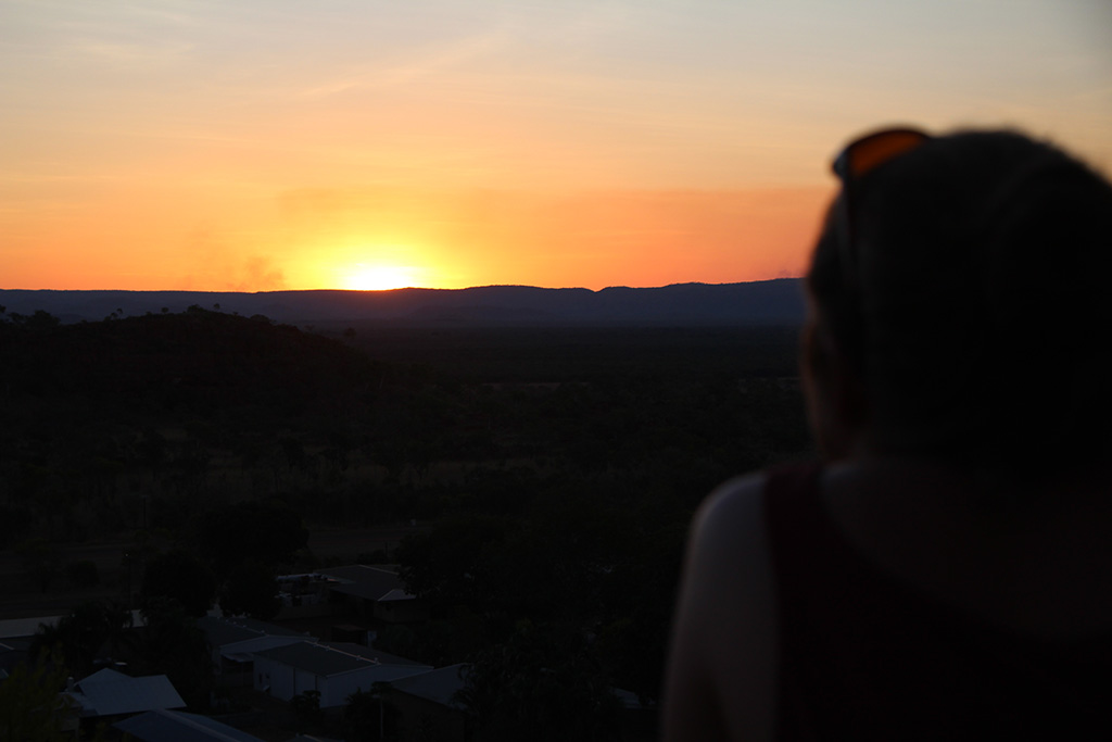
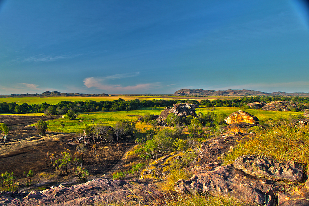
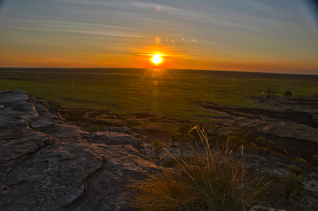
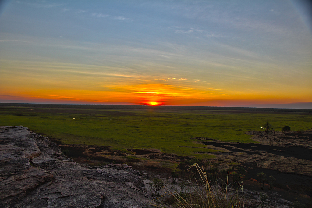
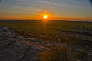
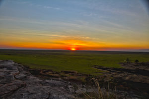
We then walked up to the lookout where only a few people were and set up to watch the sunset. As sunset got closer, more and more people came. By the time the sun eventually set there would have been a couple of hundred people up on the rocks watching it. The lookout at Ubirr is very beautiful. It looks out over the wetlands which are amazingly green and when the sun sets it looks brilliant. We found it difficult to capture on camera but enjoyed the beauty of the sunset very much.

KakaduUbirr_HDR1 KakaduUbirr_HDR7 KakaduUbirr_HDR11

Day 6 in Kakadu (perhaps now week 7?)
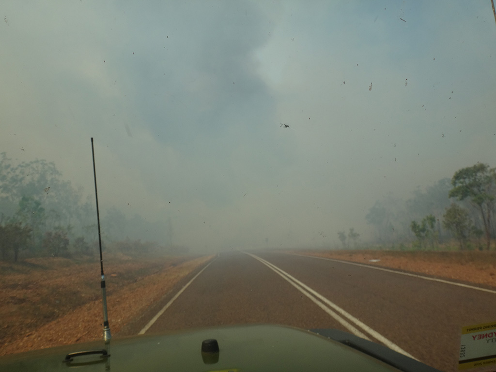
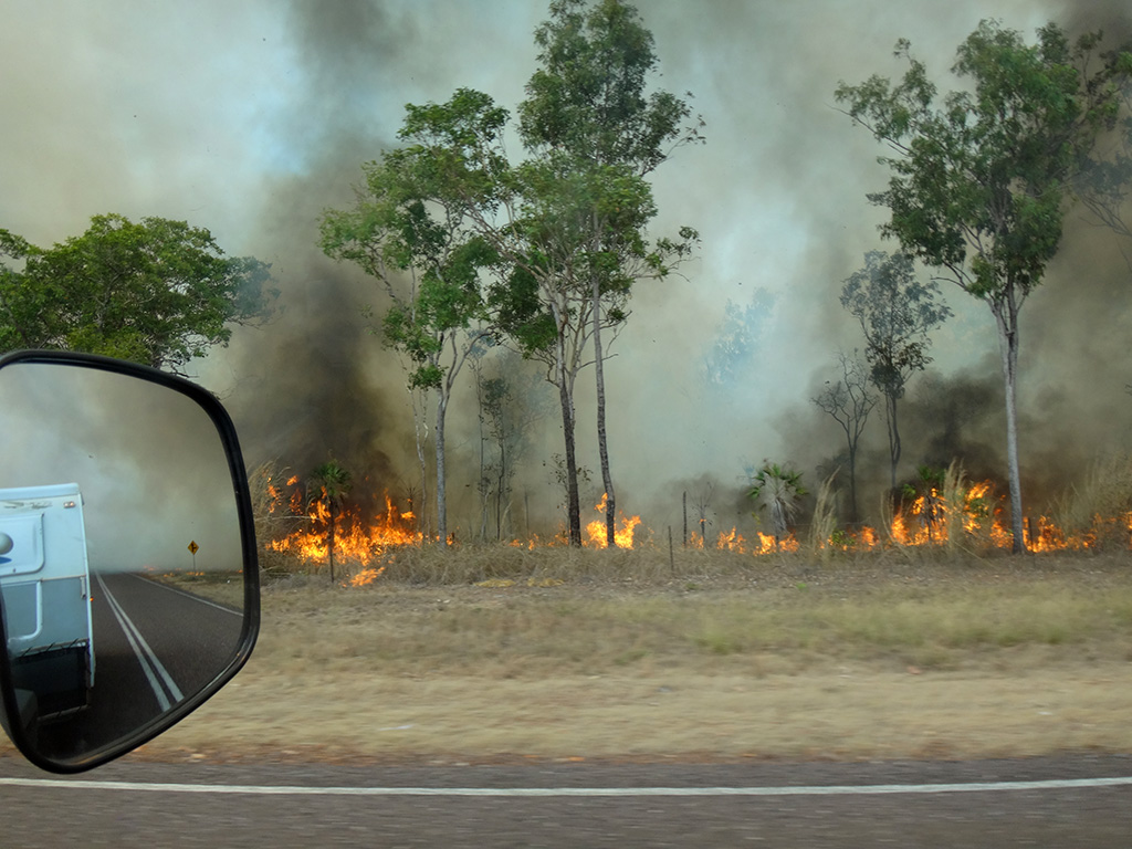
It was now Sunday and time for us to leave Kakadu. We had had a great time in Kakadu with beautiful swimming spots, great walks, amazing wildlife and a rich history of aboriginal culture. We were however disappointed by the costs ($40 entry each for 7 days, $30 camping per night) and the severe lack of care and maintenance for the facilities and roads. The toilet blocks were quite dirty, there was no hand soap, Gunlom didn’t have toilet seats at all, the roads were unmaintained and severely corrugated, there is differing information in the visiter guides/flyers/signs to what’s actually there, the visiter guide online which I downloaded a few weeks before we left has out of date information ($25 entry for 14 days, wrong information about the park, where to buy tickets etc.), the Rangers don’t seem to have a clue about the actual road conditions but yet the cultural centres were amazing with great displays and beautiful facilities. It is disappointing that some care and maintenance couldn’t go into other parts of the park as well.

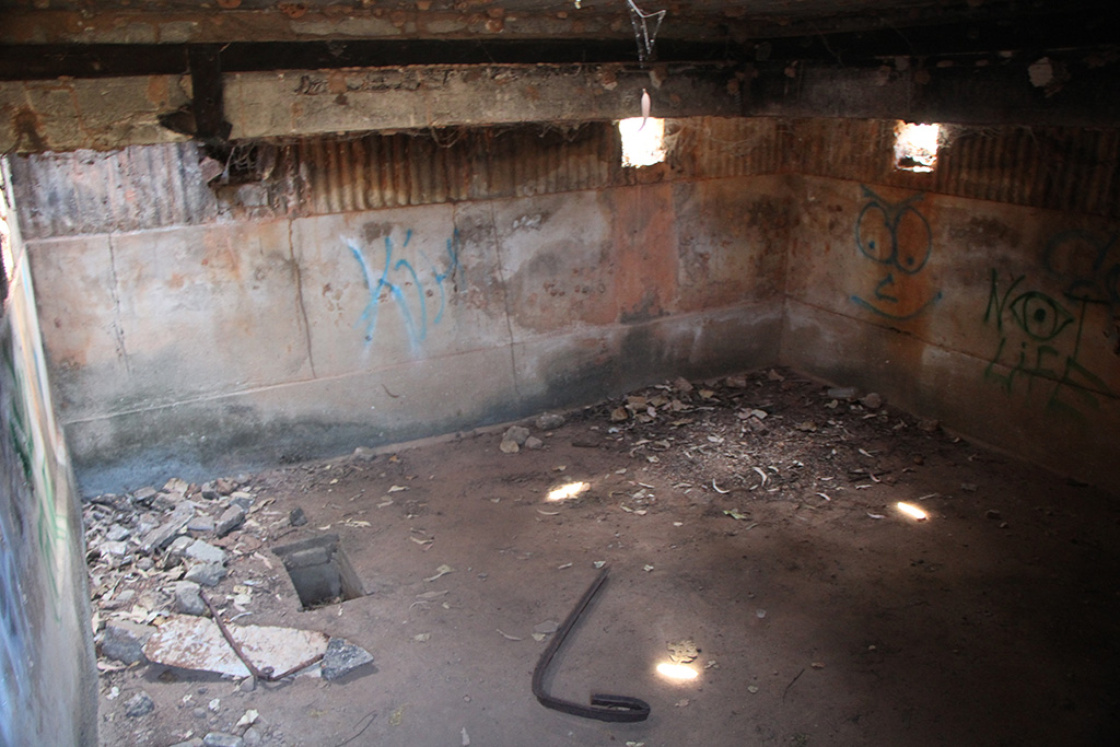
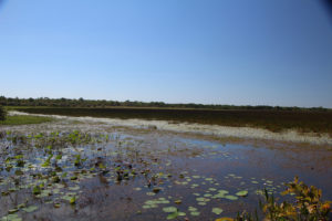
On our way out of Kakadu we visited the Mamukala Wetlands. It has a nice little bird watching bunker where we planted ourselves with a set of binoculars to see what we could find. We saw some Magpie Geese, some Jacanas, an Egret and birds we couldn’t quite make out in the distance. We found that our knowledge of the wildlife had greatly increased due to our guide on the Yellow Water Cruise.

IMG_01874

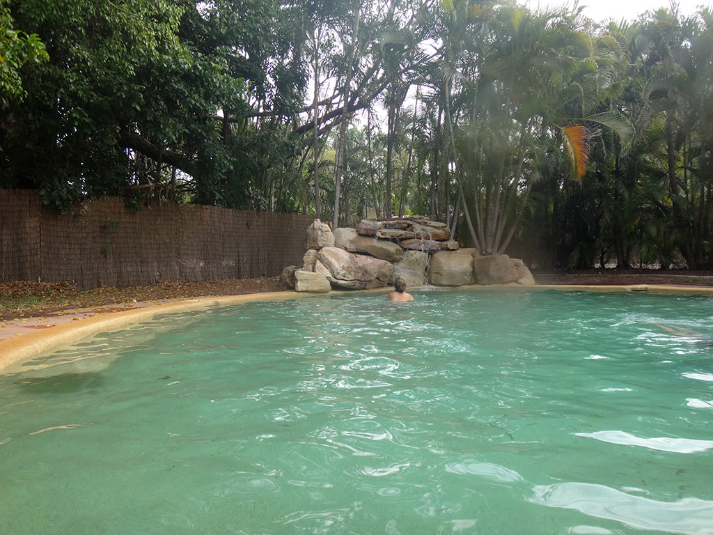
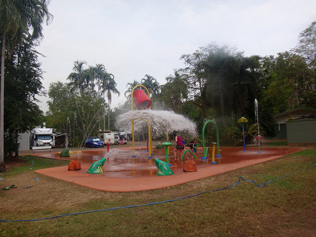
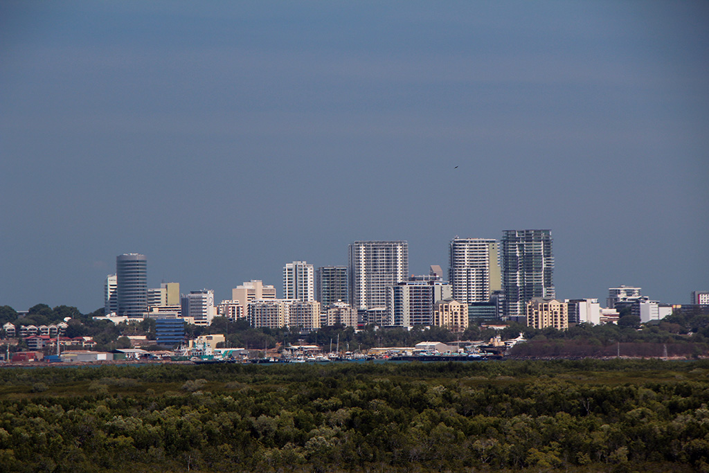
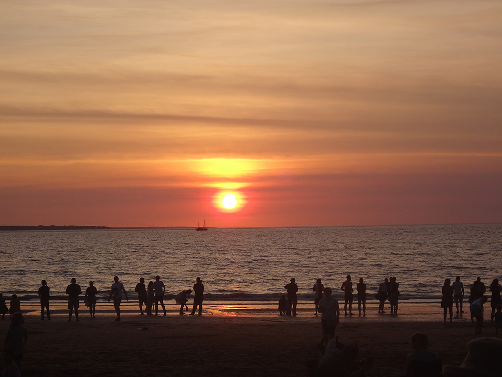
We traveled up to Darwin and made ourselves at home in the Big4 at Howard Springs. In the evening we went up to the Mindil Beach Markets and had a nice time looking around, having dinner and watching the sunset. It was pretty busy and there would have been a couple of thousand people on the beach watching the sun set with us but it added to the vibe of the markets.

DSC08745


Leave a reply

Week 6: (Part 1) Nitmiluk National Park

We end week 5 and start week 6 in Katherine Gorge which is within the Nitmiluk National Park. On our first full day, which just so happened to be the Saturday of a long weekend in the Northern Territory, we hired a double canoe and headed up the gorge.

We met for the canoe hire at the specified time of 7:45am with a crowd of people, collected our PFD’s, our paddles and boarded a boat to be transported up to the second gorge. After a short 10 minute boat ride and a small walk over some rocks we collected our canoe and started paddling up the river. The gorge was quite deep, the water not so bad and the rock walls amazing.

DSC08347 DSC08339 DSC08345

We eventually made it to the end of gorge 2 and scrambled over some small rocks to gorge 3. We paddled up gorge 3 and came to a more sizeable rock scramble. After negotiating the rocks we saw we only had 50m of water before the next rock scramble which didn’t give us much encouragement. We had a chat to a young couple who were making their way out of the gorge to get a guage of how bad they would be. We felt encouraged that they thought this was one of the worst ones. After making it over the rock scramble we stopped for some morning tea.

DSC08351 DSC08355

We kept paddling and after a couple more rock scrambles we made it into the start of gorge 6. we decided not to proceed further as there were some large successive rock scrambles. We turned around and made our way back to Smitt Rock for lunch and to spend some time swimming.

DSC08364 DSC08384 DSC08393 DSC08415

After a couple of hours of enjoying the water we made our way back down the gorge, over the rock scrambles and back to the boat. We had a great day and paddled around 13km over the course of the day.

The next day we prepped ourselves to leave Katherine Gorge but before we left we walked the Baruwei Loop walk. It was around 5km but felt much further due to the heat! It was a very rewarding walk and gave us a great view of Katherine Gorge and out beyond the gorge down the Katherine River. We would highly recommend doing this short walk.

KatherineGorge_HDR1 KatherineGorge_HDR4

From Katherine Gorge we headed back to Katherine and then up towards Edith Falls. Due to it being so busy at Edith Falls we camped outside of the National Park in a rest area not far.

The next day, being the 1st of August, we headed into Edith Falls. The day was already starting to heat up but we decided we wanted to see everything we could so we set out for Sweetwater Pool which is the furthest walk. It was a 4.5km walk out to it and you are greeted with a nice uphill section first. After the first uphill it is not a difficult walk but it is very exposed to the sun and feels very hot. However, Sweetwater Pool does not disappoint and is a great reward for taking the time to get out there. It has a beautiful big pool with clear water and then a series of small water falls into some smaller pools. The big pool has refreshingly cool water and the smaller pools warmer water. We thoroughly enjoyed the swim!

EdithFallsSweetwaterPool_HDR1 EdithFallsSweetwaterPool_HDR2

We then headed back down the track and then down to the Upper Pool. It has a nice waterfall and a huge swimming area. There were lots of people swimming here, however, it didn’t feel overly crowded.

EdithFallsUpperPool_HDR1

After cooling off and having a swim we continued around the loop track to a lookout which overlooks the middle pool back towards the upper pool. This was definitely worth coming to and gave us an amazing perspective of the area.

EdithFalls_HDR1

We made our way back to the Jeep via the Lower Pool which was full of people floating around on their pool noodles and the water felt much cooler than the upper pools. From here we continued driving north and camped just outside Kakadu National Park.

IMG_01358


Leave a reply

Week 5: (Part 4) Cutta Cutta Caves

On Friday 29 July we left Mataranka and made the short journey north to Cutta Cutta Caves. They are only around 80km from Mataranka and 20km from Katherine. There is only 1 cave they tour in, Cutta Cutta Cave, but the cave takes you 30m below the surface and 240m deep.

IMG_01217

The cave is home to a number of rare species of animals including Ghost Bats and Brown Tree Snakes. We were lucky enough to see 3 Brown Tree Snakes on our tour including one which was slithering 4m above us on a rock wall. The caves themselves are quite beautiful and there are a number of amazing formations.

IMG_01224  IMG_01228 IMG_01238 IMG_01225

The tour lasted around 2 hours and then we left and headed for Katherine for supplies and then onto Katherine Gorge where we stayed 2 nights.


Leave a reply

Week 5: (Part 3) Mataranka

Yesterday we left Butterfly Spring in Limmen National Park and made our way off the dirt roads back on to the black top near Mataranka. We were happy to make it back to sealed roads after over 1200kms on the dirt.

IMG_01212 DSC08230

We finally made Mataranka where we planned to have a couple of days rest in the thermal springs and then continue north to Katherine. While we were in Mataranka we spent a lot of time in the Mataranka Thermal Pool which was only 100m walk from our caravan. It has crystal clear water which comes out of the ground at 34 degrees and at the rate of 30.5 million litres per day! It is an amazing place to swim and relax and was surprisingly not too busy.

DSC08249 DSC08247

We also headed up to Bitter Springs which is a more natural thermal spring as it doesn’t have the formed sides in the pool. Bitter Springs is only around a 10 minute drive from Mataranka Thermal Pool. It is not just a pool but a section of the creek that you can swim in. You start at the top end and slowly meander your way down to the other end. The current slowly carries you down. It was much more busy at Bitter Springs and we would highly recommend taking your pool noodle or tube to float in.

DSC08263 DSC08275 DSC08288