Leave a reply

Week 12: (Part 1) Shark Bay Region

We drove into Carnarvon in the morning and visited the local supermarket and fueled up then drove out to the big jetty on the coast. We didn’t walk to the end of the jetty but admired it from the shore. We also visited the heritage precinct adjacent to the jetty which was quite interesting. It showcased some of the old shearing stories, transport and life in the area. There is also a water tank which is now a lookout which is worth going up and looking out to the jetty.

img_03750 img_03753 img_03754 img_03760

We left Carnarvon and headed for the Shark Bay area. We arrived in the afternoon and booked in to the Nanga Bay Resort. There weren’t many people staying there but it is not a bad caravan park. They have an artesian hot spa that is very nice for a dip in the cooler weather, it is right on the bay and they have a bar/bistro area.

dsc00599

The next morning we left early in hope of making it to Monkey Mia by 8am for the first of the dolphin experiences. Unfortuntely it took longer than we thought to get there and we arrived at 8:30am just as they were finishing feeding the first of the dolphins. As they say they do up to 3 dolphin experiences between 7:45am and 12 midday we decided to hang around.

We could see the dolphins off in the distance playing around in the water but they did not come in close to the shore. We hung around for a few hours, as it was approaching 12 we decided to leave but finally a young dolphin came in and swam around the shore catching fish and showing off to the crowd of people. It was great to see the dolphin and watch it in its natural habitat.

img_03762 img_03766 img_03789 img_03801

We were happy we finally saw one and left after it swam away. We headed into Denham and had a BBQ lunch in the park. The facilities were super clean and nice. After lunch we headed up north to Francois Peron National Park.

Firstly we went to the Peron Heritage Precinct which gives some good information about the National Park and early life. They also have an artesian hot spa but we resisted and headed on up north.

img_03817

As instructed, we aired down to 20PSI and headed up north. The track was fairly sandy but not too bad. We drove all the way up to Skipjack Point. Closer to the top, it was very sandy and soft. We did a short walk to the coast which has some great lookouts. We stayed there and observed for quite a while. We were lucky enough to see a couple of turtles, a dolphin and its calf and a few small sharks. The coast was very pretty along here as well.

dsc00589 img_03823 img_03846 img_03824 img_03832 img_03839

We then drove around to Cape Peron and walked down to the beach. The coastline was similar and pretty. The red sand meets the white sand which gives it an amazing contrast.

img_03858

We headed south and drove out to Gregories. We walked down to the beach to have a look at the snorkeling area and walk around on the rocks. The reef looks to be quite large here but it was too cold for us to go in. We were lucky enough to see another few dolphins in the bay swimming around catching fish!

img_03860

We drove back down to the Peron Heritage Precinct and aired up at the air stations provided. We then went for a dip in the artesian hot spa. There were some locals aready in there and we joined them. The water was very warm and we enjoyed relaxing for a short while before we headed back to the caravan.

dsc00595 dsc00598

The next day we packed up and left the caravan park. We headed north a short distance up to Shell Beach. The walk down to Shell Beach is short but has some great signage with lots of informtion about the formation of the beach and the geological features around the area. The beach was very firm under foot and was covered in tiny little shells. It was quite amazing and we’d seen nothing like it before. There appeared to be no sand just shells! The beach was very beautiful.

img_03876 img_03868 img_03869

We headed back down south and went to Hamelin Pool. Nearby to the pool is an old quarry where they mine blocks made of tiny shells compressed and seemingly glued together.

img_03890 img_03888

A short distance away is Hamelin Pool where there are some amazing marine Stromatolites. There are only two other locations in the world where these occur. They were quite abundant and amazing.

img_03916 img_03930

We headed towards Kalbarri National Park and stayed a short distance from it.


Leave a reply

Week 11: (Part 2) Ningaloo Reef

We had camped just out of Tom Price at a road side stop. We got going early and headed for Exmouth. The drive was easy and pretty; there were many flowers lining the roads and off in the surrounds.

dsc00020 dsc00033

We arrived in Exmouth in the afternoon and were trying to book a campsite in the Cape Range National Park. We were not sure if it was fully booked out or if we were doing something wrong but we couldn’t get a site. We ended up staying at the Lighthouse Caravan Park as we wanted to be as close to the National Park as possible.

Earlier that week I had accidently dunked my camera underwater and had opened up the case and left it to dry for a few days. This afternoon was the time to put it back together and see if it was going to work. I first tested the lens on my older Canon 40D and it worked! I was feeling excited. I then put the camera together stuck the original battery back in and it didn’t turn on. I thought it was dead, but as a precautionary I changed batteries and to my amazement it worked! The lens and camera had survived!

We went out on to the beach for sunset and watch it disappear behind the headland and were lucky enough to spot some Humpback Whales out to sea.

img_03428 img_03399 img_03402

Ningaloo Reef Day 1

The next day we packed up early and arrived at the visitors centre in Cape Range NP right on opening. We chatted to the staff member and we were told that we were first in line for a booking cancellation and to wait until 10:45am.

dsc00424

We looked through the displays and waited. Finally she got a call and we had a campsite in the Mesa campground until Saturday morning. We were stoked and headed up there immediately. The campground was basically a big gravel carpark but was close to the beach. We unhitched and got ourselves organised for our first snorkel.

dsc00283

We drove to Turquoise Bay and walked down to the Drift Snorkel. We headed to the south end of the beach and swam out from there. The current slowly takes you north due to the water filling into the lagoon (which is the water between the reef edge and the land) and then draining out of a gap in the reef. There was lots to see; plenty of fish and plenty of coral. We really enjoyed our first snorkel and were keen to get in again.

dsc00038 dsc00049 dsc00052 dsc00053 dsc00076

We went back to the caravan for lunch and then headed down to Oyster Stacks, which gets its name from the limestone rocks which purtrude out of the water like stacks and are covered in oysters. This snorkeling site is only able to be snorkeled at high tides over a certain hight and this was going to be our only opportunity to do it. We hurried in and were very lucky to find a turtle sitting on the bottom of the beach. We hovered and watched it for a while and then it swam off. This snorkel site was one of our favourites and had heaps of coral, lots of fish, slugs and we found a giant clam.

dsc00105 dsc00113 dsc00123 dsc00125 dsc00128 dsc00148 dsc00151 dsc00155 dsc00161 dsc00163 dsc00167 dsc00172 dsc00178 dsc00192

We then jetted down further south to have a look around and saw some whales off the coast so we stopped at one of the campsites and watched them for a while. On the way back to camp we also spotted some Stuart Desert Peas growing by the side of the road.

img_03465 img_03441

Ningaloo Reef Day 2

Today we did another two snorkels. In the morning we went down to Lakeside which is right near the National Parks Visitors Centre. To get to this snorkeling location you have to walk around 500m from the carpark and then enter the water. Again there is a current pulling north so we started at the southern end. This was another great snorkeling spot; we saw heaps of fish, lots of coral, a giant clam, a couple of stingrays and a turtle.

dsc00203 dsc00225 dsc00226 dsc00232 dsc00233 dsc00234 dsc00240 dsc00244 dsc00250 dsc00262 dsc00270

We were out of the water when we spotted the turtle swimming adjacent to the beach so we quickly jumped into the water and followed it. It looked like it had some damage to its shell at the rear but it was happily swimming along.

In the afternoon we headed to Turquoise Bay again but this time went to the Bay Loop snorkeling area. The water was quite cloudy and stirred up so visibility wasn’t great. We still enjoyed having a look around at the fish and coral. We found some star fish and we even found a clown fish (Nemo!).

dsc00337 dsc00287 dsc00297 dsc00303 dsc00313

Ningaloo Reef Day 3

This morning we traveled down to Osprey and jump into the water for a snorkel. There was a very strong current pulling south at this spot and the visibility was low. We could not find much coral here and there seemed to be less fish in this spot compared to the others. We were lucky enough to find a giant clam and an octopus sitting on the bottom but we didn’t see a lot more. We didn’t stay long here and moved on up to Lakeside for another morning snorkel.

dsc00345 dsc00348 dsc00339

We went back up to Lakeside to finish the morning off with a longer snorkel. We planned to try and go to some of the reef we hadn’t been to the day before. Again we went to the southern end of the beach and drifted north. Again we saw plenty of fish and coral but this time we saw 3 stingrays including a blue spotted stingray.

dsc00357 dsc00362 dsc00366 dsc00372 dsc00379 dsc00386 dsc00392 dsc00393 dsc00397

That afternoon we made our way to Yardie Creek to have a look around. The creek is quite large but only a small opening to the ocean. We had a quick wander but it was very windy and cold.

dsc00418 dsc00419

On our way back we saw lots of kangaroos near the road and off in the grass.

img_03567 img_03580

Ningaloo Reef Day 4

Today we left the Mesa campground and headed back around to Exmouth. Along the way we visited the Lighthouse and enjoyed the view from up high.

img_03649

Back in Exmouth we went to the supermarket for some supplies, filled up water at the visitors centre and saw an emu.

img_03668

We drove down to Coral Bay and booked in to the caravan park for 1 night. We then walked up to Skeleton Bay to view the shark nursery. There were probably 40 or so sharks swimming around in the shallow water. We stayed there for a while and then went back to the caravan park.

img_03674 img_03683 img_03696

Ningaloo Reef Day 5

We left the caravan park early and left the caravan outside the visitors centre in town. We headed out of town and north past the airstrip. We arrived at the beach we were planning on driving north along only to find that it is closed to 4wd’s. We then drove back and headed up to the Coastal rd which is marked as 4wd only. We followed this road all the way to the sand dunes. Once at the sand dunes we headed south to Oyster Bridge. The sand is very soft so we aired down to 15psi.

Oyster Bridge looked amazing! We parked the Jeep and walked down to it and jumped in for a snorkel. Unfortunately the water was very stirred up due to the waves pushing over the bridge into the lagoon. There were some small patches of very pretty coral and there were fish. We also saw some giant clams and star fish as well.

dsc00441 dsc00448 dsc00450 dsc00458 dsc00464 dsc00466 dsc00467 dsc00472 dsc00473 img_03699

We headed back up north along the dunes and to a snorkeling location called The Lagoon. The waves were rolling in to this location and there was a large swell. We jumped in for a snorkel but due to the large swell and poor visibility decided to jump out shortly after.

dsc00440

We returned back to town and had lunch before heading up to Purdy Point for a look over the bay.

We made our way down to Five Finger Reef which is south of the township. Again there was soft sand to get down there but a beautiful drive along the coast and onto the beach. There was a current heading north so we jumped into the water at the southern end of the reef. This reef was probably the best snorkeling location we’d been in. There was a lot of coral, heaps of fish and a couple of octopuses.

dsc00491 dsc00496 dsc00504 dsc00508 dsc00511 dsc00515 dsc00529 dsc00531 img_03709 img_03714 img_03719

We had a great time snorkeling at Five Finger Reef and wish we could have gone back for a second time but we had to move on. We hitched the caravan back up and headed south. We passed through the Tropic of Capricorn and stopped for some photos. We continued south and on the road spotted a little Thorny Devil. We stopped and moved it off the road. It was very cute!

dsc00556 img_03723dsc00561

We camped at a road side rest area for the night which was swarming with flies!


Leave a reply

Week 10/Week 11: Karijini National Park

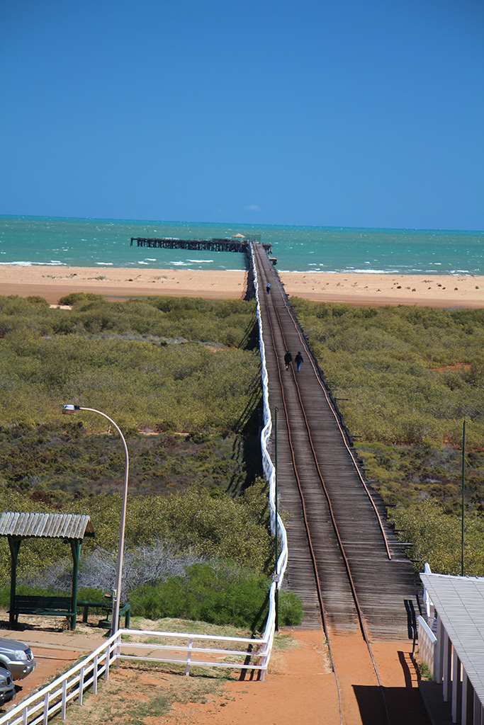
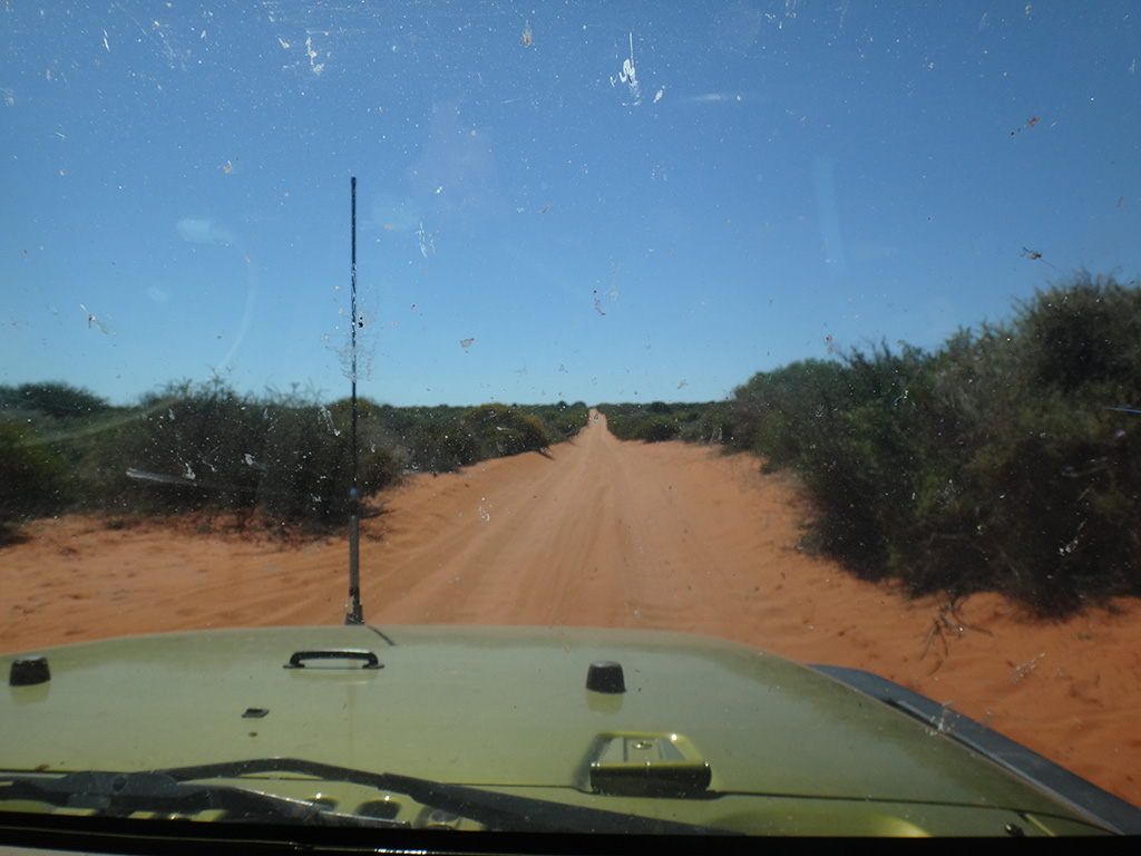
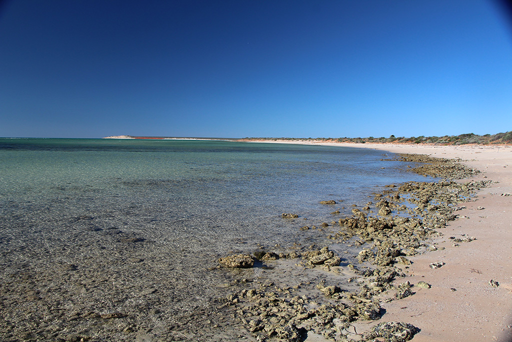
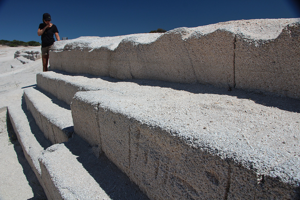
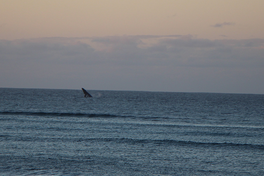
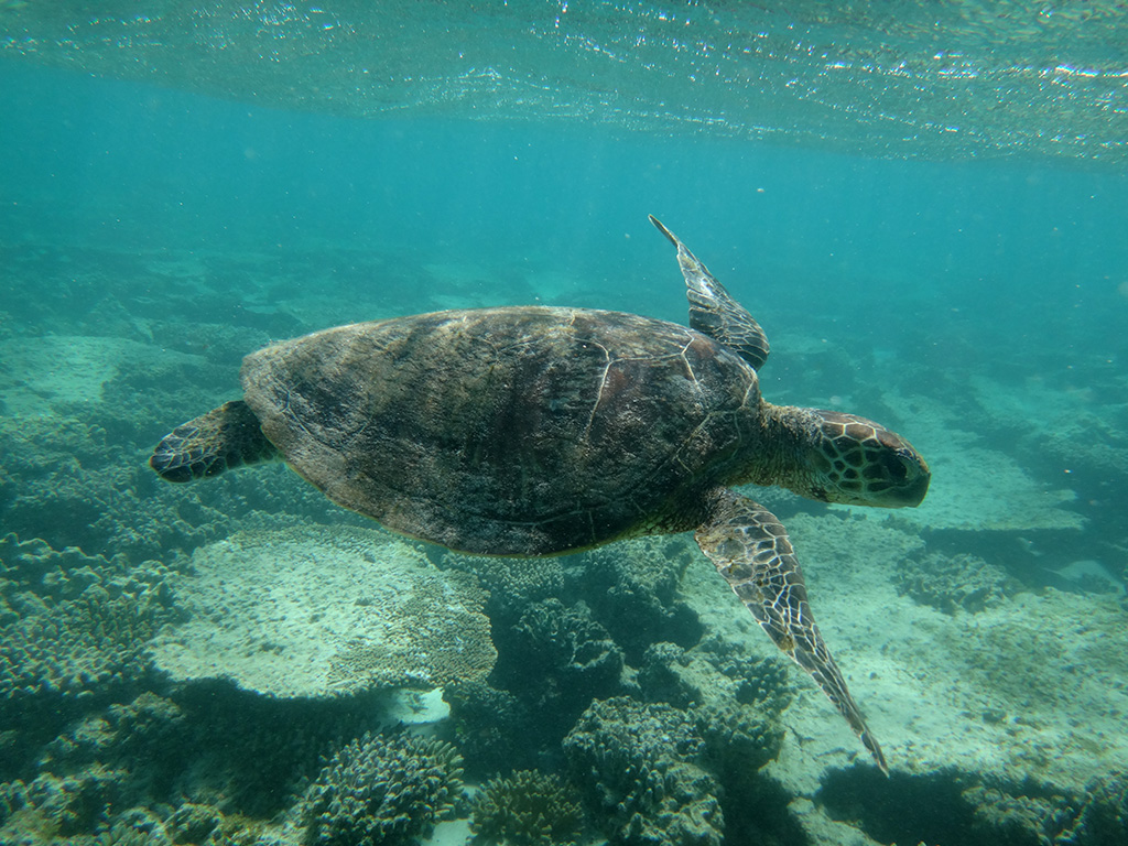
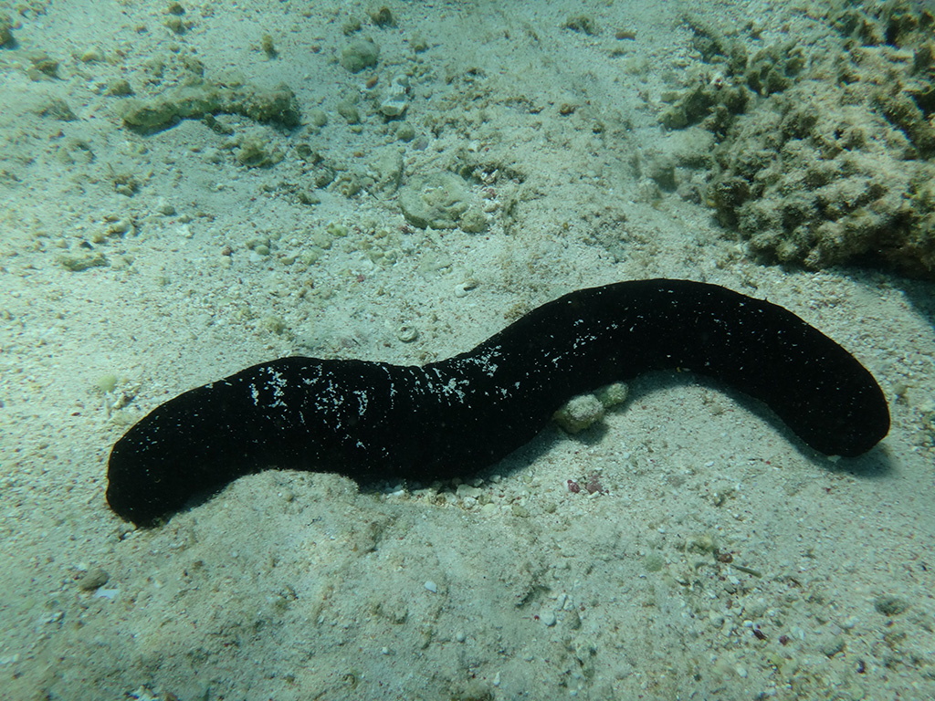
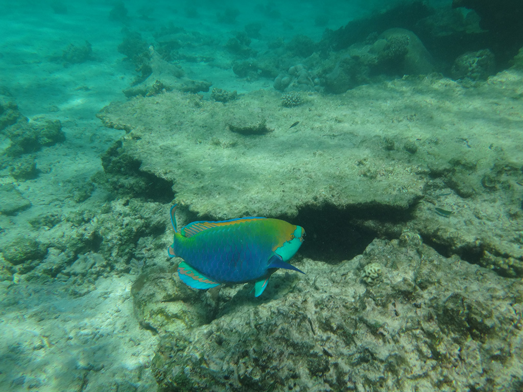
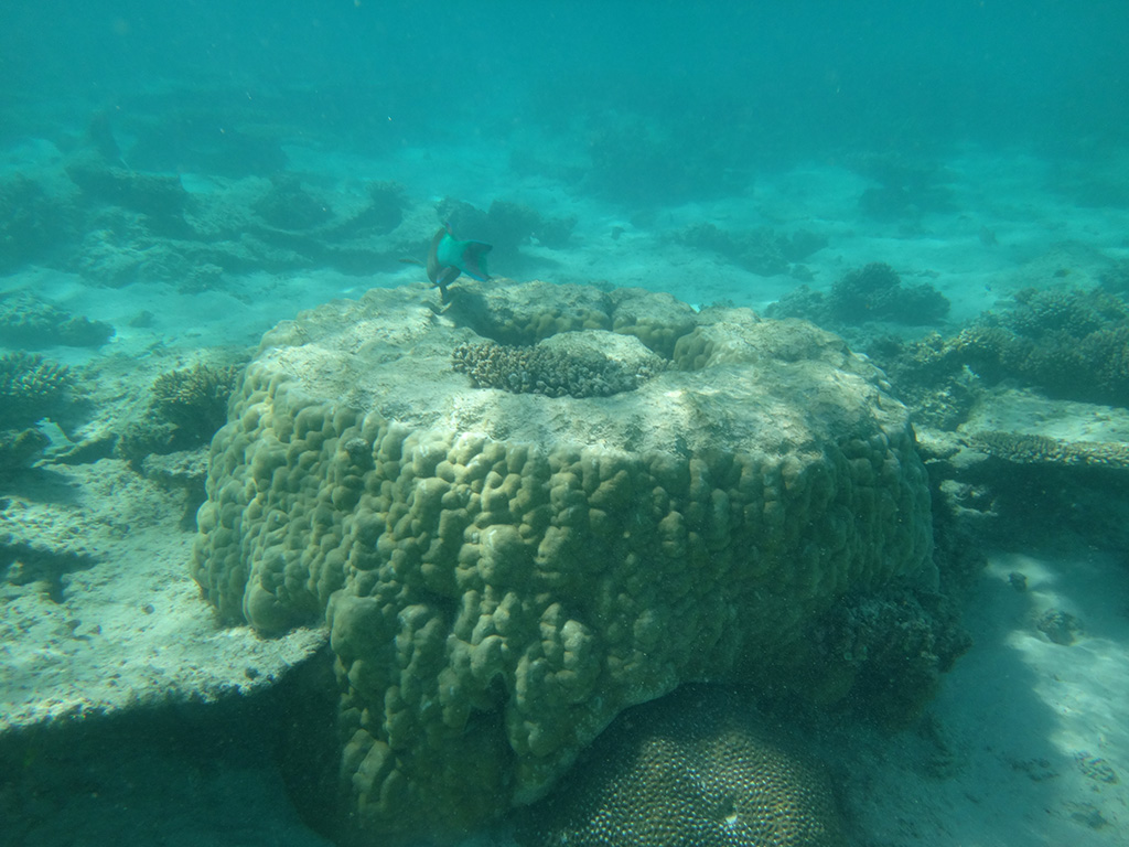
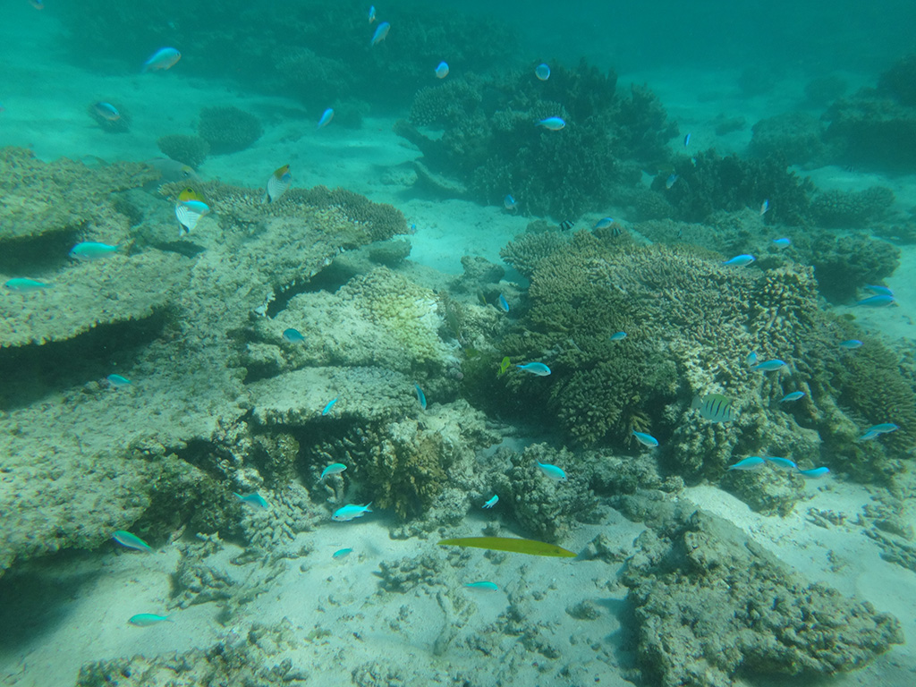
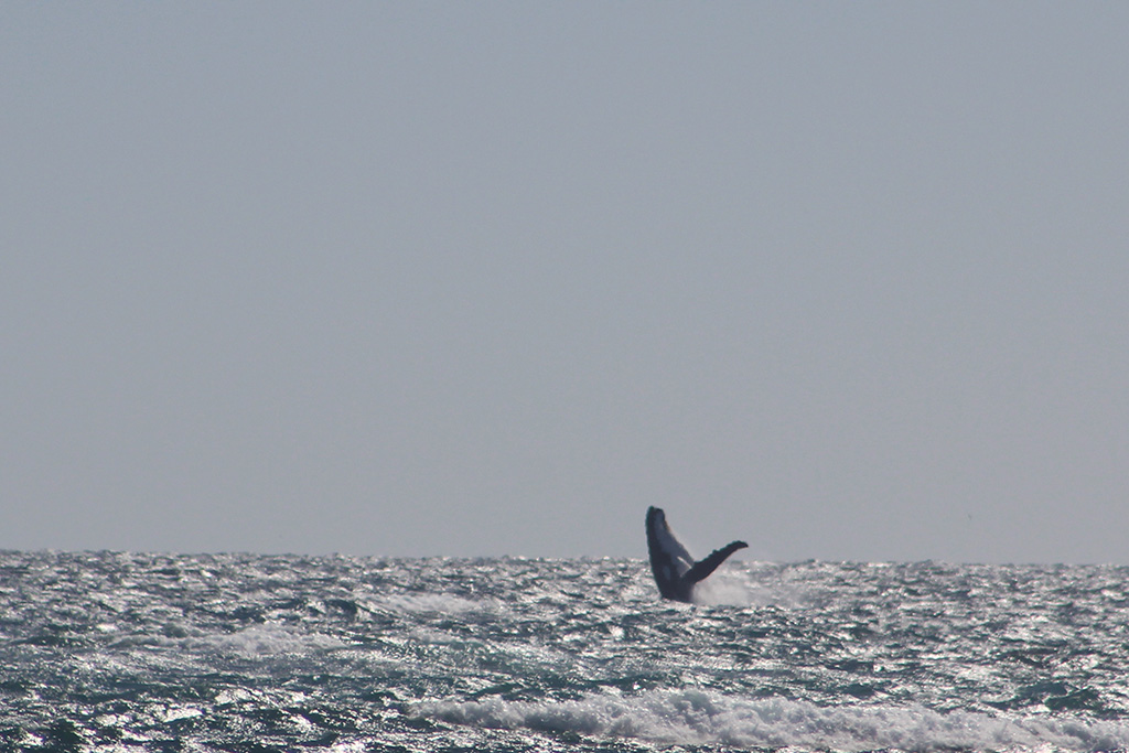
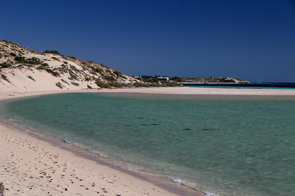
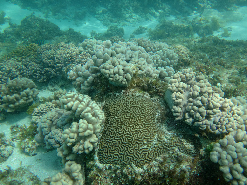
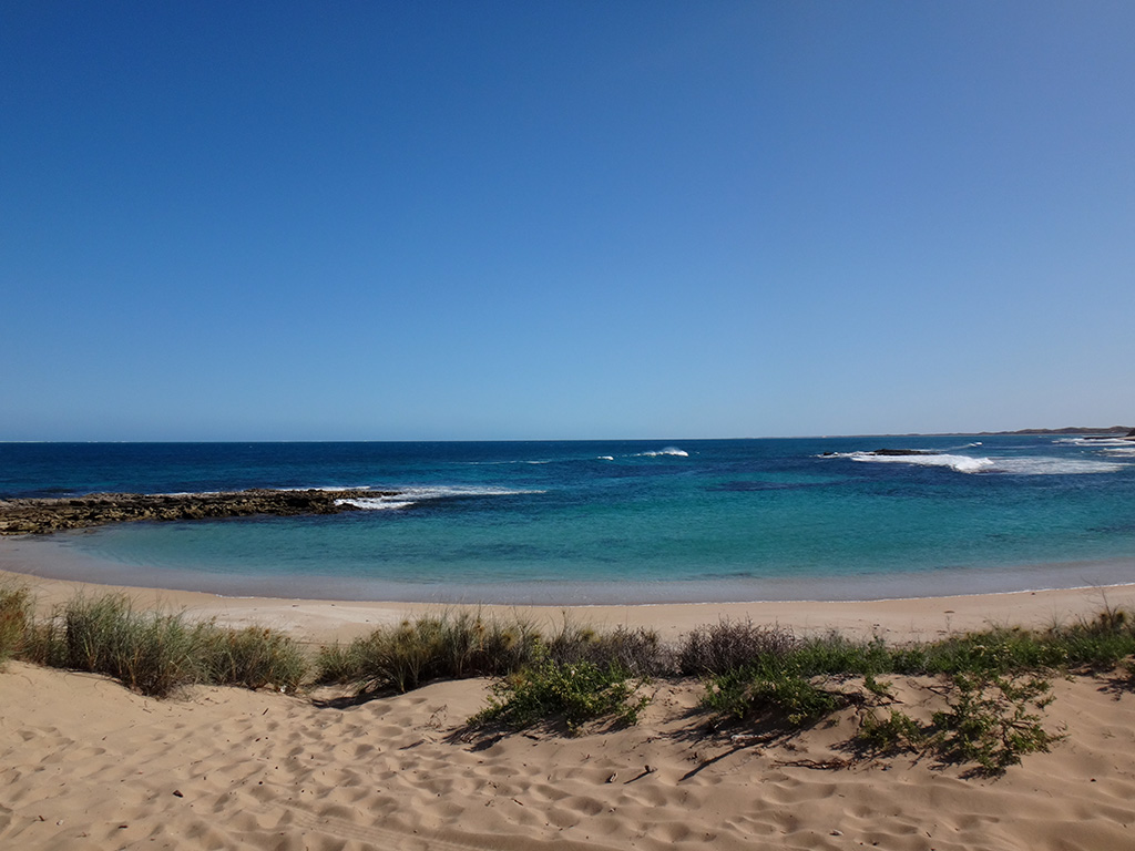
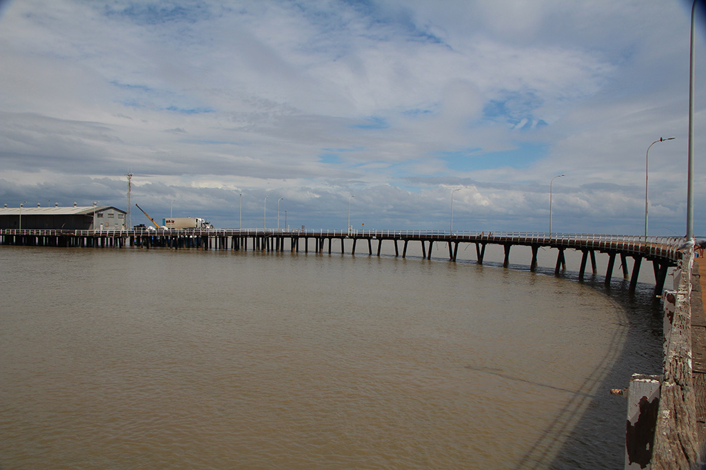
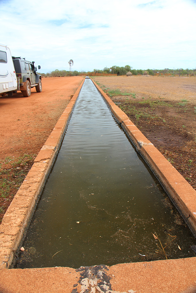
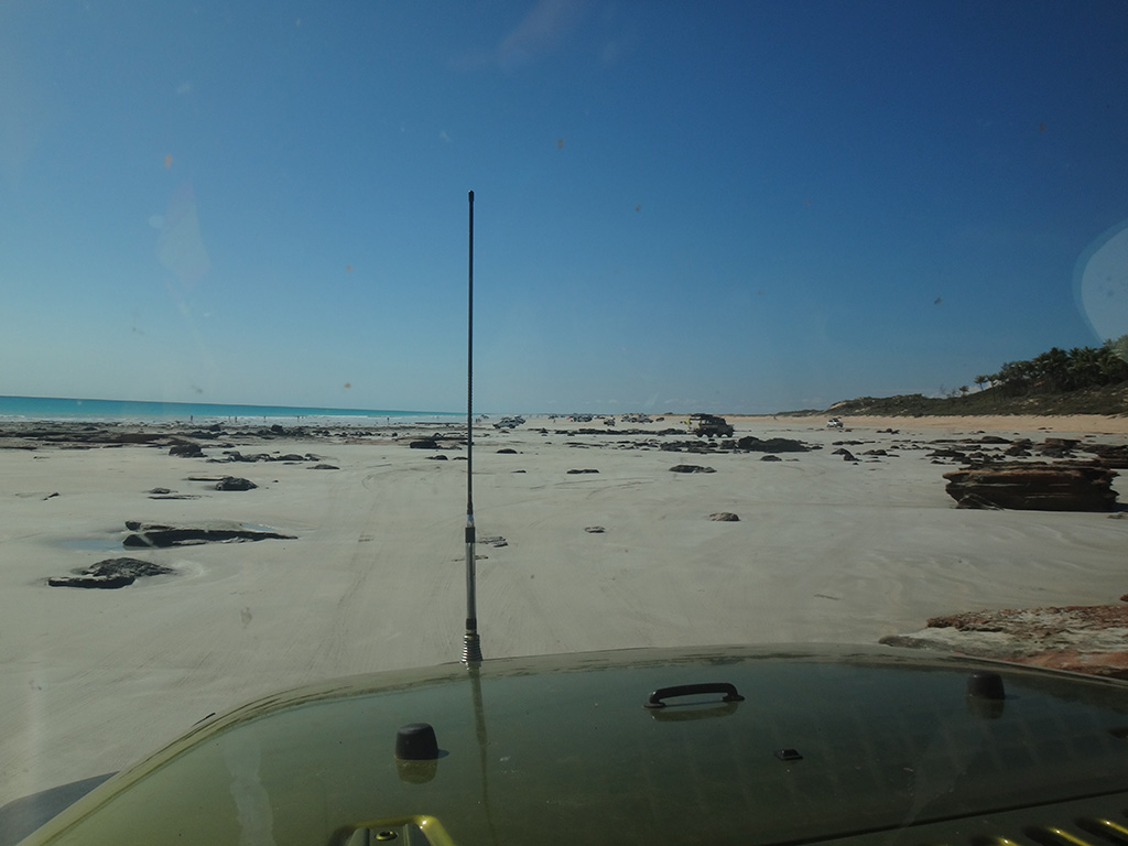
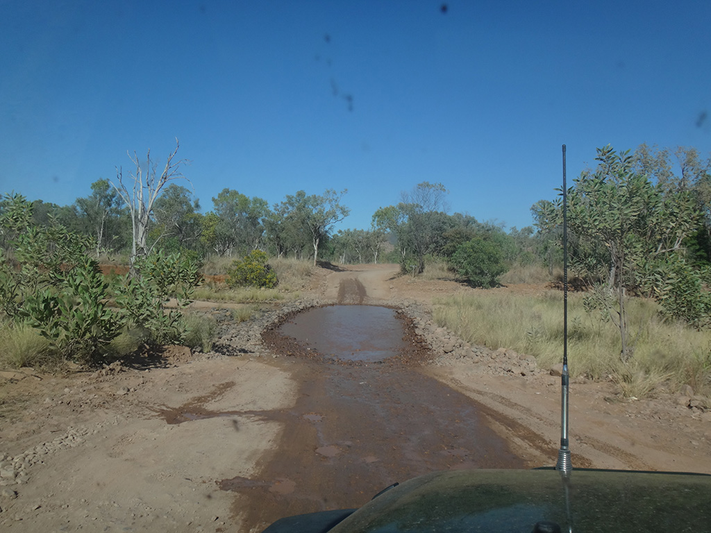
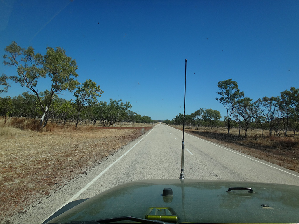
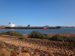
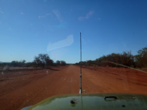
Today we left De Grey Rest area and made our way into Port Hedland. We ended up at a park adjacent to the mouth of the river which services the port and had morning tea. We enjoyed watching a massive ship be guided by a couple of tugboats through the river and out to sea. After a brief look around we left Port Hedland and headed toward Karijini National Park.

dsc09769

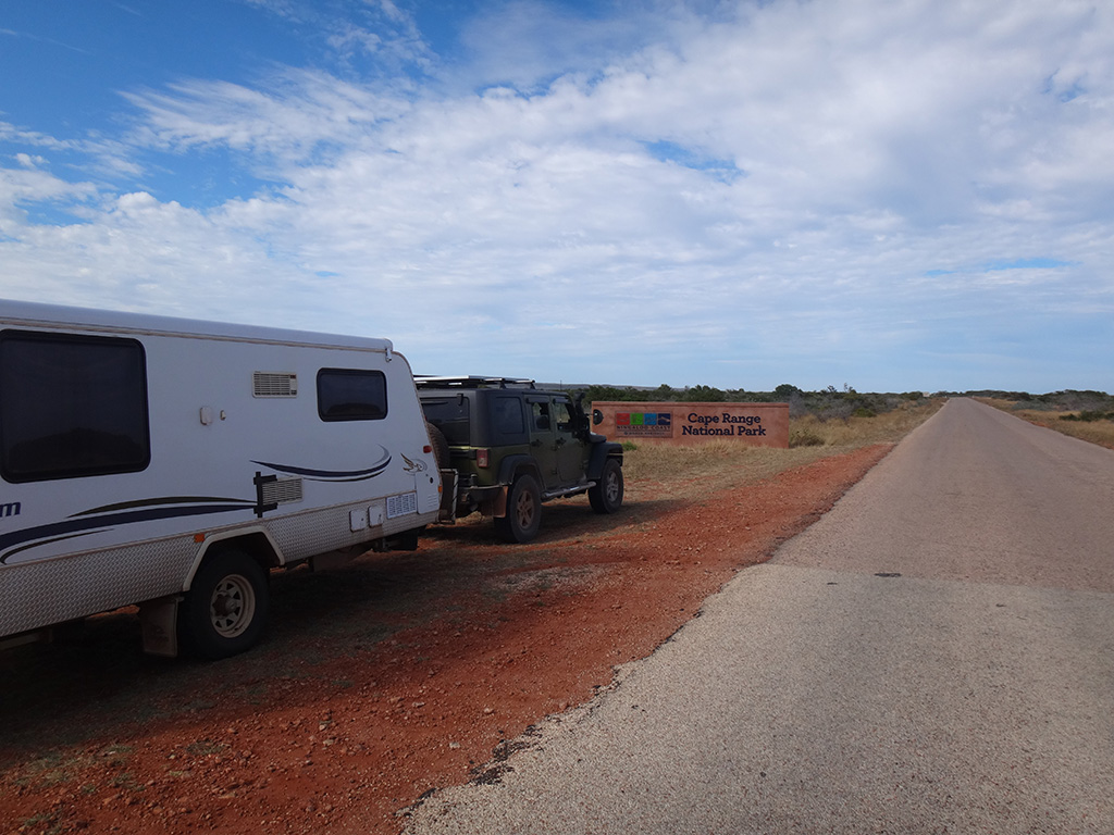
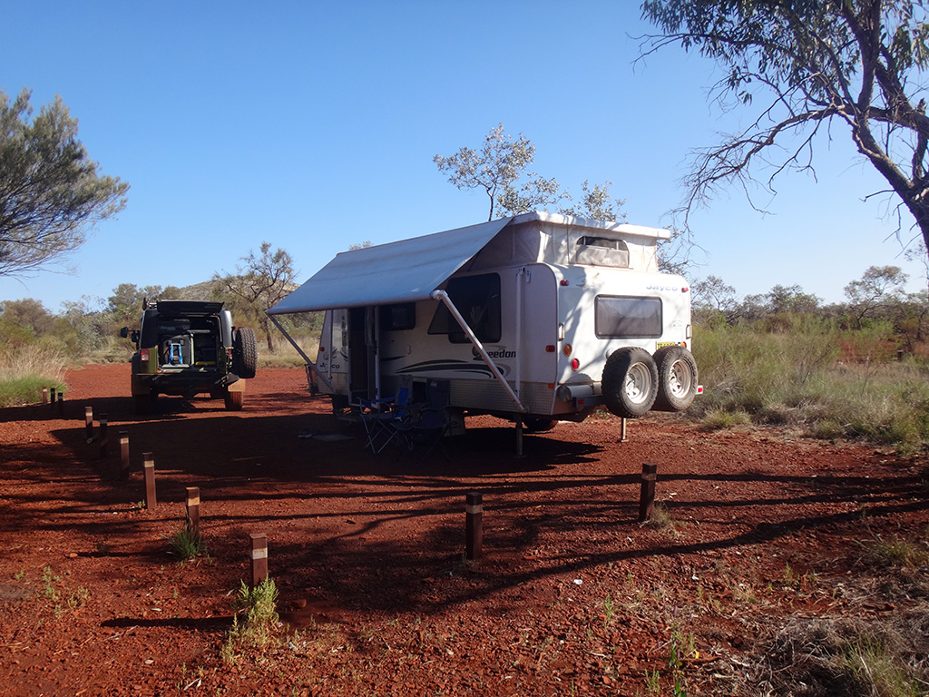
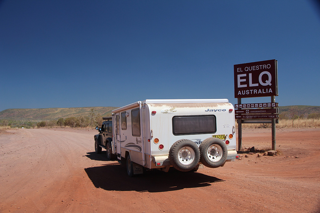
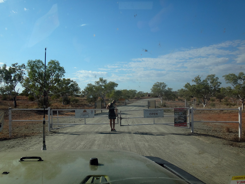
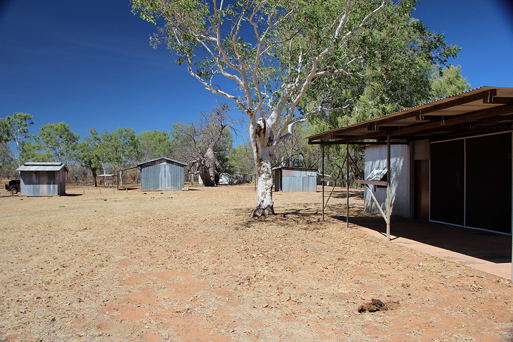
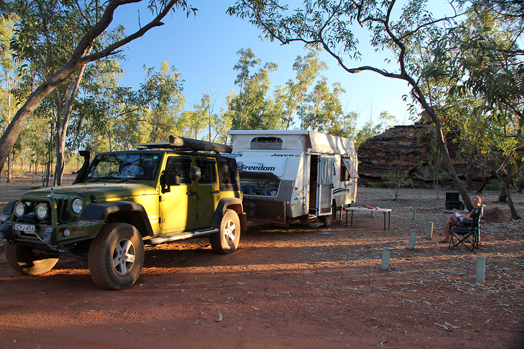
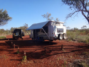
We arrived at Karijini National Park in the early afternoon and went to the visitors centre. The visitors centre is a 4million dollar building with some fancy displays and information. After talking to a staff member we headed for the campground, booked in for 3 nights and set up camp. The campground is quite basic and are managed by volunteers; for $10 per person per night you get a nice campsite and pit toilets. It seemed a bit rough considering the money that was poured into the visitors centre but we enjoyed our stay.

dsc09795

Karijini Day 1

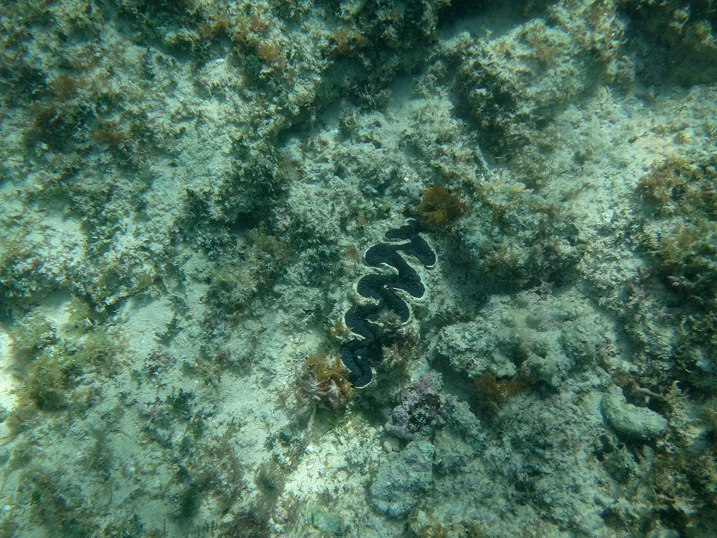
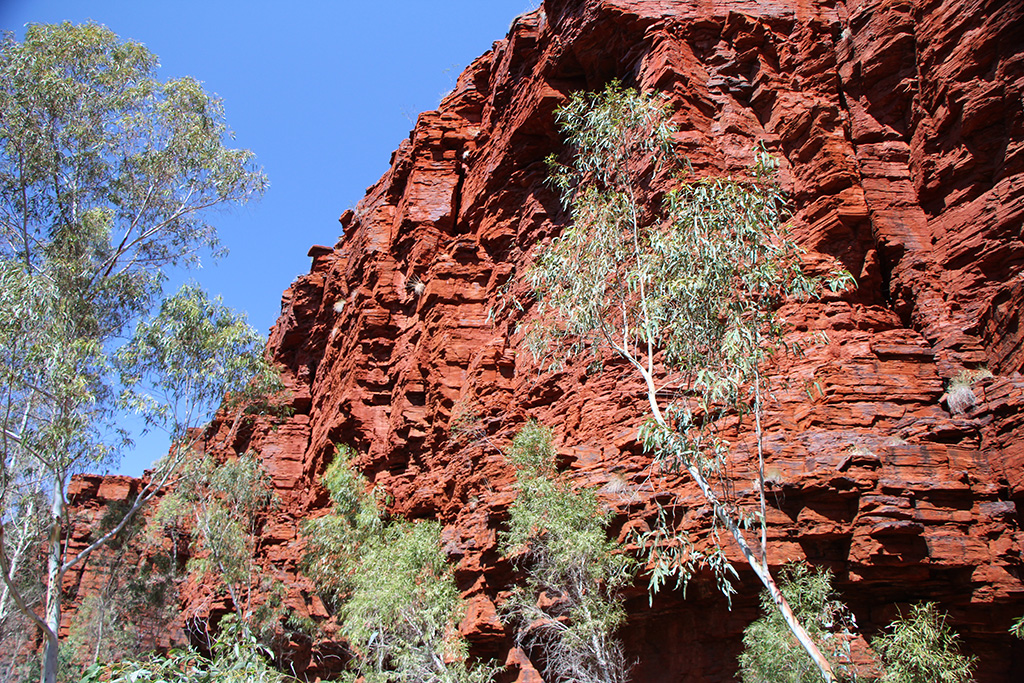
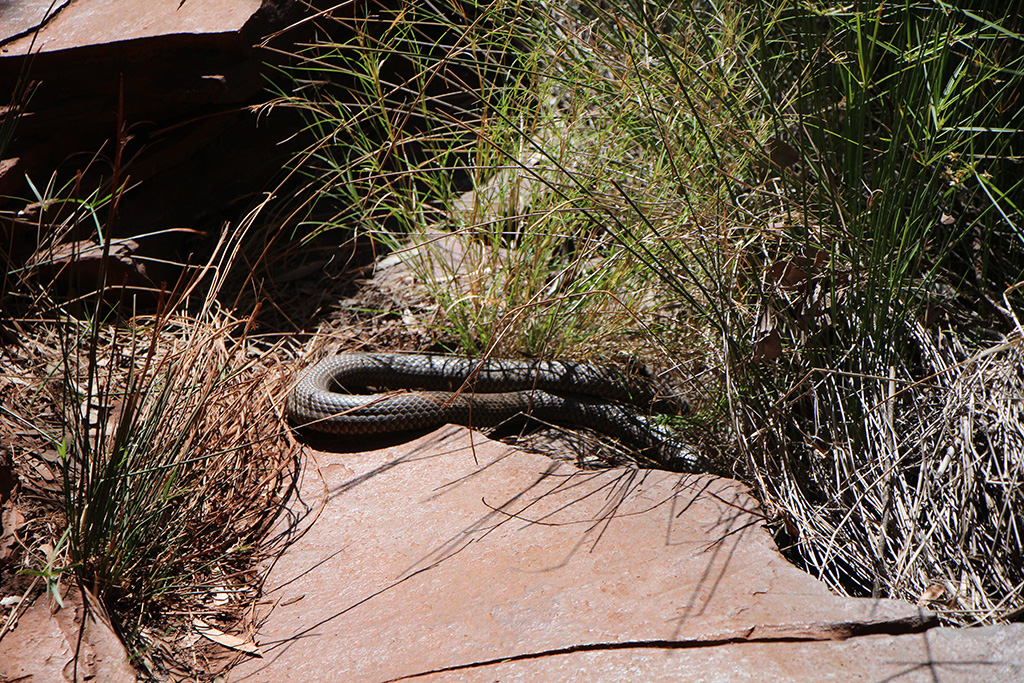
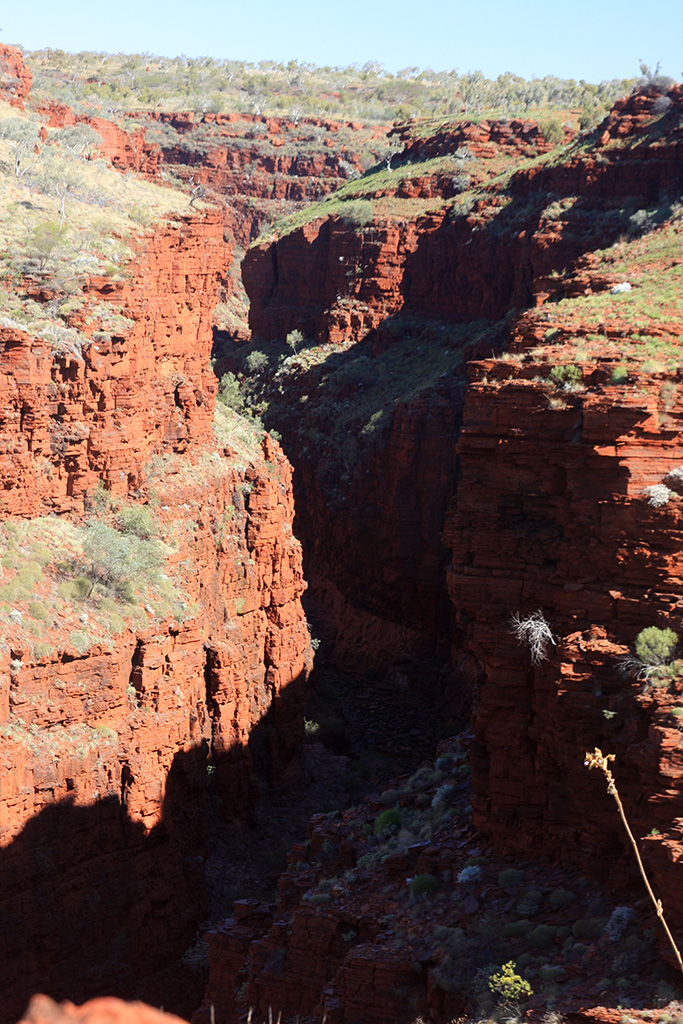
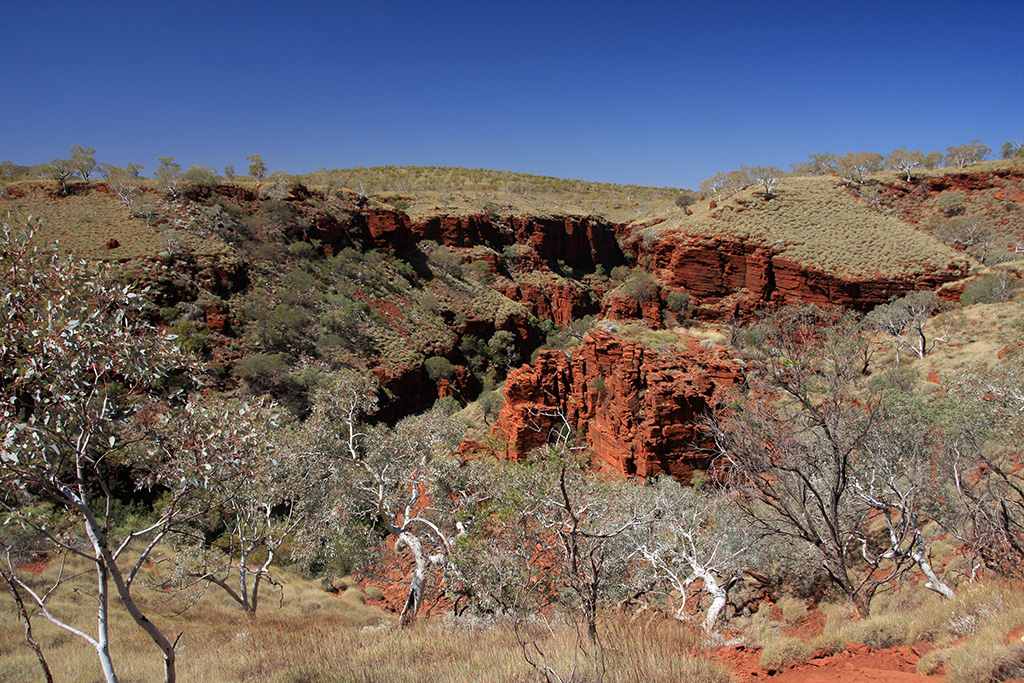
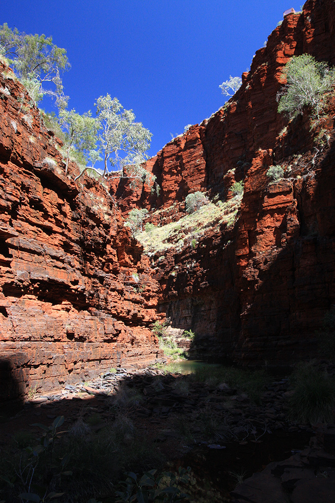
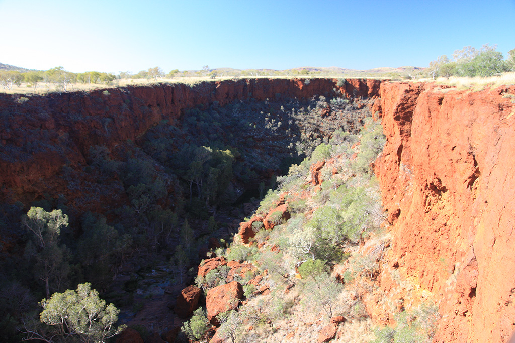
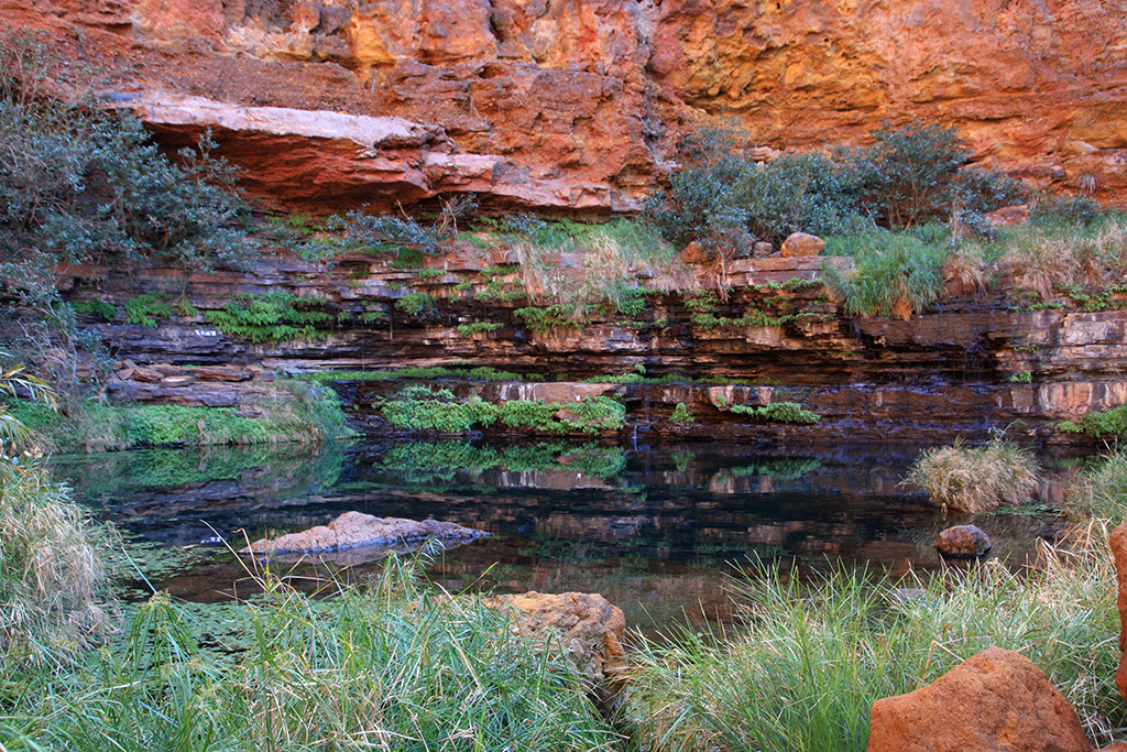
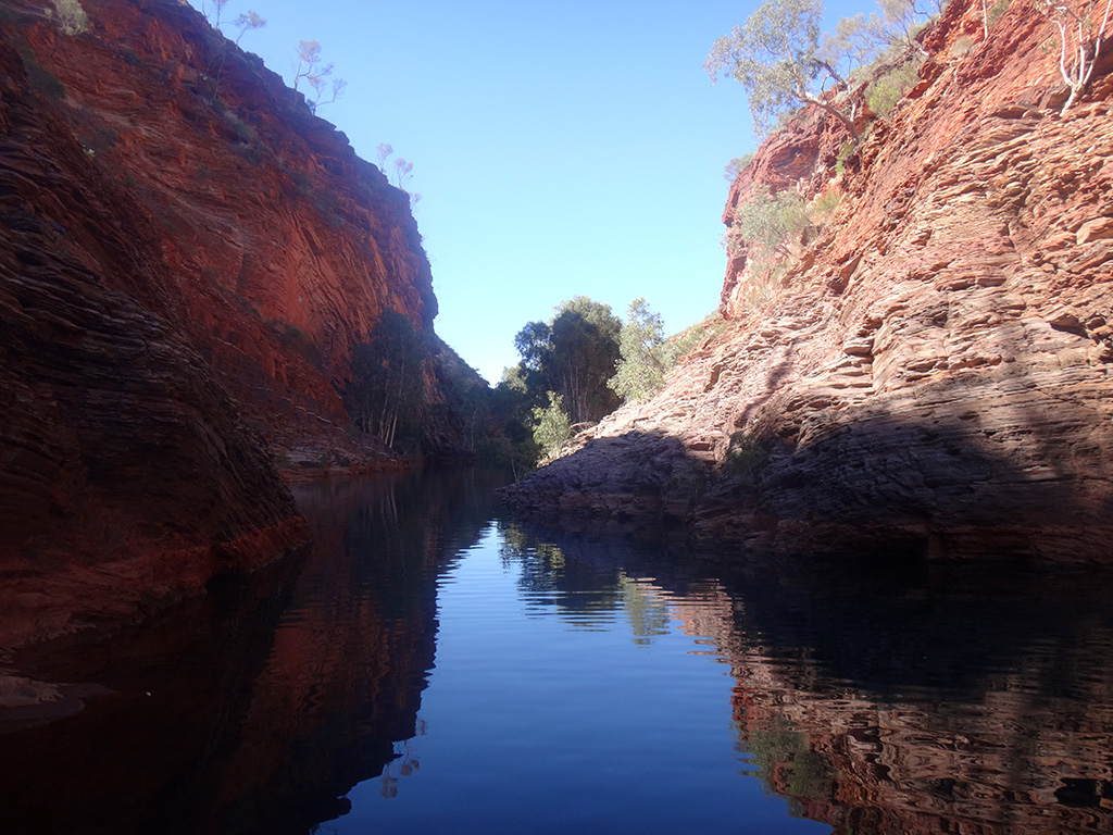
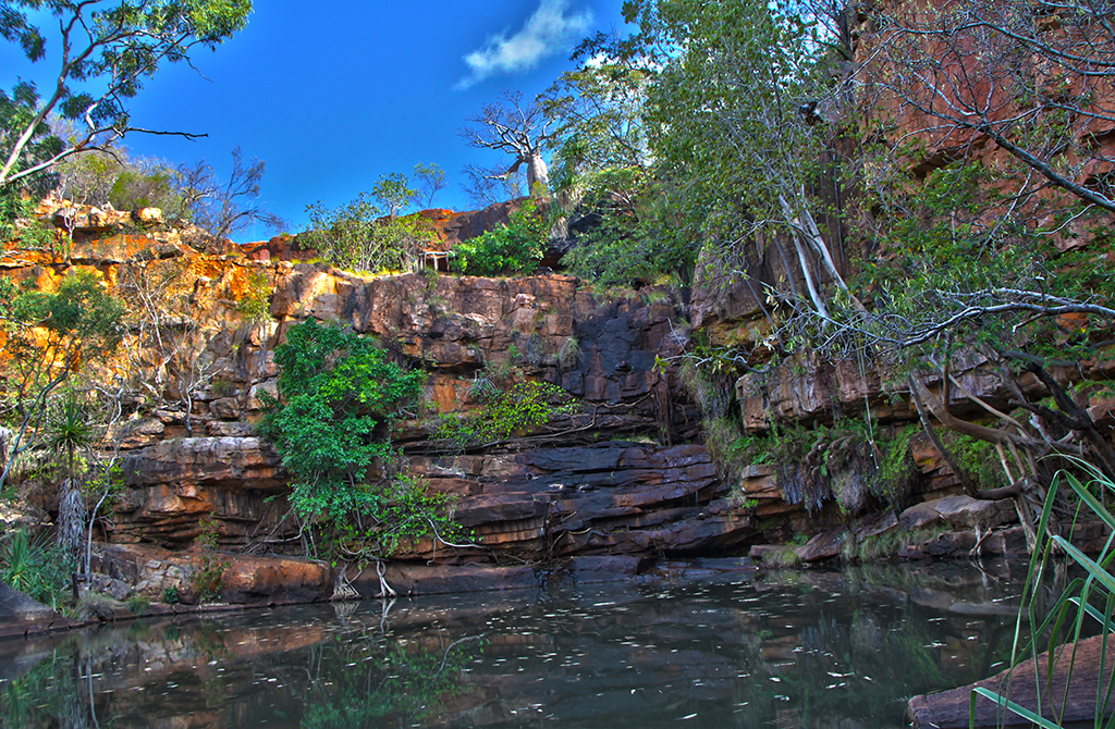
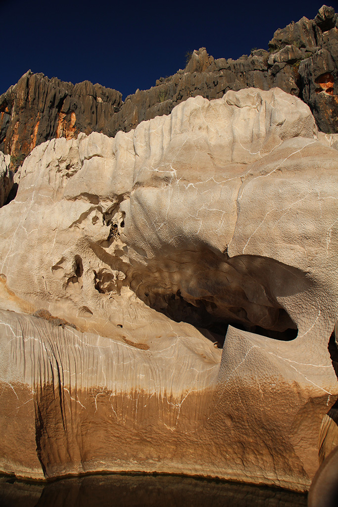
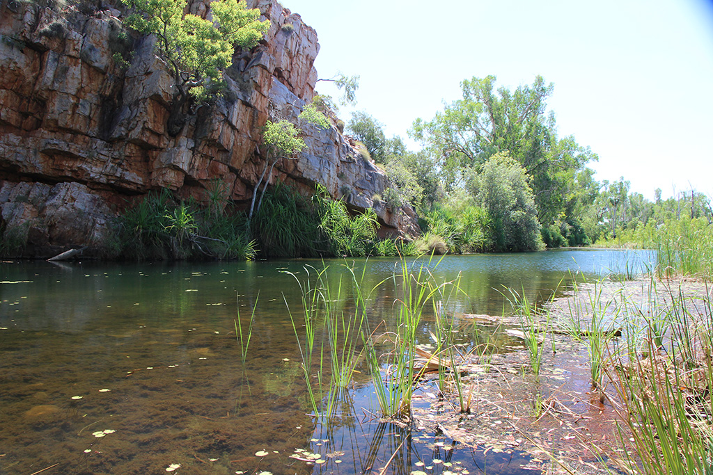
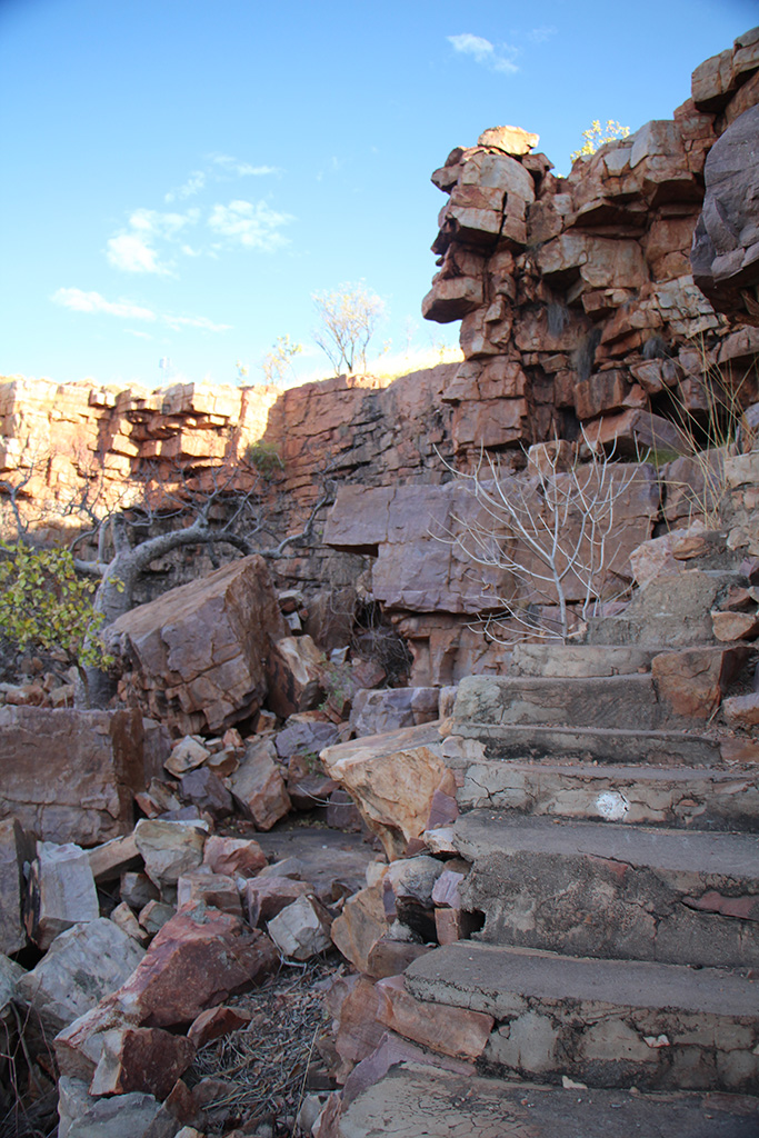
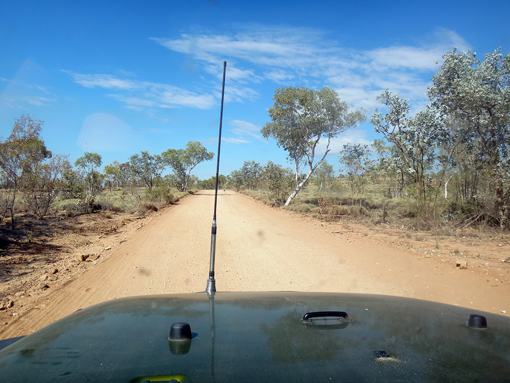
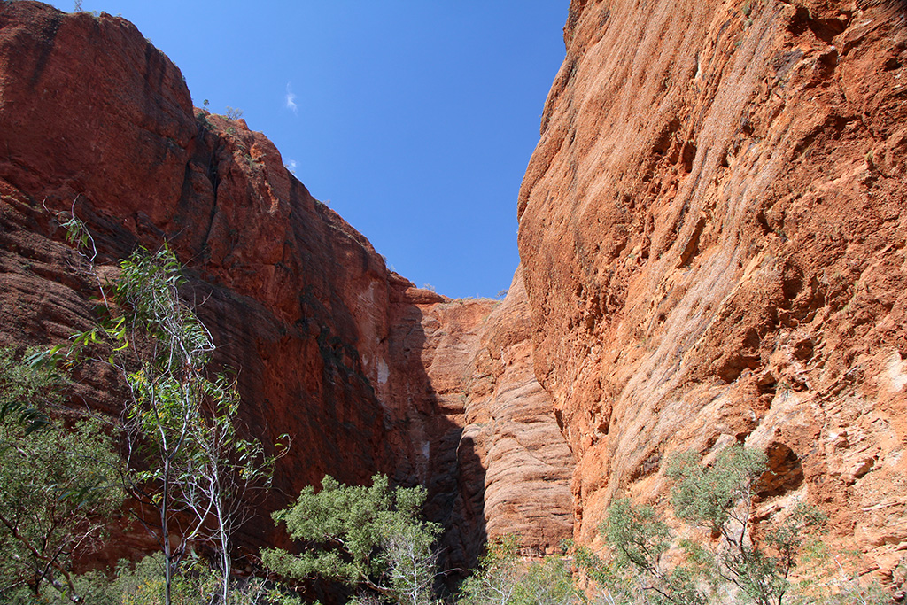
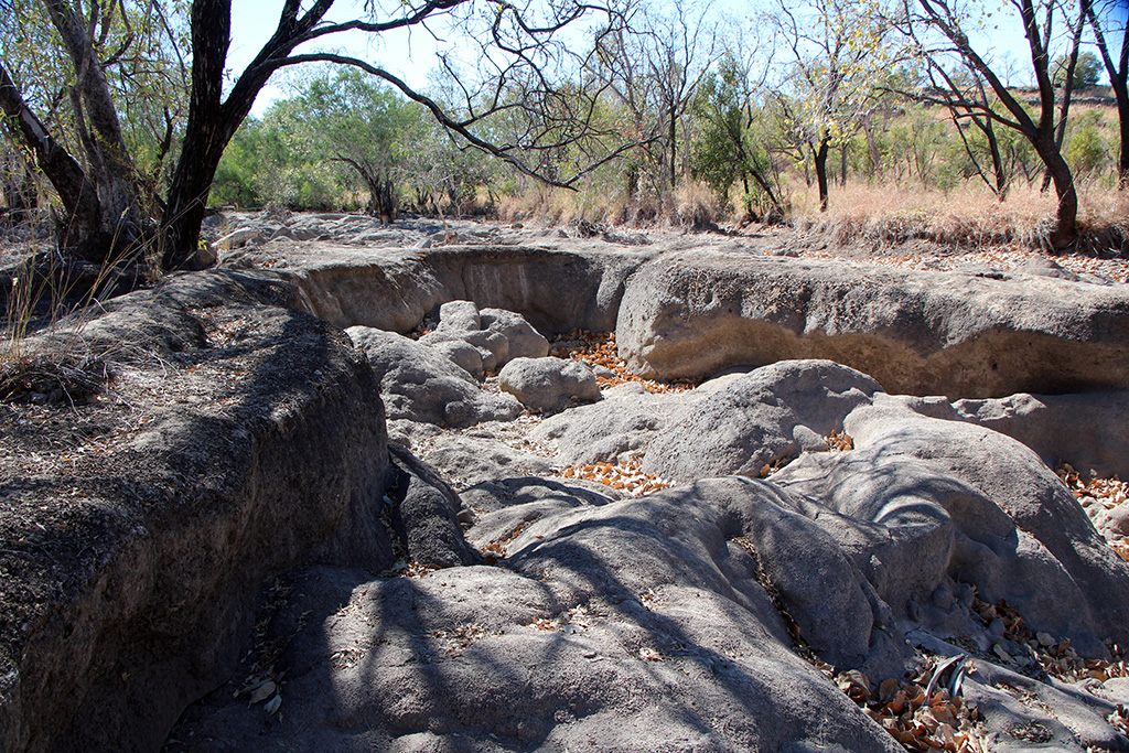
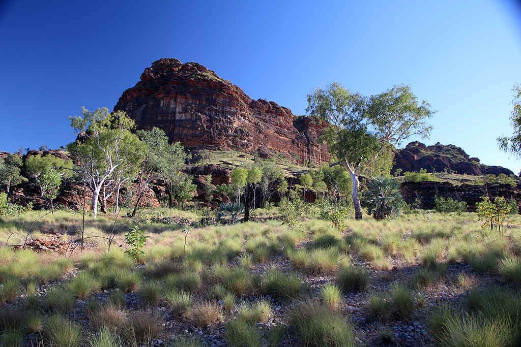
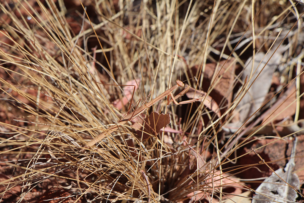
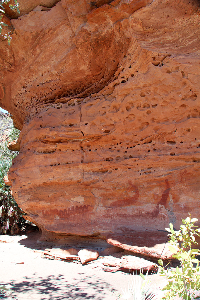
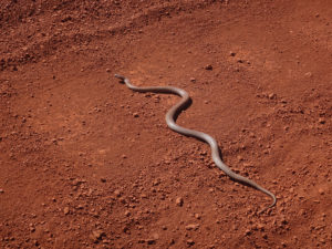
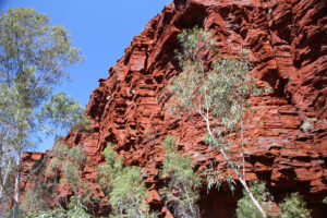
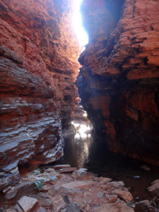
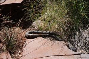
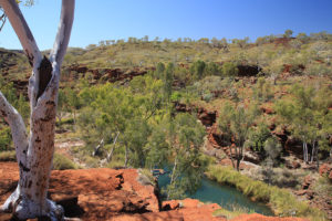
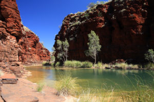
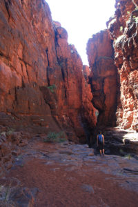
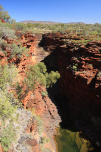
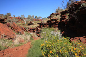
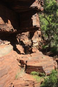
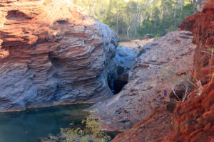
We had big days planned for our stay in Karijini. Today we drove across on the unsealed road, which was very corrugated, to Weano Gorge. On our way out we almost ran over a large snake, possibly a Mulga Snake? We did the Weano Gorge walk first which takes you out over the escarpment and then down into the gorge and back towards where you start. The gorge was beautiful with very red rock walls and a small creek running through the middle and at least one plunge pool. It was not very difficult and did not take very long.

dsc09805 img_03309 img_03315 img_03318 img_03319 img_03320

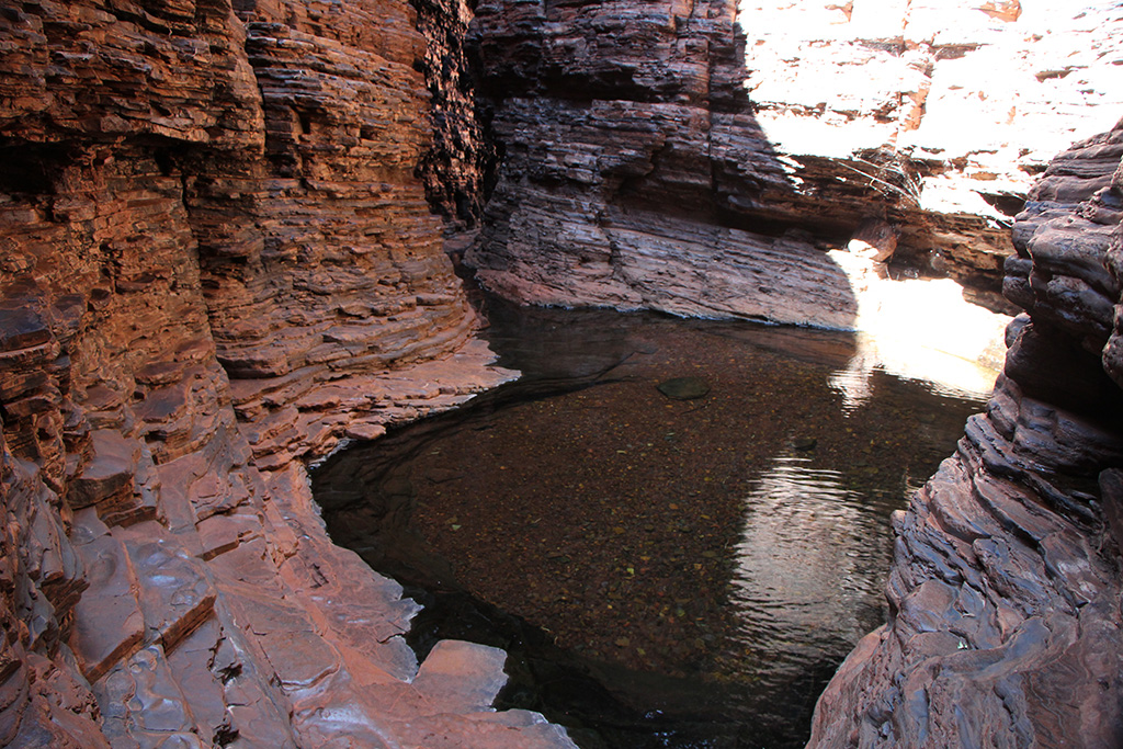
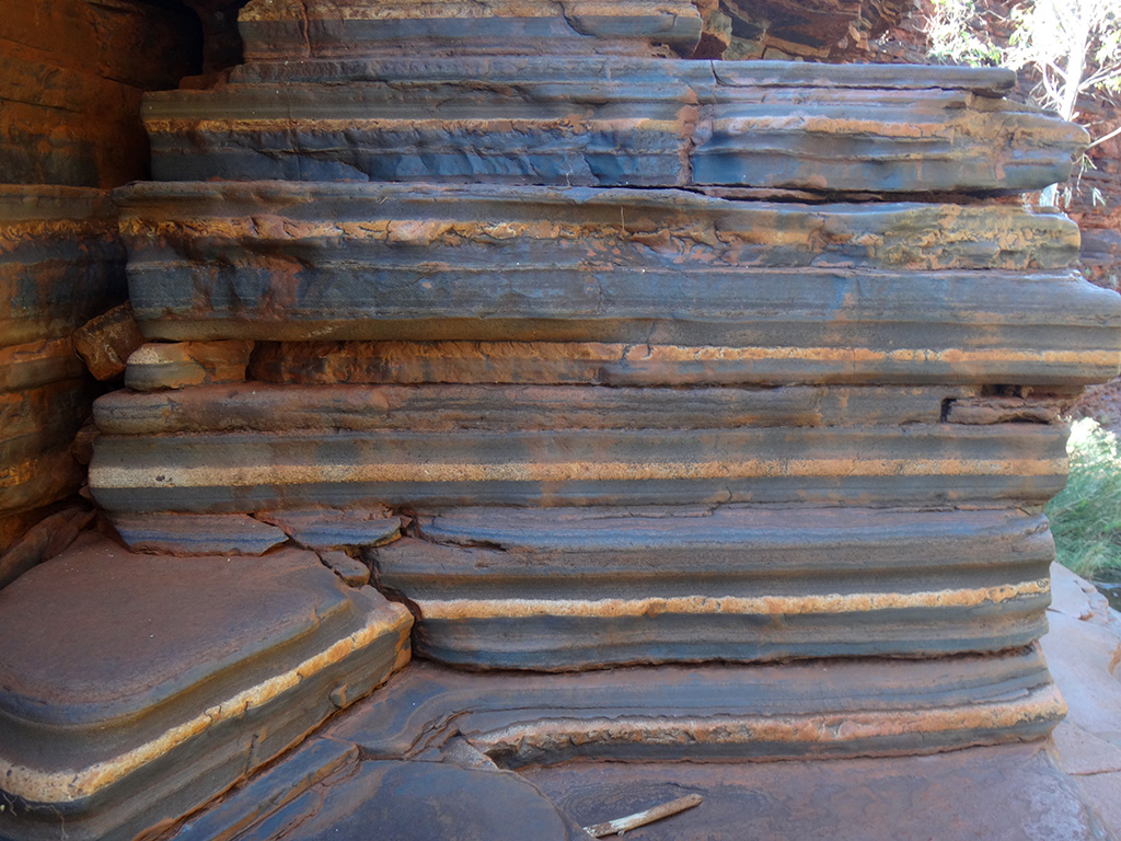
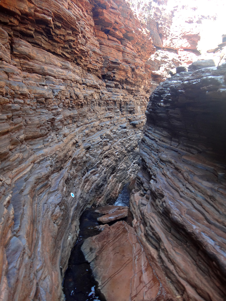
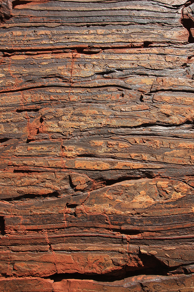
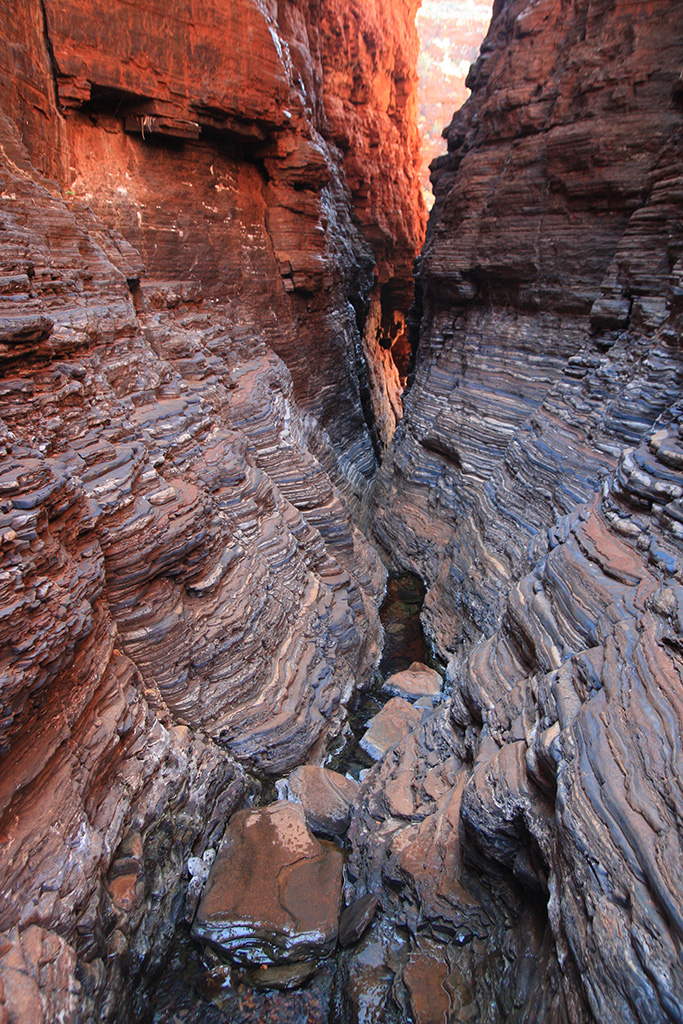
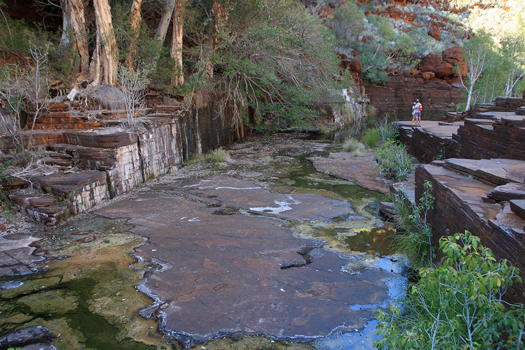
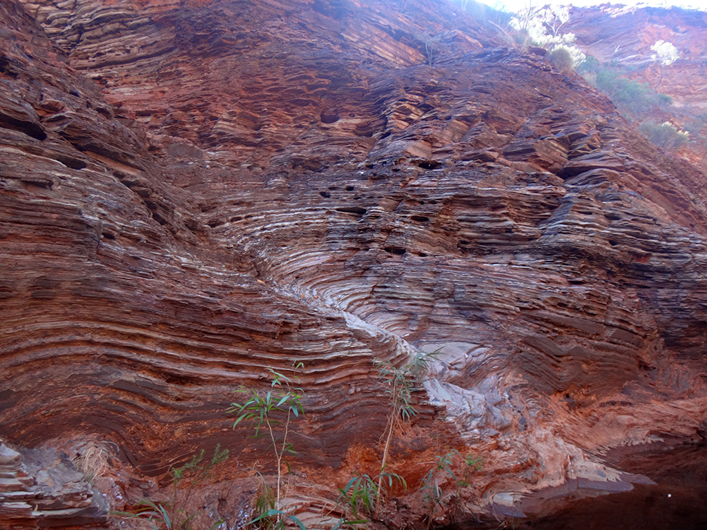
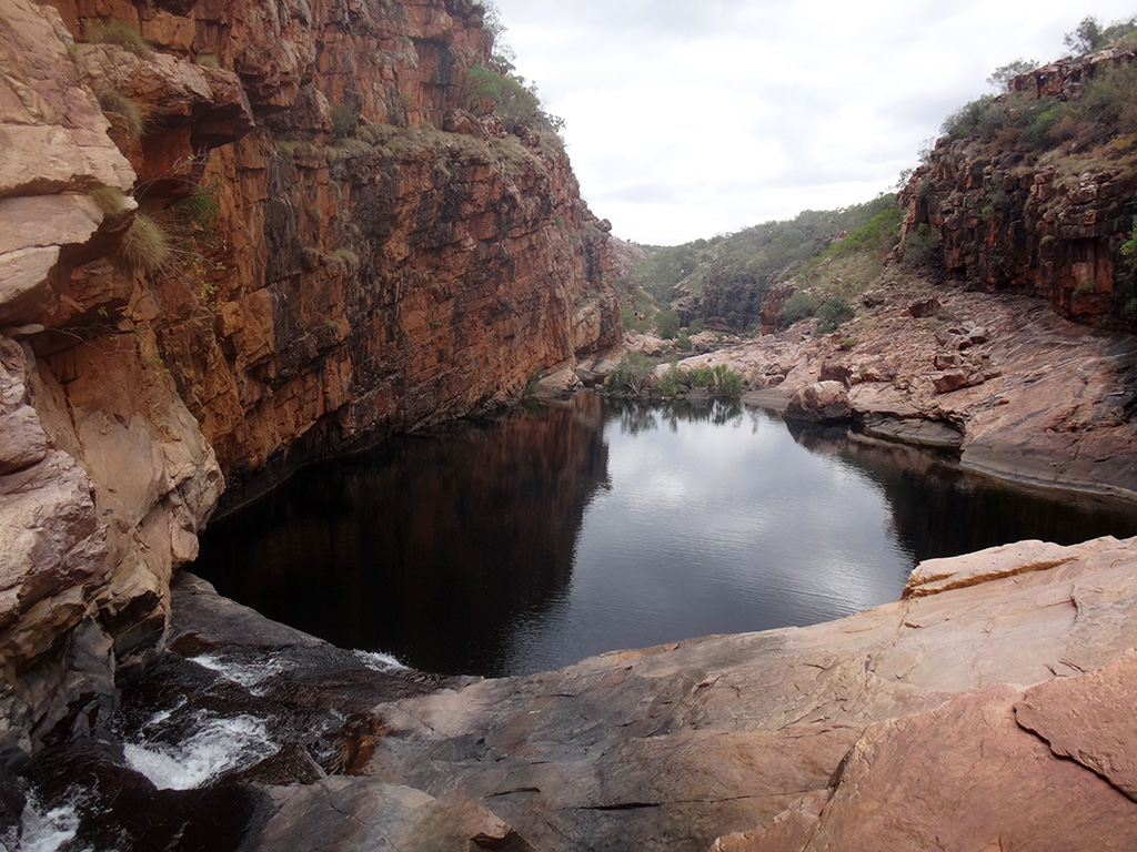
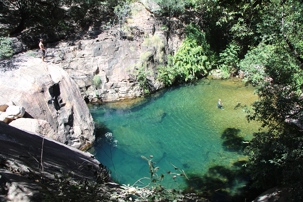
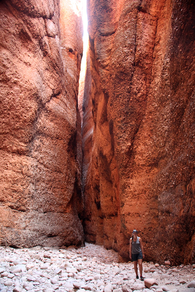
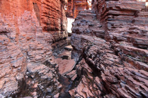
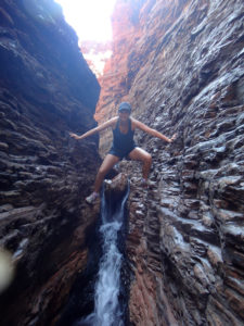
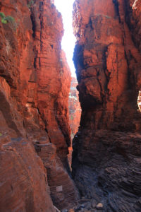
Once we reached the end we kept going and headed down to Handrail Pool. This section of the gorge closes up and is absolutely spectacular. There are a couple of sections where we needed to scramble around the rock ledges to get past some water but it wasn’t too hard. The walls and smooth and made up of hundreds of layers of rock.

dsc09813 img_03327 img_03337

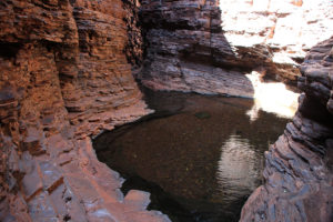
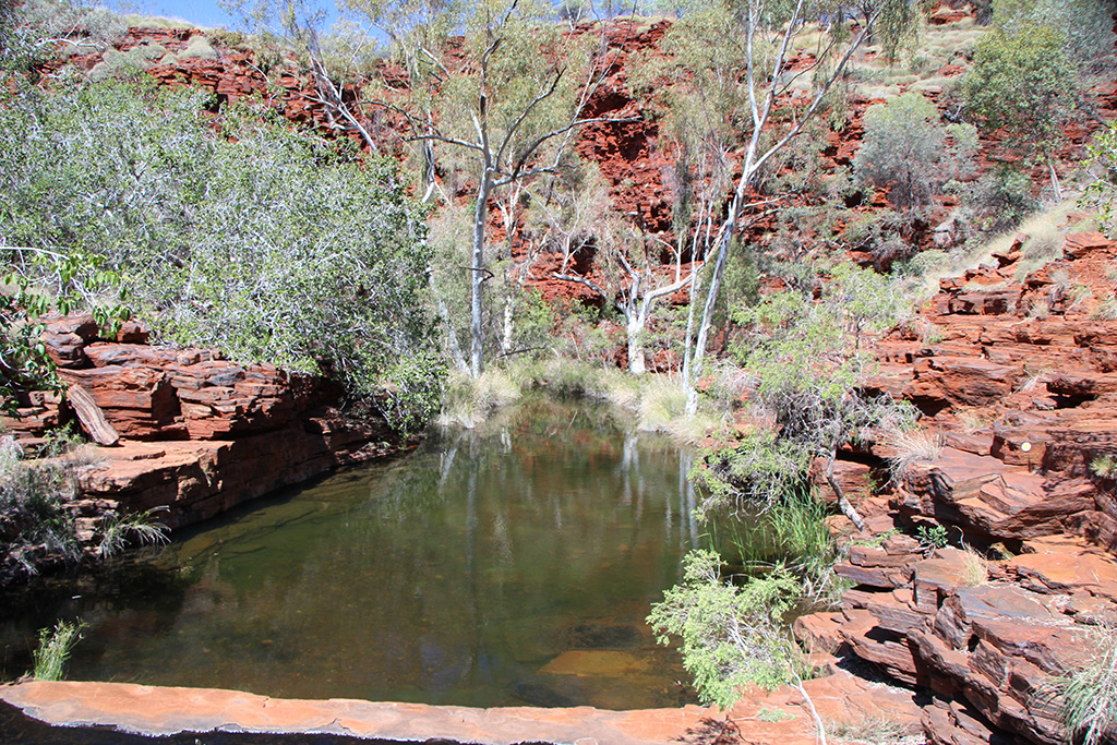
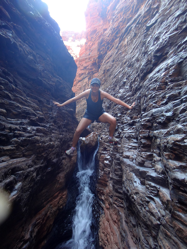
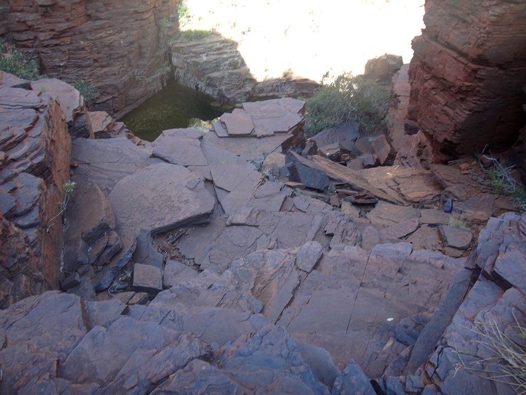
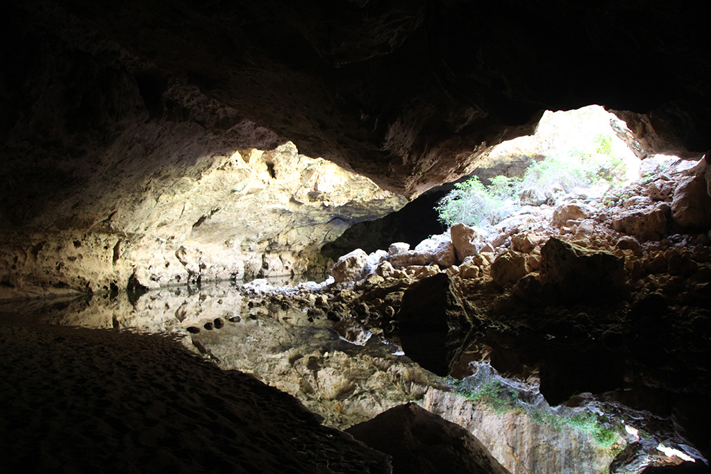
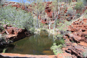
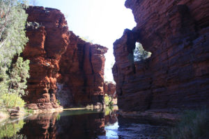
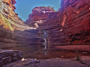
The last section down into Handrail Pool, as the name suggests, has a large handrail attached to the rock wall and some steps to help you down. The pool was nice and there were only a few other people but the water was very chilly. We ate lunch and got ready to head further down the gorge which requires a swim.

img_03346 karijininphandrailpool img_03363

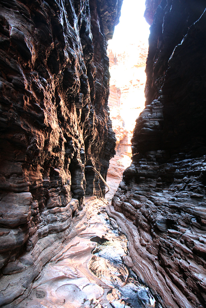
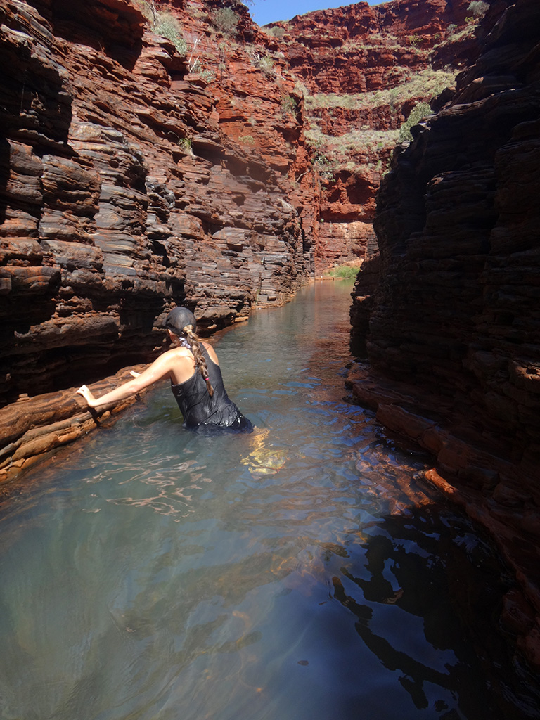
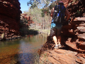
We entered the water and swam further down the gorge until we reached the part of the gorge where you are not allowed to proceed past. This section of the gorge is again very beautiful and before you reach the end the gorge almost completely closes over to create a small tunnel section. The water in here was so cold though so be prepared!

dsc09825 dsc09829

We made our way back to the carpark and met a snake on the path just before we did the last ascent out.

img_03393

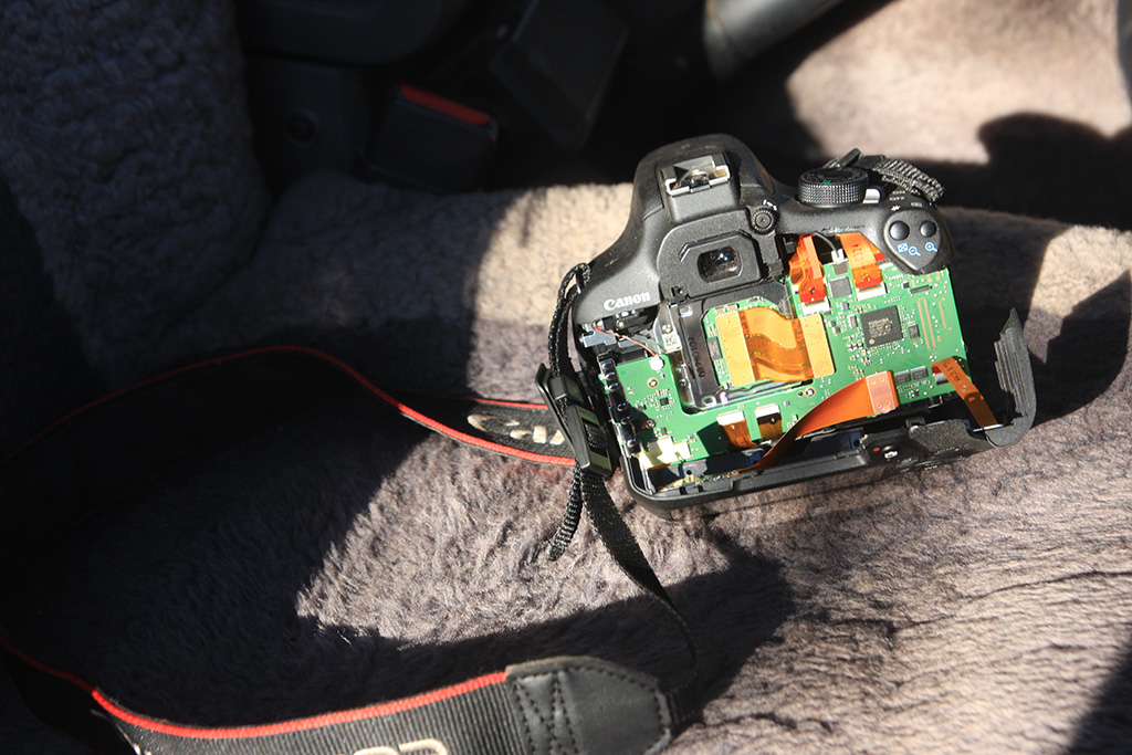
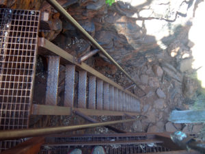
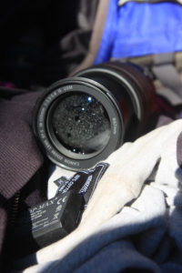
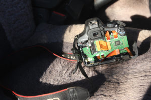
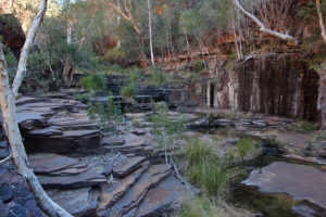
We walked back to the carpark and then made our way down Hancock Gorge. The walk is a bit steeper down as it partly follows a dried up creek/cascade bed. At the bottom there is a staircase due to a substantial drop. We continued down the gorge and arrived at the place where you have to wade through water. I took my shoes off and started walking through the pool. The rocks were slippery so I was making every effort to avoid them. I looked up and greeted a couple walking our way, as I looked down I stepped on a rock and slipped over. I dunked my shoes under water to try and stay up, at the same time I tried to lift my camera up but it was in a toploader camera case. Unfortunately it was attached to my backpacks waste strap so was dunked under water. The toploader case was unzipped so water rushed in. I stood up and made my way out of the pool. I opened the toploader case and was disappointed to see my camera floating in a bag full of water. I promptly pulled it out, turned it off and tried to dry it off as best as possible.

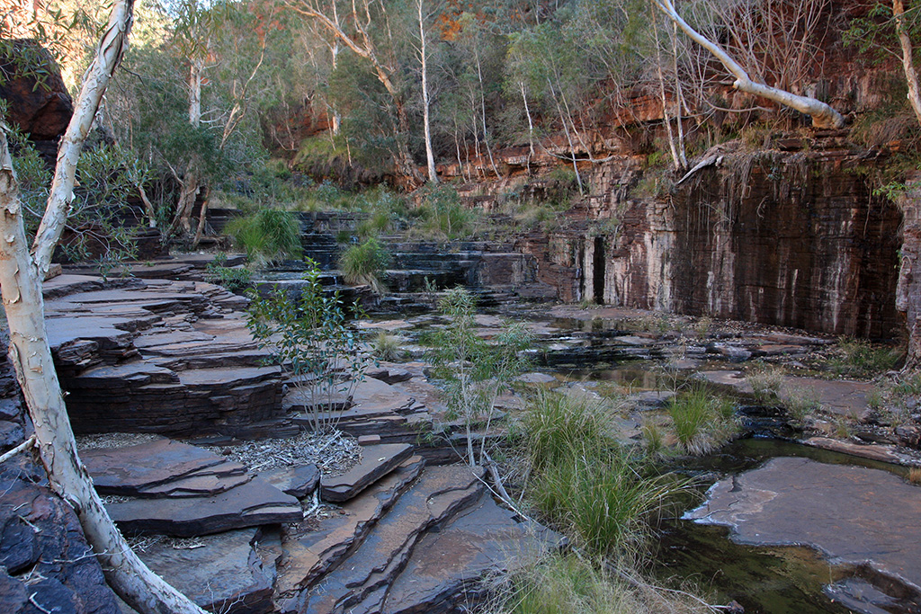
We dumped our stuff off onto a rock and jumped into the next pool of water. We swam down and got out of the water. We walked down and had a look at the Amphitheatre. It is a natural rock formation where there are steps leading up to the edge of the gorge wall and are nicely rounded.

dsc09888 dsc09848 dsc09850 dsc09884

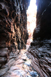
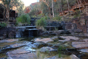
We continued down the gorge into the Spider Walk. This is a very narrow section over a small amount of water where you can spider walk your way down by using both your arms and legs on either side of the gorge. You don’t have to do this, you can simply walk in the water if you like.

dsc09854 dsc09857

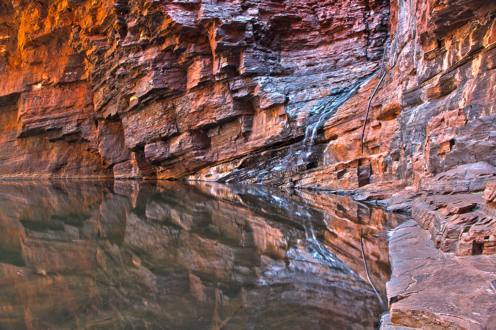
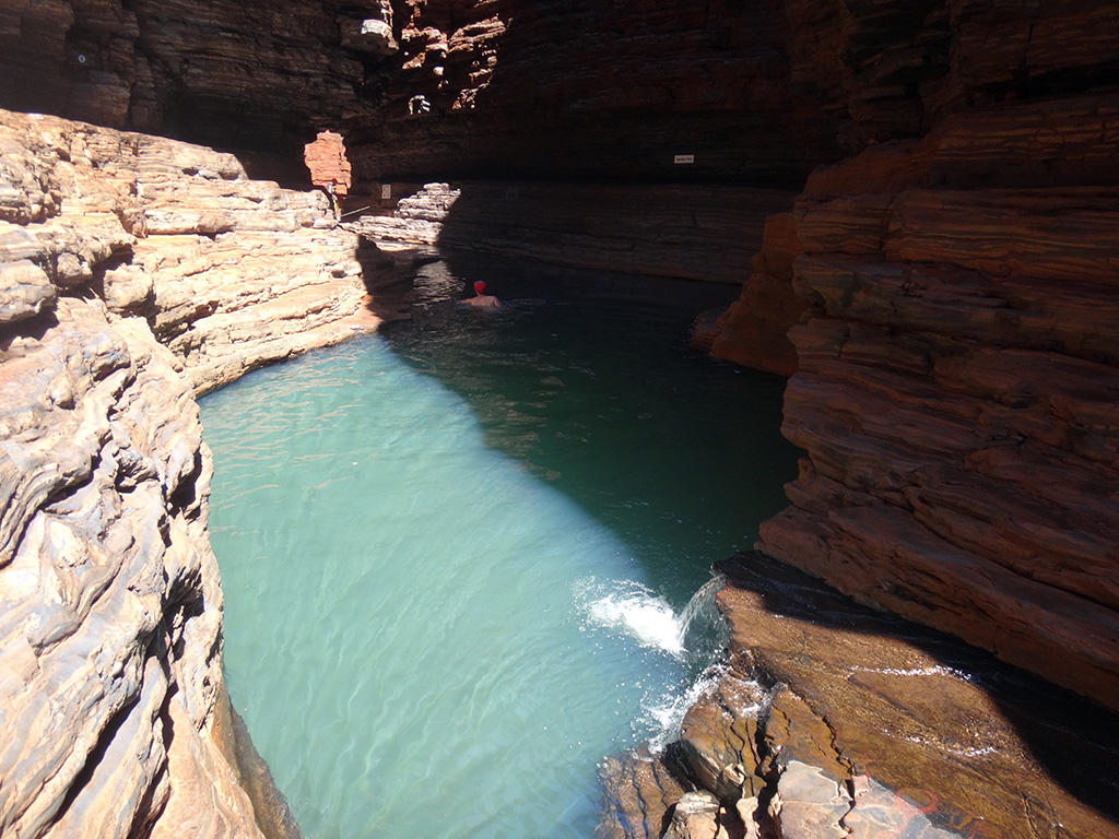
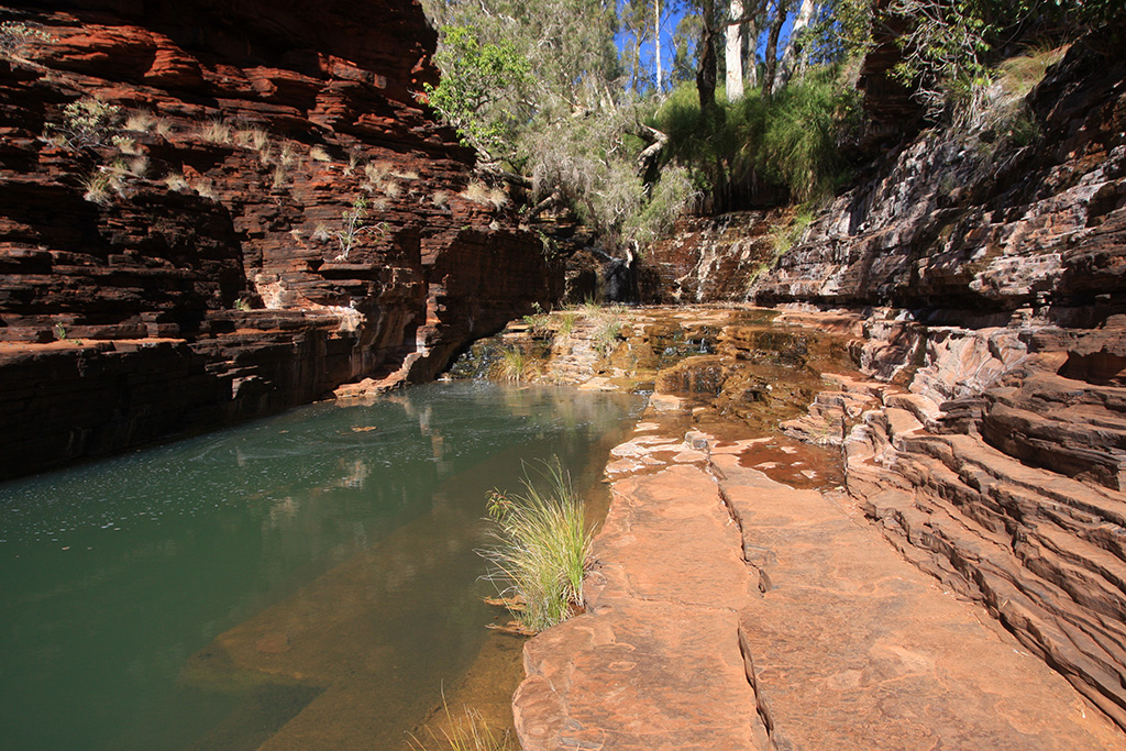
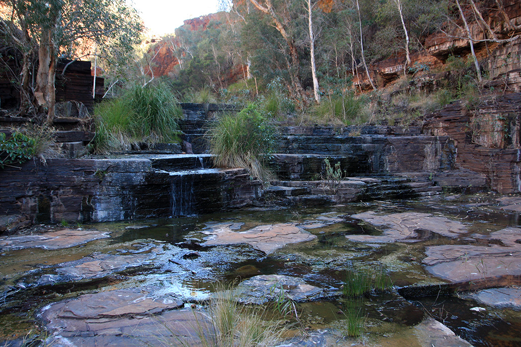
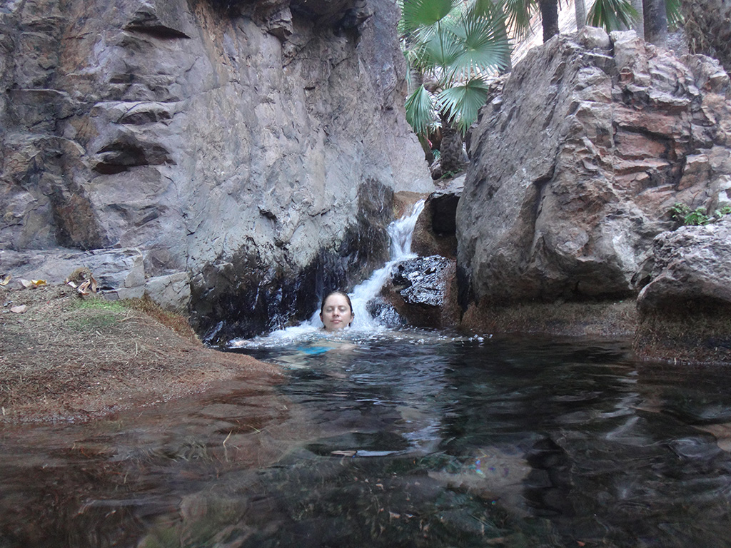
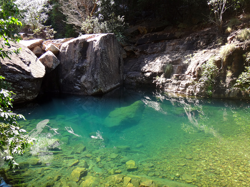
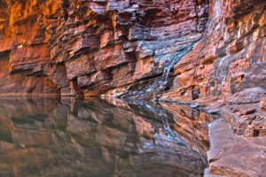
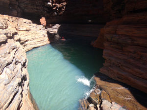
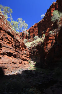
After Spider Walk is Kermits Pool. It is a picturesque blue pool in the gorge which looks inviting for a swim. We both had a swim but not everyone does as the water is very cold.

dsc09866

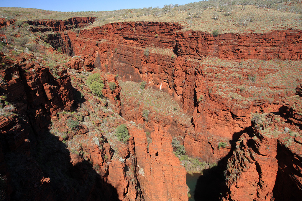
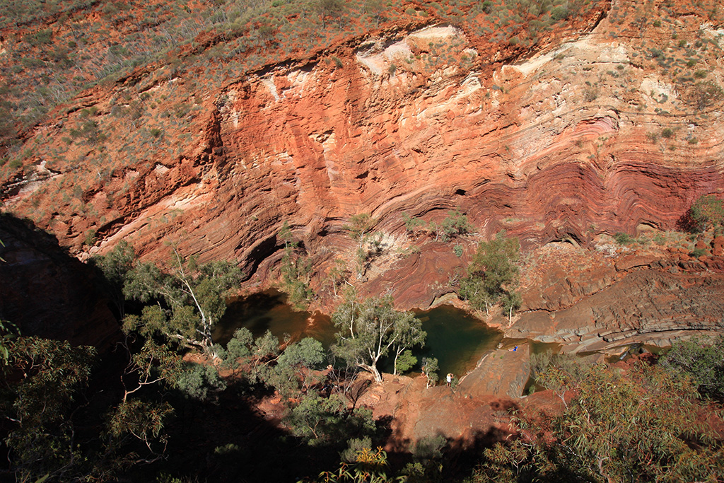
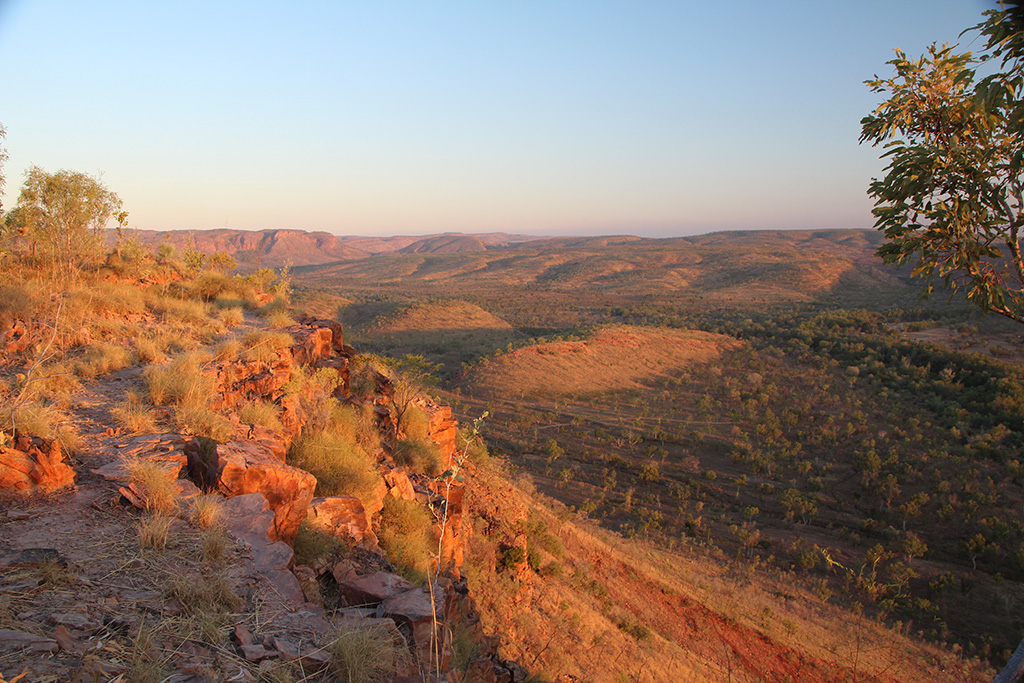
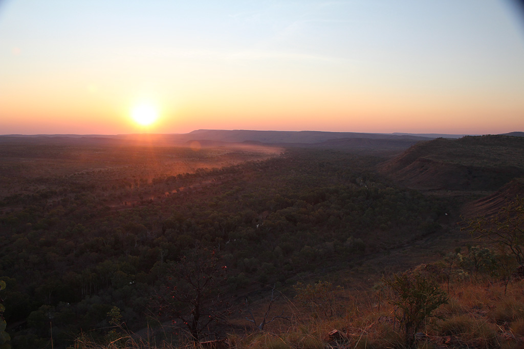
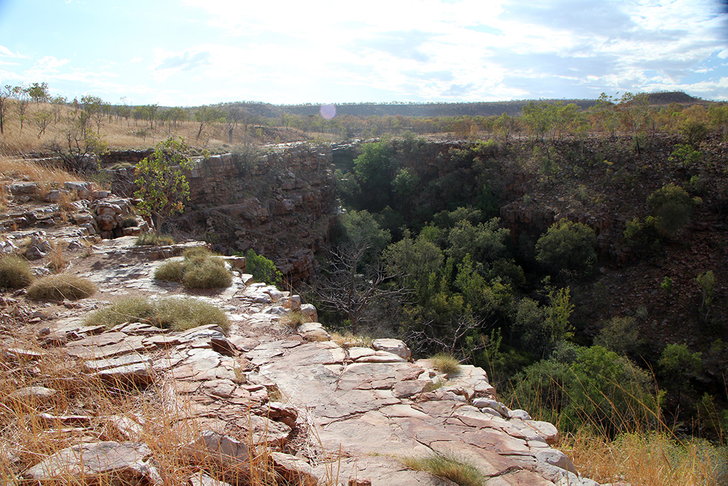
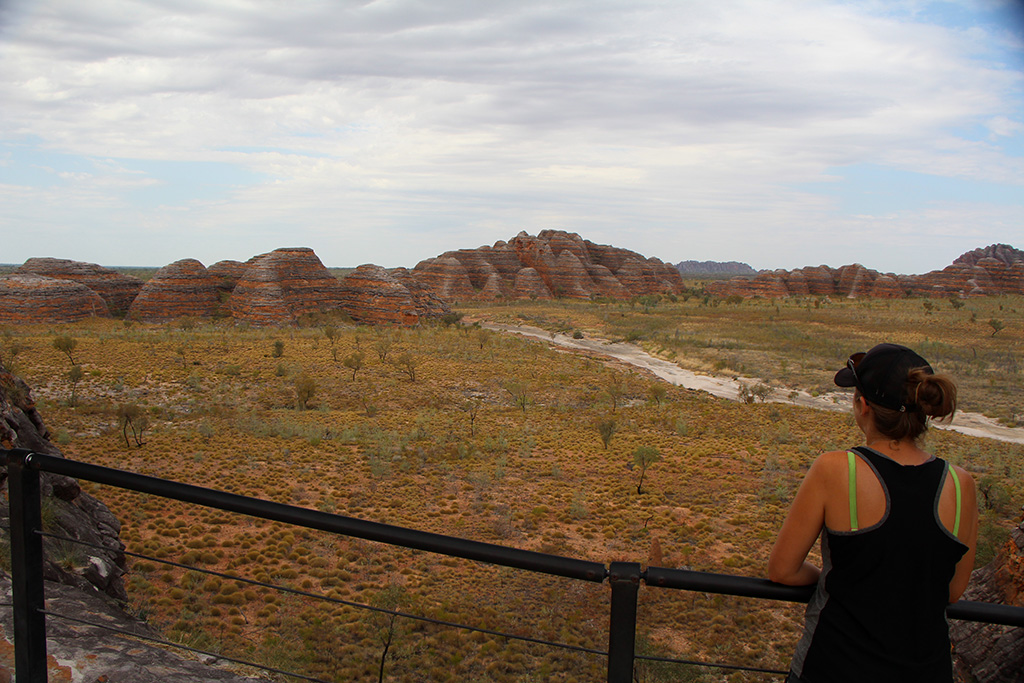
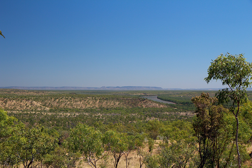
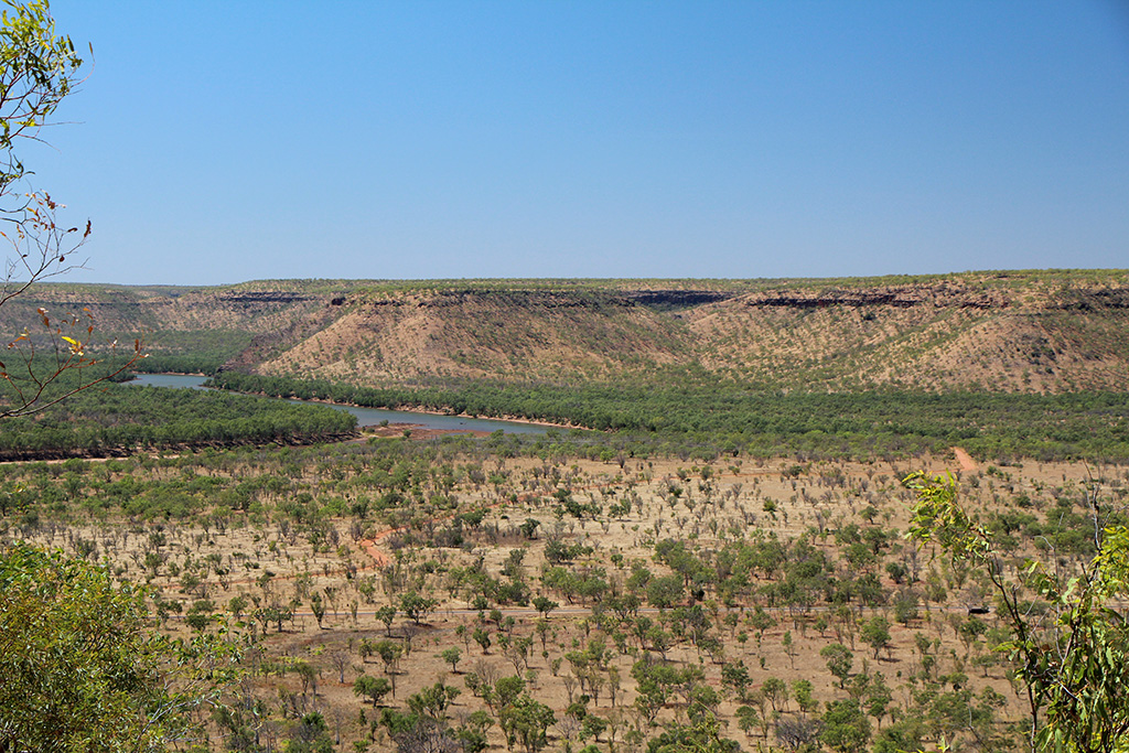
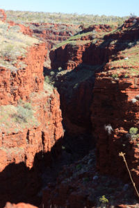
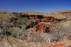
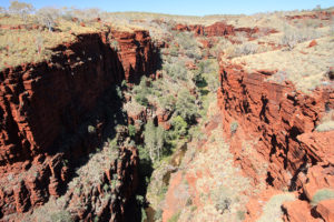
We made our way out of the gorge and back to the Jeep. We drove a short way and had a look at the lookouts which are nearby and overlook the gorges. They were quite amazing and gives you a good indication of just how steep and high the gorge walls are. We ended our day there and went back to camp via the sealed road.

img_8673 img_8683

We arrived back to camp and I opened up my camera case and moved the lens and camera into the sun to try and dry it.

img_8708 img_8709
Karijini Day 2

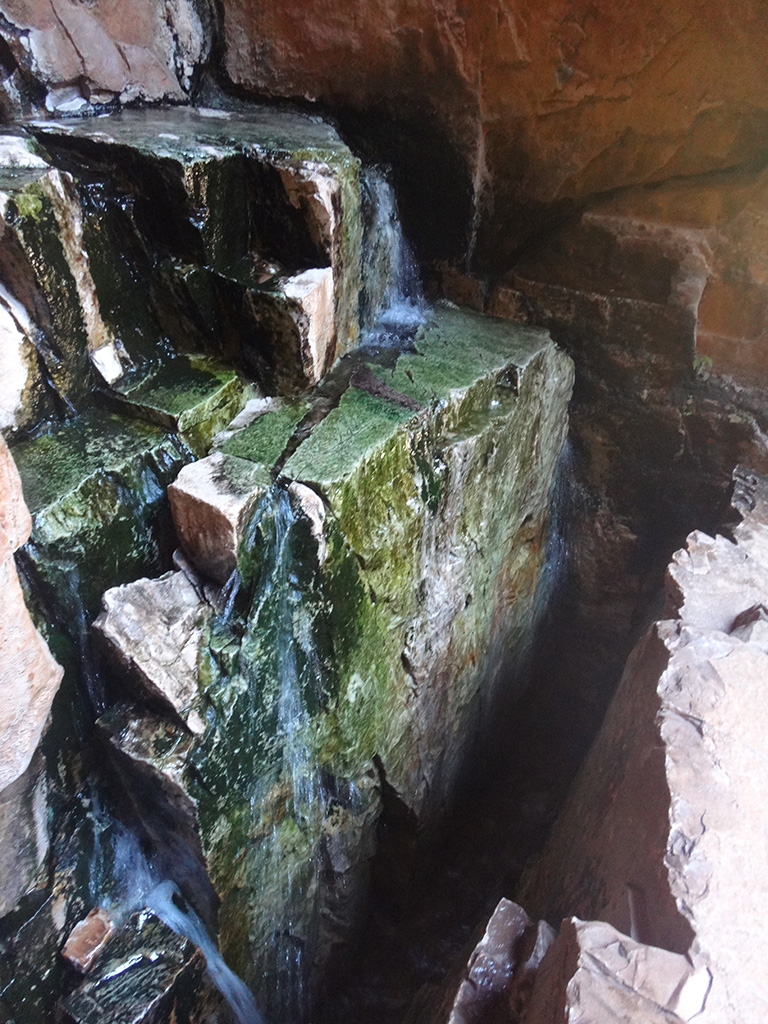
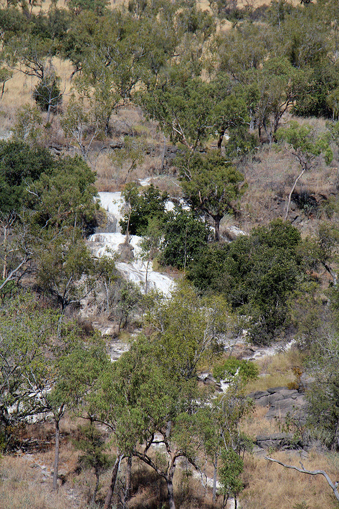
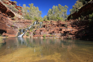
Today we made our way back across the unsealed road and went to Kalamina Gorge. This is an easy walk down into the gorge and then following it down to The Arch. The gorge isn’t very deep but has nice rock walls and a beautiful stream of water flowing through the middle. There is a waterfall just upstream from where you enter the gorge and a few pools along the way.

img_8765 img_8715 img_8726 img_8735 img_8749

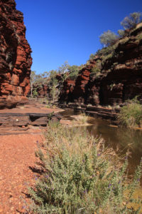
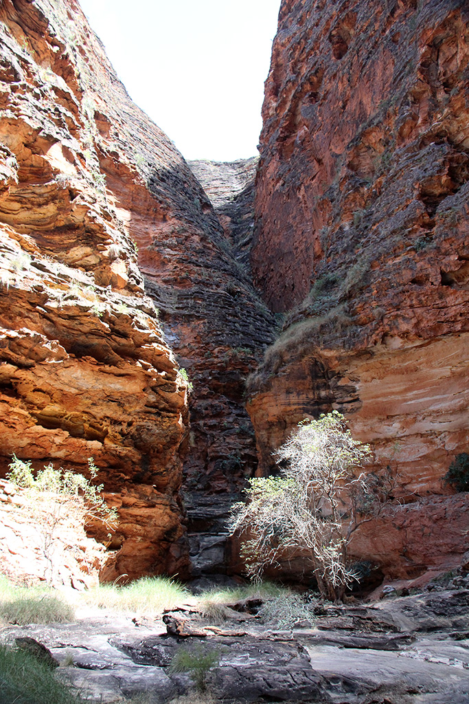
We left the gorge and walked back to the Jeep. We drove to Knox Gorge and had lunch at the top. We decided to do the gorge walk which takes you down to the bottom and further down the gorge. The walk is very steep and loose.

img_8769 img_8772

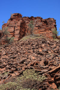
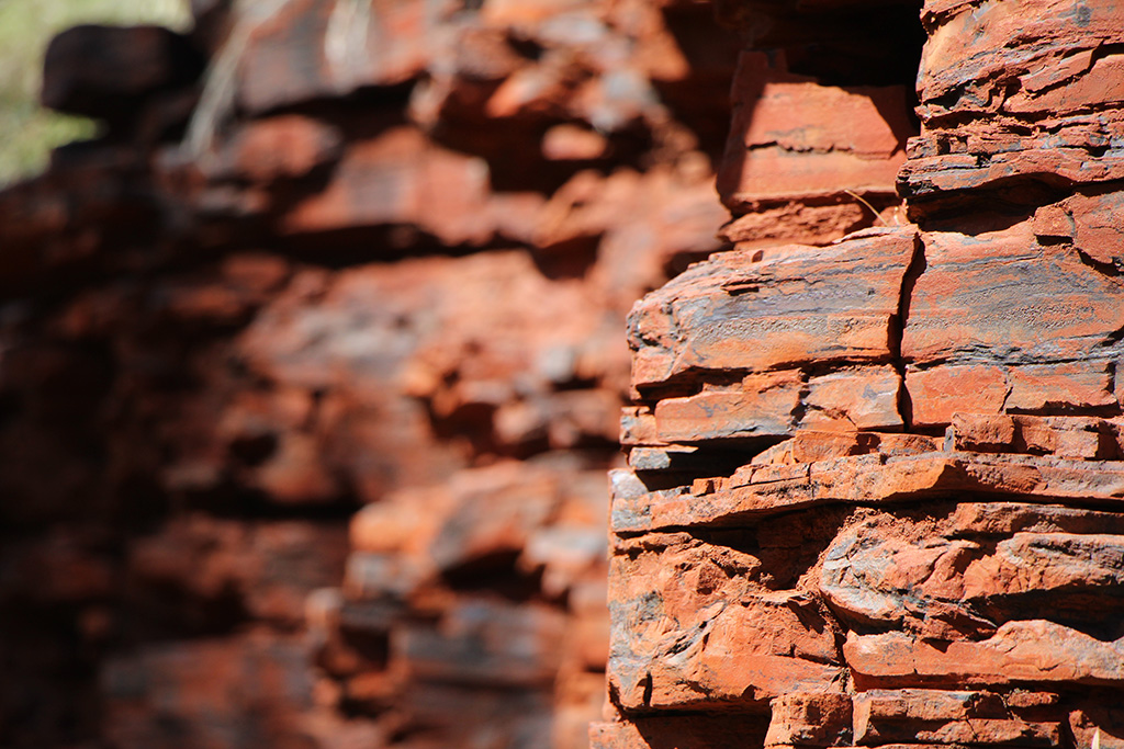
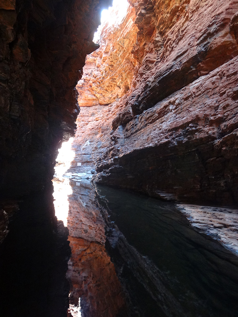
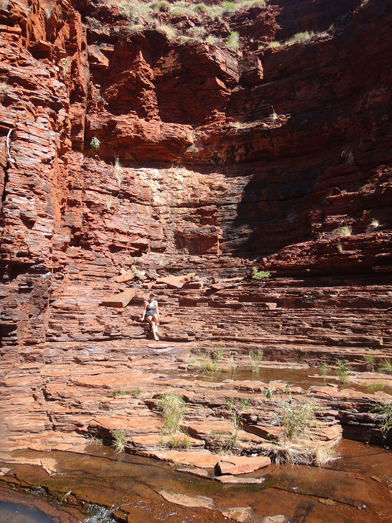
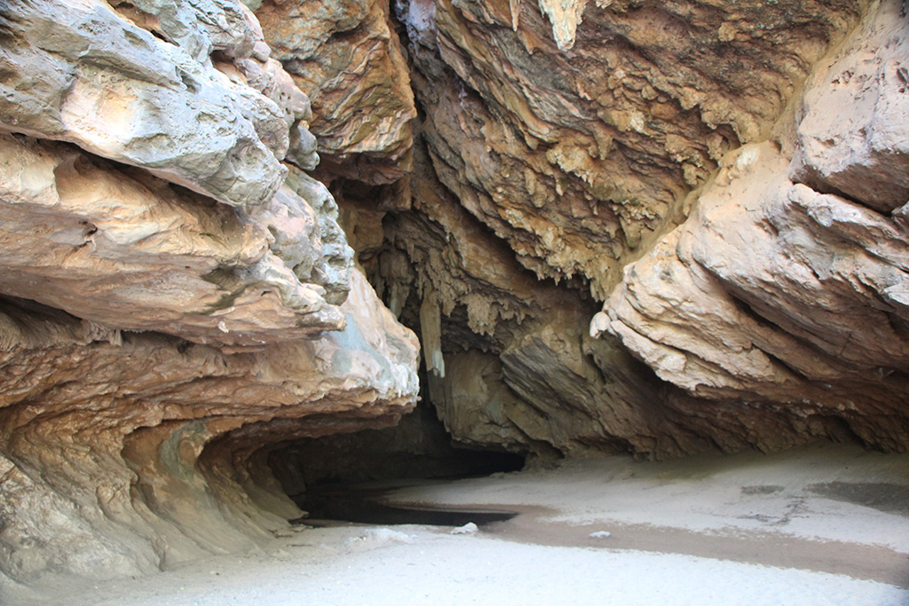
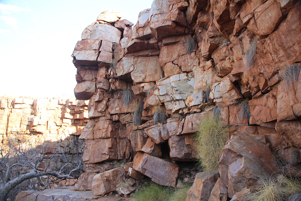
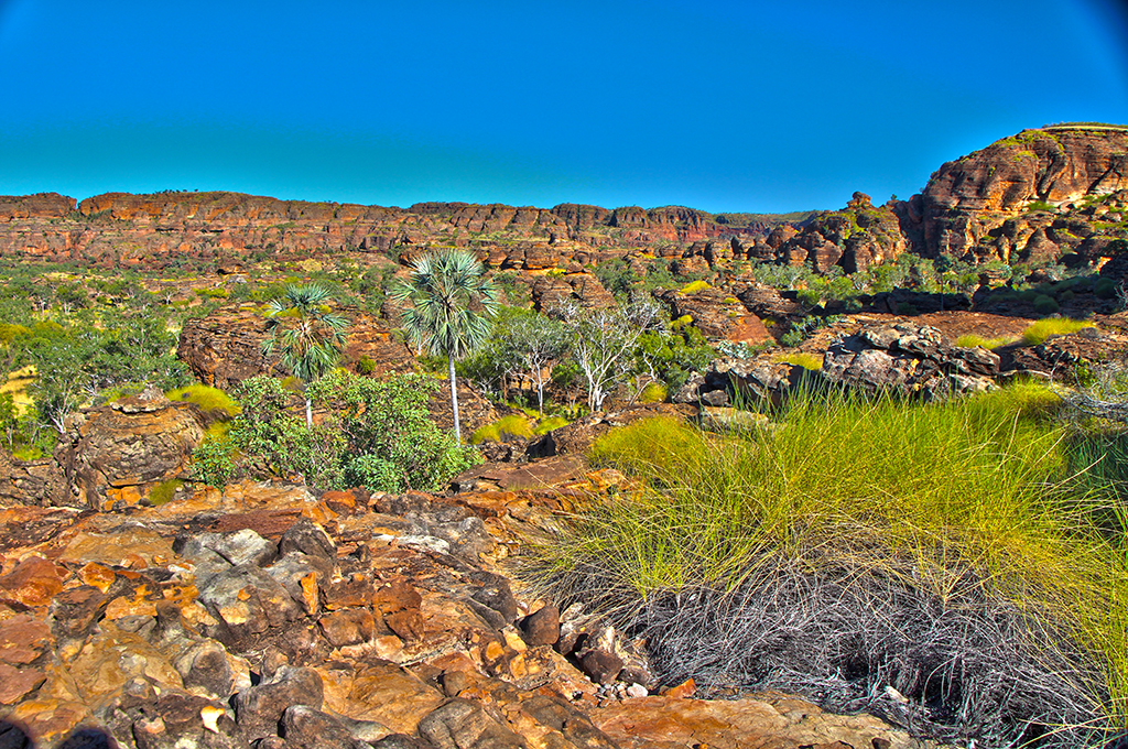
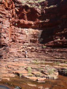
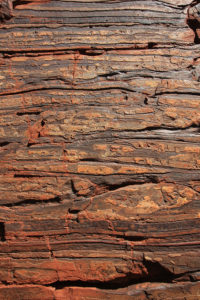
Once we were down the bottom the walk is fairly easy and takes you past some pools finally to where the gorge closes up and you are not allowed to proceed further. The gorge has steep, high walls which are made up of hundreds of layers of red rock.

img_8775 img_8782 img_8787 img_8789 img_8823

We made our way back up the gorge and did the hard slog to the top. We did the short walk to the lookout and enjoyed the view from the top.

img_8830

We then drove around near to the resort and went to Joffre Falls. It is a bit of a climb to get down to the bottom of Joffre but it didn’t take too long. The water was freezing cold and very shaded so we did not swim. We walked around to the falls and sat there for a while.

img_8836 img_8839 dsc09950 karijininpjoffreyfalls

We made our way back out of Joffre Falls and up to the Jeep. By this time we were feeling quite tired and went back to camp for the night.

Karijini Day 3

We packed up camp and drove around to the day use area for Dales Gorge. On our way out we spoke to a volunteer ranger about our day and he highly recommended going up to Hamesley Gorge.

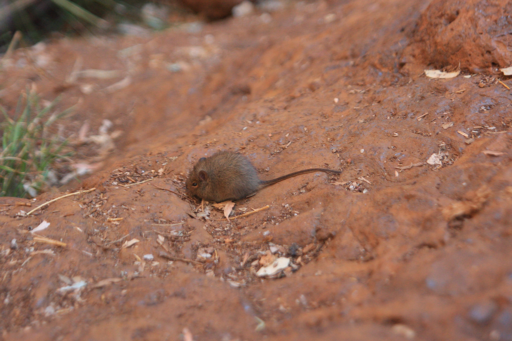
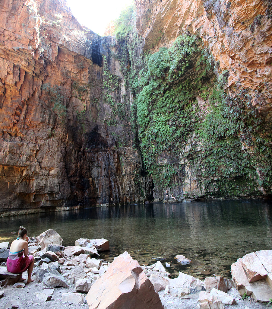
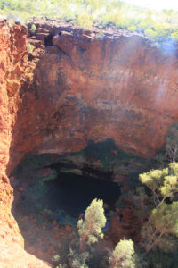
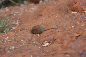
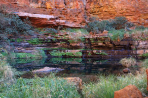
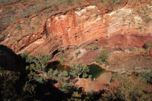
We set out on our walk, first going to the lookout over Circular pool and then making our way down the bottom of the gorge and up to Circular Pool. The walk down the bottom is absolutely beautiful and unique. As we sat at Circular Pool a very friendly native mouse came and was scaviging on the rock we were sitting on. It was very cute and we enjoyed its company.

img_8856 img_8859 img_8860 img_8861 img_8865 img_8889 img_8897

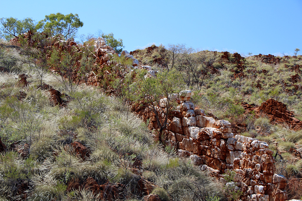
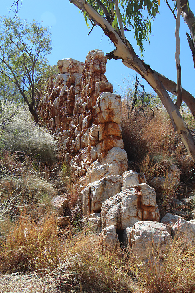
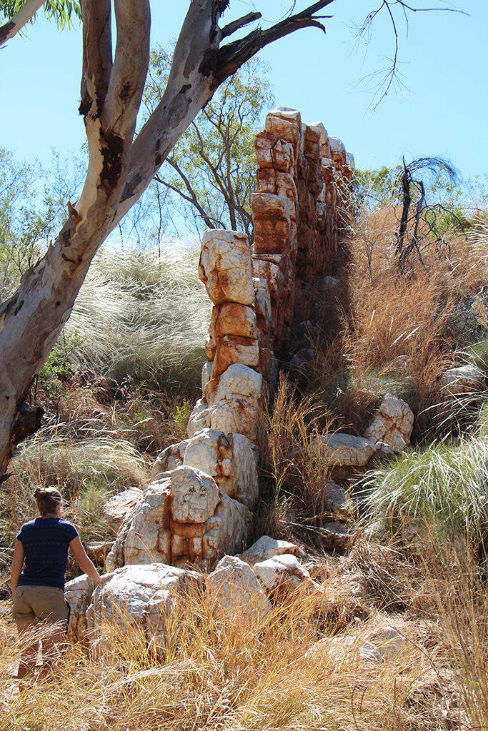
We walked back down the gorge and made our way around to Fortescue Falls. The walk is amazing and is well worth it. There is a very precarious rock which looks to be propped up by a column of stacked rock, it is quite impressive! Fortescue Falls is very nice and a good spot to have a rest.

img_8904 img_8900 img_8911

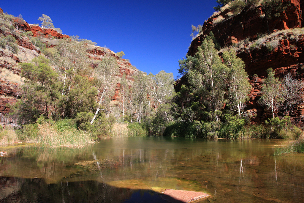
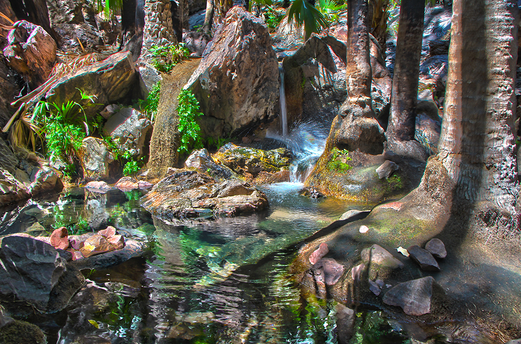
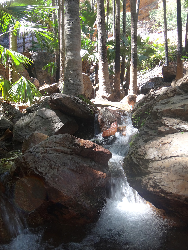
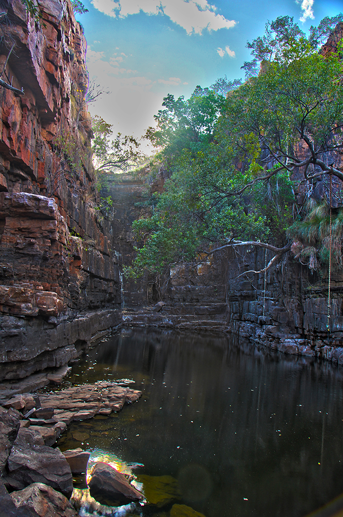
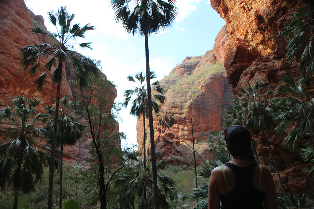
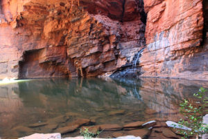
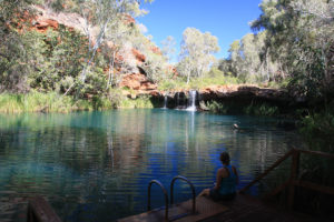
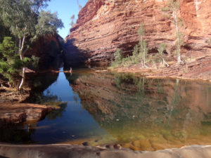
We made our way up to the top of Fortescue Falls and then up to Fern Pool. Fern Pool is the best place in Dales Gorge for a swim. It is sunny, the water is an amazing blue colour and the water fall feels warm. We enjoyed a dip in this pool to cool off.

img_8922

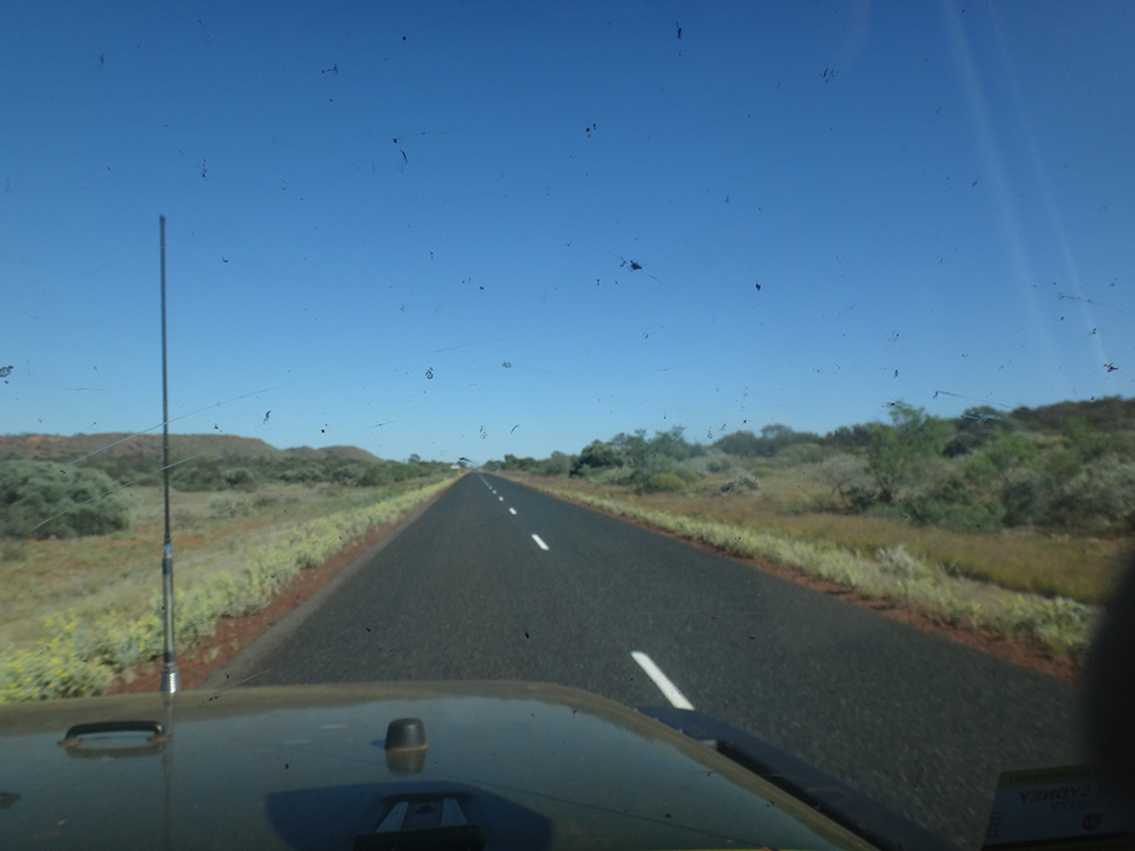
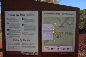
We made our way up and back to the Jeep and then headed to Tom Price. We had lunch in Tom Price and dropped in to the Visitors Centre to ask about Hamersley Gorge. We made our way up to Hammersley Gorge from Tom Price. The roads were in very good condition and it took us around 45 minutes to get there.

dsc09991 dsc00001

On arrival we parked and made our way to the signage. We were very disappointed to find a paper sign stuck to the map of the area outlining that all the upper pools and Spa Pool are no longer accessible to the public. We were disappointed that there were no signs in the Karijini Visitors Centre that were obvious, that the Parks and Wildlife officer we spoke to failed to mention this, that the volunteer ranger didn’t mention this, that the lady in the Tom Price visitors centre didn’t mention this and that there were no signs in the Tom Price visitors centre alerting the public. We had come up to Hammersley Gorge to see Spa Pool. Spa Pool is used on a lot of the advertisements for Karijini and a lot of the flyers.

img_8950 img_8945

Feeling disappointed we walked down to the bottom of the gorge and had a swim. We looked around and enjoyed the large swimming area at the bottom. The rock walls are quite spectacular and are made up of hundreds of layers of rock, some parts of the rock have been bent and folded in really amazing ways. They are definitely worth a look if you’re here.

dsc00006 img_8949 dsc00002 dsc00003

We made our way back to the top and left, heading back to Tom Price. We refueled, filled the caravan with water and headed out of Tom price staying at a rest area that evening.


Leave a reply

Week 10: (Part 2) Broome

We packed up camp, we’d been staying at the Lennard River unofficial campground near the Windjana Gorge turnoff, and headed west for Derby. The Gibb River Road from here to the end is partly unsealed and partly sealed. The corrugations are not over from this point so it is not smooth sailing to Derby.

dsc09661 dsc09659

We arrived in Derby just a bit before lunch time and did a lap of the main street and then headed out to the jetty. It was very humid in Derby, more humid than anywhere we’d been, so we were not planning on staying too long. Derby experiences the second biggest tides in the world and tides can reach up to 11.8m high! It was low tide heading in to a high tide when we arrived and it was clear that the tide was coming in extremely quickly and there were strong currents rippling under the jetty.

img_03146

We did a quick stop for some supplies and then headed out to the Prison Boab tree not far out of town. The location is also home to an old bore which had a pool that an army official had built in 1944 and is home to a trough for stock. The bore no longer is operational and water is now pumped up to the trough using a windmill.

img_03162 img_03160 img_03150

We had lunch and continued on our way for Broome. Not far from Derby it began to rain which was a nice break. It was still raining that afternoon when we made it to Broome and there were many puddles formed on the road. We booked in to the Palm Grove Caravan Park just off Cable Beach and settled in for a few days.

dsc09666

Broome Day 1

The next day, our first full day in Broome, we headed in to town for a look around. We found out that Broome is home to the worlds oldest operating picture garden. It is fascinating and the public is welcome to have a look around inside.

dsc09672

After wandering the streets looking in all sorts of shops and getting rained on, we finished up in town and went out to the Dinosaur Footprints which can be found out at Gantheaume Point. We had a quick look around but knowing that the tide was no low enough to see the prints did not venture down to the water. We did take some photos of the cast of the print which is up near the lighthouse.

dsc09679 dsc09677

That evening we drove out on to Cable Beach and enjoyed watching the sunset and a good break from the rain.

img_03236 img_03207

Broome Day 2

The next day, the last day of winter (31 August), we were blessed with some sun. That morning we did 4 loads of washing some general house work in the caravan.

After lunch we drove back down onto Cable beach and enjoyed a swim. The water was a beautiful temperature and we thoroughly enjoyed the sunshine!

dsc09693 dsc09703

From there we went and met up with our camel ride tour on Cable Beach and met the camels. We were booked in for an afternoon camel ride. It was a real nice way to wander down Cable Beach and back up in the afternoon sun. We really enjoyed the experience.

dsc09710 dsc09735 dsc09729 dsc09726

After our camel ride finished we quickly left and drove up to Gantheaume Point. This was our only opportunity to view the dinosaur footprints as the tide was going to be low enough and it was daytime. We walked down to the shoreline and spoke to a gentleman who gave us some vague directions. We had our visitor guide map and eventually found some of the prints. We found a second set but forgot to photograph them!

img_03259

We then decided to look for Anastasia’s pool which has had some damage during a cyclone. We found the pool but were disappointed to see that it is now unusable and full of broken rocks and debris.

dsc09744

We hung around at Gantheaume Point and watched the sunset. It was very beautiful.

img_03286 img_03279 img_03302

Broome Day 3

The next morning we woke up early and packed up quickly as we needed to get to the local plumber/gas fitter to try and fix our leaking hot water system. Unfortunately for us both caravans opposite us were leaving at the same time so there was a little bit of negotiating and a few glares from the wife opposite us but we got away. We arrived at the plumbers early and showed the local expert the issue. He removed the hot water heat exchange, welded up the issue and put it back in. We were super happy with the job he did and how quickly he did it. Thanks Broome Plumbing & Gas!

dsc09758 dsc09757 dsc09756

After a few more odd jobs in town we left and headed for Port Hedland. We camped at a nice 24 hour rest stop around 80km’s from Port Hedland. It was called De Grey Rest area and was equiped with toilets, a dump point and free wifi!


Leave a reply

Week 10: (Part 1) Gibb River Road

Today we headed up Gibb River Road. We left the caravan at the Lennard River unofficial camp site and were aiming to get up to Manning Gorge and back with a few stops on the way. We knew this was going to be a big day and left the caravan early in the morning.

Our first stop was Lennard Gorge which was around 8km off the Gibb and then a 3km return walk. The day was very humid making the walk feel harder than it actually is, however, it is a bit of a rocky and uneven walk with a hill between you and walking down to the gorge. Some tourism literature claims that you can swim in the gorge but it is very steep and loose either side of the gorge and our assessment was that it must be incorrect!

There is a nice lookout at the edge of the gorge and no access to get down. It is a big gorge and very pretty. We enjoyed sitting there and having fun with the echo as there is a large rock wall opposite the lookout.

img_03094 lennardgorge

After walking back to the Jeep we were feeling like we were ready for a swim, however, our swim was not until Bell Gorge which was almost an hour away. We arrived at the Bell Gorge carpark and had an early lunch and then made the short walk in. It was an easy walk to get to the mouth of the gorge and then a walk up the hill and a bit of a scramble to get down to the swimming area. The gorge is large with a beautiful waterfall at one end.

dsc09612 bellgorge

We swam around for a while and made our way further down stream. There are some smaller pools and some small cascades. Further on there is a large waterfall which opens up to a huge part of the gorge with a very large plunge pool. There is no way down to it so we enjoyed looking at it from the top.

dsc09637 dsc09630

We made our way back up to the main part of Bell Gorge and after being there a few hours made the walk back to the Jeep. We drove back to the Gibb and drove a further 90km up to Manning Gorge. We arrived at around 2:30pm and went in to the roadhouse/booking centre. We were told we were not allowed to do the walk this late in the day – people are supposed to leave the gorge no later than 3pm. We felt pretty disappointed and made our way back to Galvans Gorge which was not far.

We walked in to Galvans Gorge which is a very easy walk of around 1km in. It’s said to be the most easily accessable gorge on the Gibb River Road but that by no means is to say that it isn’t worth coming for a swim or look. It is a lovely pool and a nice walk in.

galvansgorge img_03144

We stayed there for a while, dipped our feet in and then walked back. We saw a beautiful goanna on our way out warming itself on a rock in the afternoon sun. We started our journey back to the caravan which now was around 180km back down the Gibb. We arrived back at a bit after sunset and were feeling tired after our long days travel.


Leave a reply

Week 9: (Part 3) Great Northern Highway

The next day we traveled down to Halls Creek and visited China Wall. It is an amazing natural wall made from limestone. It is white so really sticks out from the surrounding area. The blocks of limestone are precariously stacked to form the wall. It is a very short walk to view the wall and the drive in is short as well. It is quite interesting and worth a look.

IMG_02907 IMG_02909 IMG_02911

We left Halls Creek and made out way all the way down to Fitzroy Crossing. They have a really new and well stocked IGA which we stopped in to. From there we headed up to Geike Gorge and did the sunset cruise. It was run by Parks and Wildlife and lasted 1 hour. Geike Gorge is an old Devonian reef which means at one time it was underwater and is made up of limestone. It has some amazing tunnels and rock formations which make up the walls of the gorge. It is said to be around 380 million years old! The sunset was very beautiful and we saw some nice colours on the gorge walls which also made some great reflections on the still water. The river is also home to a number of fresh water crocodiles which we saw no shortage of. We would highly recommend this tour and having a look at the gorge. It wasn’t like anything we’d seen up until this time!

IMG_02934 IMG_02938 DSC09527 2016-08-26_GeikeGorge

It was getting late so we quickly left the gorge and continued west. Darkness fell and we traveled all the way to the turn off to Windjana Gorge/Tunnel Creek where we stayed the night.

After a discussion with a truckie and a fellow caravaner who had just come down the road we decided to proceed with the caravan. The road was unsealed all the way through but with the exception of a couple of small sections, it was in really good condition.

We arrived at Tunnel Creek and proceeded straight into the walk. It is only a very short walk to the beginning of the tunnel and then the tunnel itself is 750m long. It is a real natural wonder! Make sure you have a good torch as the tunnel is large and dark. A few different animals inhabit the tunnel including fish, shrimps, bats and you may even see some small fresh water crocodiles down the far end. They are very shy and stay away from you so it would seem there is nothing to be frightened of. There is some rock scrambling to get into the tunnel and some shallow wading through water in the tunnel.

IMG_03024 IMG_03033 2016-08-27_TunnelCreek DSC09575 IMG_03046

We had a great time doing this walk and it was very different to other things we’ve done. Outside the tunnel you may be able to find some aboriginal rock art. The authenticity isn’t known and there are no signs directing you to it. When you go through the massive rock shelter on the way to the tunnel it is just up the small hill on the rock wall.

We made our way to Windjana Gorge and enjoyed some shade and lunch. We then did the short walk into the gorge and made our way up the gorge a short way. The gorge walls are from the Devonian reef and are steep and tall. You may even see a fossil or two on the walls.

IMG_03051 IMG_03054

Once you reach the body of water in the gorge you will be amazed by the number of fresh water crocodiles in it. We saw over 80 crocodiles in total! As a result there is no swimming in the water – not that it looks very inviting anyway.

IMG_03078 2016-08-27_WindjanaGorge2 2016-08-27_WindjanaGorge

The gorge is quite amazing and the crocodiles just add to the experience!

We left the gorge and made our way to the Gibb River Road. Only a short drive up the Gibb is the Lenard River and on the northern side of the road is an unofficial camp area. We found a place we liked and set up camp.

DSC09589


Leave a reply

Week 9: (Part 2) El Questro

We left camp early morning heading south and then turned onto the Gibb River Road. We traveled down to El Questro. The road is sealed all the way up to El Questro and a few hundred metres beyond. The El Questro driveway is around 16km to get to the campground and is unsealed. They maintain it pretty well and have their own grader on site. It is worth noting that there are 2 water crossings as well, one was only around 30cm deep and the other 40-50cm deep and a bit longer. They both have rock bottoms so are not a problem for a 4wd.

DSC09239 DSC09383

El Questro Day 1

We booked in our camping and set up in a nice shaded unpowered site. We quickly got ready and headed to Zebedee Spring as it is only open from 7am to midday. The spring is well shaded by palm trees and they ask that you do not wear sunscreen to minimise pollution. It is a hot spring and sits between 28 and 32 degrees. It is not a large swimming area and consists of many small pools, most of them quite shallow, with the water cascading off the rocks. We stayed mostly in the lower pools today and relaxed until midday.

IMG_02902 DSC09295 ElQuestro_ZebedeeSprings_HDR1 DSC09288 DSC09267 DSC09277

We headed back to camp and had lunch. We chilled out and caught up on a few things plus some blogging. That afternoon we made our way up to Brancos Lookout for sunset. It took around 20 minutes from camp to get up there. It included crossing the Pentecost River which wasn’t so much a water crossing but more of a rock crossing. It is a ford which is made up of large rocks and boulders.

DSC09296

The drive up to the lookout is not difficult but a 4wd is required as it is steep and a little rock in some spots. The view is fantastic and overlooks the Pentecost river. You may even see a salt water crocodile in the water below if you’re lucky. This lookout was a real treat to finish the day with.

IMG_02819 2016-08-24_ElQuestroBrancosLookout

El Questro Day 2

We rose early this morning and made it out to Zebedee Spring by 7:30am. There were already a number of people there including a tour bus. We were a little disappointed but went in and found ourselves a little pool. This time we worked our way up the springs to have a look and enjoy the water. We spent around 3.5hours relaxing and hanging out in the different pools.

DSC09328

We were very wrinkley by the end but had a great time. We then went to Moonshine Gorge for a look and a swim. We only stayed a short time but it was a very lovely spot.

IMG_02849 DSC09377

We had a late lunch and I did an oil change and tyre rotation on the Jeep in the afternoon. Just before sunset we drove up to Saddleback Ridge and enjoyed the lookout for sunset. We had company up there but we enjoyed a good laugh with them and watched the sun go down.

IMG_02864 IMG_02865

El Questro Day 3

We packed up the caravan and made our way back to the Gibb River Road and back 9km’s to Emma Gorge. The road to the gorge is again unsealed but only a few kilometres long and well maintained. The walk out to Emma Gorge is not difficult but does involve some scrambling over rocks. Towards the end of the gorge there is a gorgeous pool called Torquiose pool which as its name suggests is an amazing torquiose colour.

2016-08-25_ElQuestroEmmaGorgeTurquoisePool IMG_02898

At the end of the gorge is another plunge pool but this time much bigger and colder. The amazing thing about this pool is that there is warm water coming in. At the right side of the pool there is a rock overhang. If you swim under the rock overhang and feel the dripping water you will notice that the water is quite warm. It is a great way to warm up after swimming in the cold water.

EmmaGorge DSC09427

Closer towards the bank on the right side is a spring of water coming out of the rock. Again this is nice warm water and we enjoyed a bit of a shower in the crack of the rock. It is an amazing place!

DSC09445

We left the pool and walked back to the Jeep. We decided to drive down Gibb River Road to see what the condition of the road was like and to talk to someone who had come from that way. We made our way around 9km down the Gibb and decided to turn back. The road was very rocky and rough and very corrugated. We stopped to have a chat with a gentleman who had just done the Gibb River Road and his report was that it gets worse and is back all the way to the Mitchell Falls turn off. That made up our mind, we drove back to the tar and made our way down the Great Northern Highway. We camped at the same rest area that we had been at just days before when we visited the Bungle Bungles. We felt a bit disappointed but we didn’t want to take the caravan on 600km of non-stop corrugations.


Leave a reply

Week 9: (Part 1) Wyndham and beyond

Today we packed up our camp after staying 3 nights across the road from the Bungle Bungles turnoff. I also inspected the Jeeps tyres, after yesterday the pressure sensor detected a tyre which was low, and as expected the rear right tyre was quite flat. After a short inspection it was clear what the problem was; there was a piece of wire lodged into the tread of the tyre causing a slow air leak.

DSC09203 DSC09206

I removed the tyre and put the spare on. I used a plug from our puncture repair kit to plug the hole up and then popped it into the rear tyre carrier.

We left the rest area and headed north. We traveled all the way back to the Great Northern Highway and then onto Wyndham. On the outskirts of Wyndham we turned west and headed for Moochalabra Dam. It is an unsealed road but was mostly in good condition. We ate lunch at the dam picnic area under a massive boab tree and then headed back down the road 200m to the Aboriginal art site. It is a small scramble up to the rock ledge but once up there it is easy to follow the ledge. There are some really good drawings in this location. Some are quite faded and look like original drawings. This art site is not well sign posted or advertised but it is definitely worth a look.

DSC09214 DSC09216

The ledge continues for around 100m so make sure you walk the full length if you visit. We enjoyed the rawness and authenticity of this art.

DSC09217 IMG_02689 IMG_02675 IMG_02677 IMG_02682 IMG_02686 IMG_02688

We drove back to the main track and turned left to continue west. Not too far down is the Prison Boab tree. This tree is said to have been used by police to lock prisoners up while they rested on the journey back to Wyndham. It is a very broad boab tree and completely hollow. It is possible to climb in through the hole and have a look.

IMG_02702

We drove back to Wyndham in hope of going to the Five Rivers Lookout. We were really disappointed that they do not allow caravans to drive up so we had to give it a miss. We re-fueled in Wyndham (quite cheap compared to the roadhouses at only 135c per litre of diesel) and headed back down south. On our way out of town we stopped in at the big crocodile statue and also met an aboriginal man by the name of Rodney Johnstone. He was sitting in the park carving a boab nut. I stopped and had a good chat to him and he offered me the boab nut artwork at a small price. I accepted and we left Wyndham heading south for The Grotto.

DSC09225 DSC09232

The Grotto is an amazing pool which holds water year round. It is a short walk with 142 man made steps down to the pool. The path is quite precarious with a large drop on one side and is built up by stacked rocks. The pool itself is believed to be around 300ft deep which is almost unbelievable considering the size of the pool!!

IMG_02712 IMG_02715 IMG_02760 IMG_02761 TheGrotto

We continued south and camped at the rest area on the main road.


Leave a reply

Week 8: (Part 4) The Bungle Bungles

Today, Friday the 19th, we left Kununura and headed west before turning south down the Great Nothern Highway towards the Bungle Bungles. We had lunch along the way and set up camp in the free camp almost opposite the turn off for the Bungle Bungles. There were several other campers staying there but we were glad for that as we planned on leaving the caravan parked there over the following two days.

The Bungle Bungles had been closed for around a week prior to this due to an out-of-control fire and was due to open 9am the following day.

The next day we left at around 8am in hope of making it into the Bungle Bungles by 9am. The road was corrugated and windy so it took us longer than 1 hour to get there. We made it there a bit after 9 and sorted out our passes (on top of your Holiday Pass you need to obtain a day pass at no charge).

DSC09082 DSC09084

We headed to the northern end of the park, our first stop at Echidna Chasm. When we arrived there was no one there so we got ourselves organised and walked into the chasm. It was very amazing! The chasm walls are up to 200m high and the chasm is around 600m long. The shining sun makes the rock walls glow an orange-red colour which is spectacular.

IMG_02347 IMG_02355

We walked right to the end before coming back and meeting other people walking. We sat and stayed in the chasm for over an hour and waited for the golden 11:30am. At this time the sun passes over the chasm and the suns rays shine down through the chasm. It was quite nice!

IMG_02369 IMG_02374 IMG_02406

After lots of photos we left and went up to the small lookout not far from the chasms entrance.

IMG_02442 IMG_02446

We returned to the Jeep and had lunch and then headed down to Mini Palm Gorge. This was another short walk which took us up a creek bed and then into the gorge. The gorge was spectacular and much different to what we’d already seen. We rested at the end and took in the view for quite some time before heading back.

IMG_02485 IMG_02450 IMG_02452 IMG_02459

We then chilled out for over an hour before heading to the sunset lookout near to the rangers station. We arrived and walked up to the top with around 40 minutes until sunset. We relaxed with some food and drink. Sunset was very nice and we headed out of the national park and back to the caravan in the dark.

BungleBunglesSunset

The next day we headed back into the Bungle Bungles but this time headed south. We arrived at the trail head at around 8:30am and began our walk for the day. We walked to the Picaninny Creek Lookout first. The Bungle Bungles were amazing and we gazed at the towering beehive like rocks as we walked.

IMG_02601 IMG_02541

Our next stop wasn’t too far and is not far from the main track and is the Window. It is a hole in one of the rocks. It wasn’t quite as amazing as what we were expecting but was worth a look.

IMG_02561

We continued along the track and made our way up to the end of Whip Snake Gorge. It was a fair walk and was mostly in the creek bed of sand or rock. The gorge was large and had a very dry plunge pool and no water flowing down the waterfall so it was a little underwhelming.

IMG_02593 IMG_02594

After spending some time there we made our way back to Cathedral Gorge. It is a beautiful walk up the creek and is only 500m from the main track. Cathedral Gorge is a massive natural amphitheatre with sand on the floor and a pool of water in the middle. It was absolutely amazing – we were blown away!

BungleBunglesPicininnyCreek BungleBunglesCathedral_2

We then walked back to the Jeep via the Dome walk and had lunch. When we got back in the Jeep it wwas flashing that one of the tyres was flat. I had a look at them and they seemed ok so we made the trek out of the national park and back to the caravan where we chilled out for the afternoon.


Leave a reply

Week 8: (Part 3) Gregory and Keep River National Parks

We left Katherine today and headed west towards Gregory National Park. We made a stop in at the Victoria River Roadhouse for lunch and made it to the Big Horse Creek campground in the Gregory National Park by the afternoon. This campground is just off the Victoria Highway and is next to the Victoria River, making it a great stop for caravaners.

DSC09033

That night we listened to the local Park Rangers talk about the National Park and made plans for the next day.

The next day we got going nice and early and made our way back to the entrance to Gregory NP and headed to the Calcite Flows which is nearby to the Limestone Gorge. On the way out to the Calcite Flows we stopped in at the Tufa Dams which are in the creek adjacent to the road. These are really interesting and almost look like some sort of man made dams. It is hardly a walk and just a quick stop so it is worth having a look.

IMG_02151

Not far up the road is the Calcite Flows. The walk takes you a short distance up the hill to a lookout. On the way up you will see some signage and information about the eroded limestone rocks. Once you are at the lookout it is unfortunately still a fair distance from the calcite flows so it left us feeling a little disappointed.

IMG_02153 IMG_02155

We then headed down south further to the homestead. This is a really interesting place. There’s plenty of information and some first hand stories. Nearby to the homestead is the old cattle yards which is also worth looking at.

IMG_02157 IMG_02171

After looking at the homestead we exited the national park and drove back towards our campground on the Victoria Highway. Before reaching the campground we went up to some lookouts which overlook the Victoria River and Timber Creek (the town).

IMG_02173 IMG_02175

We then drove past our campground and went out to Gregory’s Tree. Gregory’s Tree is a massive boab tree inscribed with the date “July 2nd 1856”. Gregory’s camp was at the site of the tree in 1855 and 1856. The area is of significance to the Aboriginal people as well.

IMG_02191 IMG_02190

We went back to the campground, hitched up the caravan and headed on to Keep River National Park. Keep River is right on the NT/WA border and just north of the Victoria Highway. We stayed in the closest campground to the highway, called “Goorrandalng” which is around 16km of unsealed road.

IMG_02194

The next morning we did the walk from the campground which takes you up to the base of the escarpment. It was only 2km long but has some amazing views. It was a beautiful walk and we thoroughly enjoyed it. The track is well sign posted and has a lot of good information along the way.

IMG_02227 IMG_02231 KeepRiver_HDR4

We then headed up to the Jarnem campground and did the Jarnem Loop walk which takes you up to the lookout and back down via Nigli Gap. It was very hot and much of the walk is exposed to the sun. It was a very nice walk and has beautiful rock formations and views along the way. At the end of the Nigli Gap in the cave there are some aboriginal rock drawings. It was around 7km return and definitely worth the effort.

IMG_02278 IMG_02282 IMG_02291 IMG_02295 IMG_02302

On our way out of the national park we did the very short 200m Ginger’s Hill walk which takes you up to a traditional hawk-hunting hide. It is a pretty interesting way to catch food and worth a look.

IMG_02314

We left Keep River National Park and headed west. We crossed the NT/WA border, including going through the fruit fly inspection station. This is a 24hour manned fruit fly inspection station. There are many types of fruit and vegetables that are prohibited so it is worth your while to do some research. The gentleman at the station was very helpful and allowed us to turn around and stop in at the rest area adjacent to the inspection station to prepare some of our vegetables to be allowed through.

After passing through we made our way into Kununura and restocked some of the fruit and vegetables we lost. We also purchased a 4 week Holiday Pass for the WA National Parks and booked in to a local caravan park.

That afternoon we jetted into Mirima National Park for sunset. We were slightly late but luckily still caught the last of sunset. It has some great lookouts to catch sunset and we would recommend watching from there.

IMG_02326 IMG_02316